20 hours ago
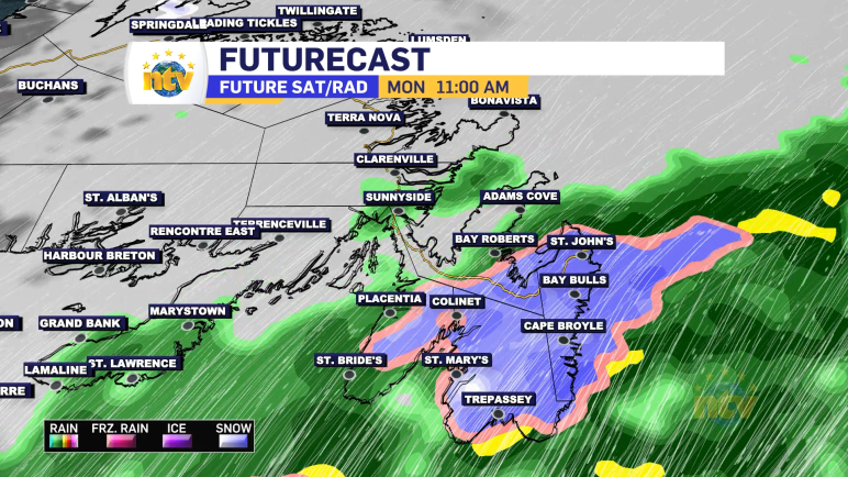
Looking at the latest guidance, it appears there has been a bit of a westward shift in the heaviest snowfall. The St. John’s Metro likely sees less snowfall (10 cm or less) rather than more. Heavier amounts (10-20+ cm) will likely be over the southwestern Avalon Peninsula, the Burin Peninsula, Clarenville, and northwest toward parts […]
Read more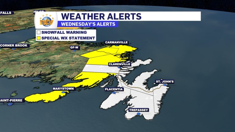
A deepening area of low pressure will pass east of the Avalon Peninsula on Wednesday. This will bring an area of heavy precipitation over eastern Newfoundland between the late morning hours and the early evening. Due to the cold air being in place behind our departing weather maker, most of this will fall as snow, […]
Read more
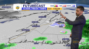
An area of low pressure is going to track through the region today and this is going to bring rain, snow, and wind with it as it does so. Over the Island, we can expect primarily rain to fall, with any mix of rain and snow over western and northwestern Newfoundland changing to rain this […]
Read more
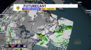
A strong area of low pressure will move across the region Tuesday and will bring a period of high winds and waves through the course of the day. For eastern and northeastern Newfoundland the highest wind speeds will occur Tuesday afternoon and peak in the 80 to 100 km/h range from the southeast. Wind speeds […]
Read more