


2 years ago
A few weather alerts remain in effect Tuesday morning
ALERTS AS OF 11:08 AM ON DECEMBER 12, 2023 A SNOWFALL WARNING WARNING is in effect for Postville – Makkovik Additional snowfall of 5 cm expected this morning. Time span: this morning. Rapidly accumulating snow could make travel difficult over some locations. Snowfall warnings are issued when significant snowfall is expected.
Read more
2 years ago
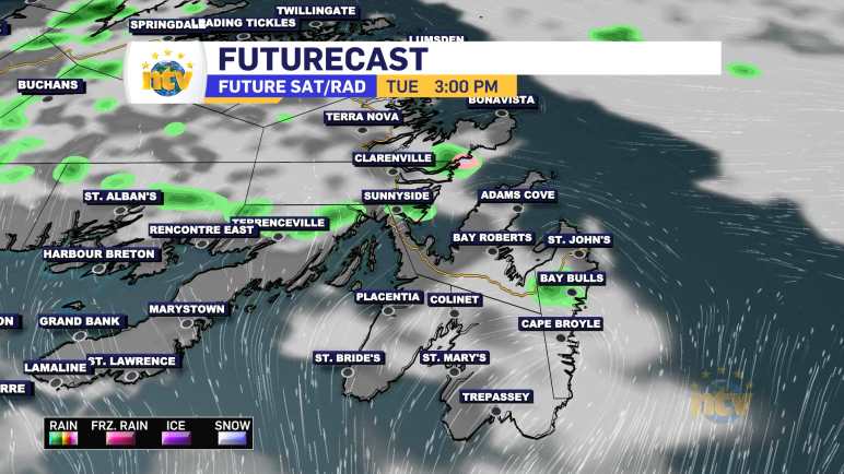
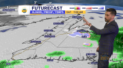
Strong low moves through Monday night
An intense area of low pressure will spin through the region overnight into Tuesday. This will bring rain, snow, and ice to Labrador, rain to the Island, and wind to many parts of the Province. I went through it all in tonight’s Evening News Hour (above).
Read more
2 years ago
Minor coastal flooding is possible along Newfoundland’s north-facing shores Saturday
The Environment and Climate Change Canada Weather Office in Gander has issued a Special Weather Statement for the following areas: Current details: Large waves, pounding surf and elevated water levels are expected, possibly exceeding high astronomical tide. Locations: Portions of the northern Avalon Peninsula and east coast from Cape St Francis to Cape St John. […]
Read more
2 years ago
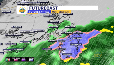
The weather will slowly improve across N.L. this weekend
Sunday’s Forecast Partly to mostly cloudy on the Island, with near 1. Labrador will also see a milder day, with highs reaching a couple of ticks below the freezing mark for afternoon highs. Snow will move into Labrador West in the afternoon as our next weather-maker moves in The Next One An area of low […]
Read more