Weather forecast: Sunday, May 17
Warm temperatures across Newfoundland and Labrador today will give way to showers and cooler conditions Monday. Here’s your weather forecast.
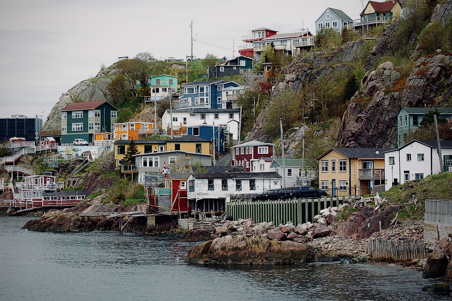
St. John’s / Bonavista
Today
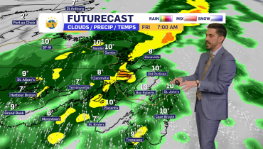
A mix of sun and cloud in St. John’s with a 40 percent chance of showers late this afternoon. Bonavista will see mainly cloudy skies with a few showers developing this afternoon and a risk of thundershowers late in the day. Wind southwest 20 km/h gusting to 40 this afternoon. High 20 in St. John’s and 19 in Bonavista, though cooler along the coast with highs closer to 14 or 15. UV index 6 to 8 or high to very high.
Tonight
Partly cloudy with a chance of lingering showers early this evening. Winds shifting northwest overnight. Low 6 in St. John’s and plus 5 in Bonavista.
Mon, May 18
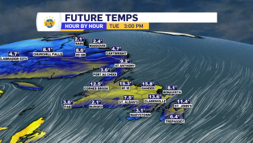
A mix of sun and cloud with breezy northwest winds. Cooler temperatures return with highs near 9 in St. John’s and 8 in Bonavista. UV index 6 or high.
South Coast
Today
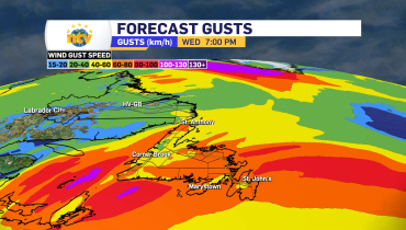
Clouds increase through the day with a few showers developing near noon. Wind southwest 20 km/h gusting to 40. High 15 in Channel-Port aux Basques. UV index 6 or high.
Tonight
Clearing this evening. Wind northwest 30 km/h gusting to 50. Low plus 4.
Mon, May 18
Mainly sunny but much cooler and windy. Wind northwest 40 km/h gusting to 70. High 8. UV index 6 or high.
Central
Today
Mainly cloudy with showers developing this afternoon and a risk of thundershowers. Rainfall amounts near 5 mm, with up to 10 mm in heavier showers around Gander. Wind southwest 20 km/h gusting to 40 this afternoon. High 18. UV index 6 or high.
Tonight
Showers ending this evening then partly cloudy with a continued chance of showers overnight. Risk of thundershowers early this evening. Wind becoming northwest 20 km/h gusting to 40 overnight. Low plus 4.
Mon, May 18
A mix of sun and cloud with cooler temperatures and breezy northwest winds. High 8. UV index 6 or high.
West Coast
Today
Mainly cloudy with showers developing around noon in Corner Brook. Rainfall amounts near 5 mm. Wind southwest 20 km/h gusting to 40. High 14. UV index 6 or high.
Tonight
Showers ending late this evening then clearing. Wind shifting northwest 20 km/h gusting to 40. Low plus 2.
Mon, May 18
Mainly sunny and cooler with northwest winds gusting to 50 km/h. High 7. UV index 6 or high.
Northern Peninsula
Today
Cloudy with showers developing near noon in St. Anthony. Fog patches linger through the day. Rainfall amounts between 2 and 4 mm. High 10. UV index 4 or moderate.
Tonight
Showers ending overnight then clearing. Flurries possible inland and over higher terrain after midnight. Wind becoming northwest 30 km/h gusting to 50 near midnight. Low plus 2, though colder inland.
Mon, May 18
A mix of sun and cloud with breezy northwest winds. High 7. UV index 5 or moderate.
Happy Valley–Goose Bay
Today
Showers with a risk of a thundershower. Wind southwest 20 km/h gusting to 40 becoming northwest this afternoon. High 17 with temperatures falling to 12 later in the day. UV index 2 or low.
Tonight
Cloudy with a chance of rain showers early this evening, changing to a 60 percent chance of flurries overnight. Wind northwest 30 km/h gusting to 50. Low zero.
Mon, May 18
Cloudy with a chance of morning flurries before skies begin to clear in the afternoon. Wind northwest 30 km/h gusting to 50. High 6. UV index 4 or moderate.
Related Articles