


The area of low pressure that, by in large, brought a miserable Monday to most of Newfoundland is pulling away, to the east, of the region this morning. This will improve the weather today, but northerly winds will keep clouds, a few showers, and seasonably cool temperatures in the cards today for much of the Island. Temperatures will reach the middle to upper single digits for highs this afternoon, and generally similar readings will be found in Labrador. Labrador will see a bit more sunshine, compared to the Island.
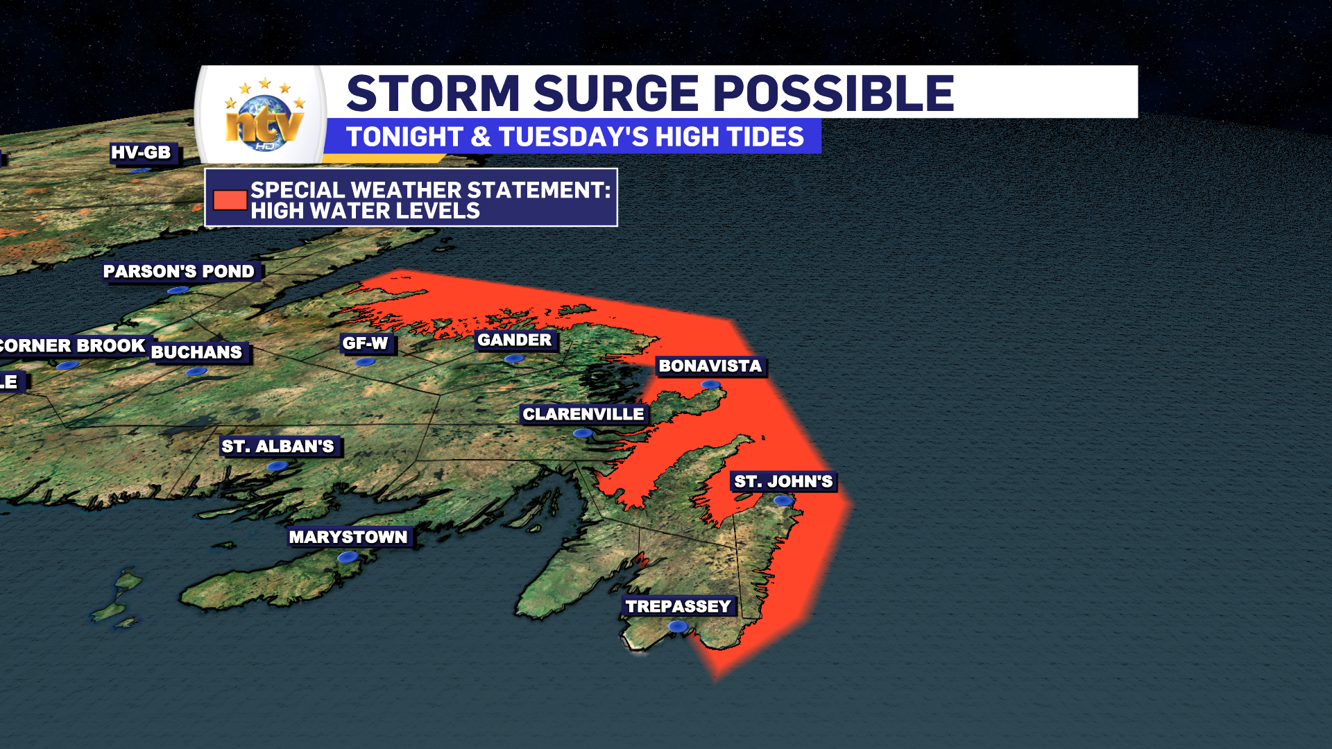
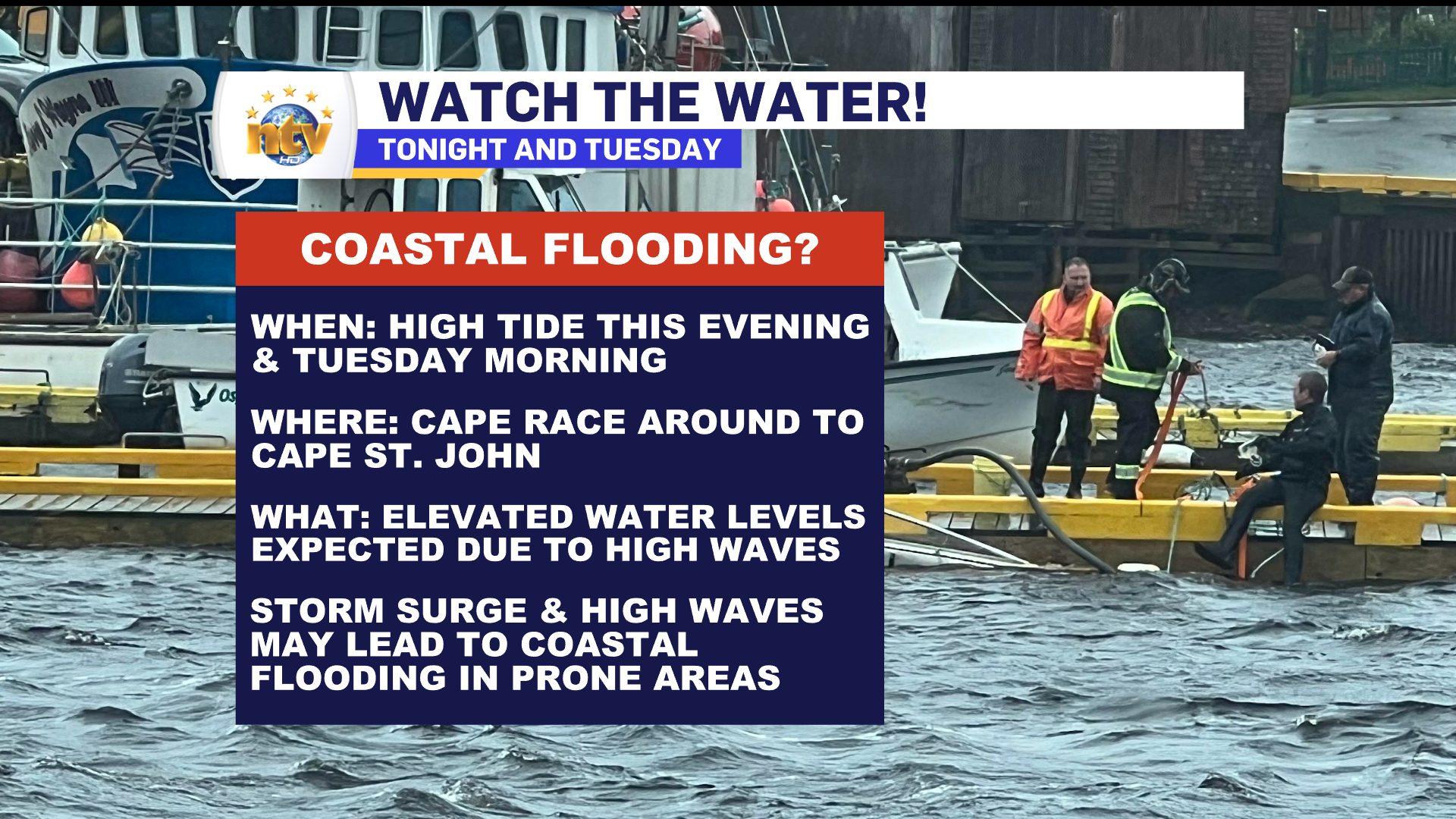
As the low slowly pulls away, there will be some high wave action along the east and north-facing shores of the Island from Cape Race (Southeast Avalon Peninsula) to Cape St. Johns (Baie Verte Peninsula). This high wave may generate higher than normal high tides this morning (7 AM to 10 AM) for the areas mentioned above. ECCC has issued a Special Weather Statement addressing the potential of minor coastal flooding. Those with interests in these areas, such as fishing vessels, should heed the alert and monitor your assets closely.
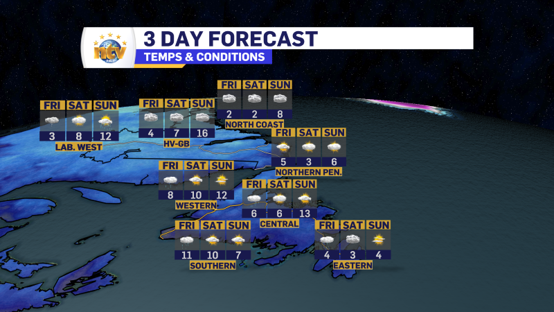
THE LONGER RANGE FORECAST
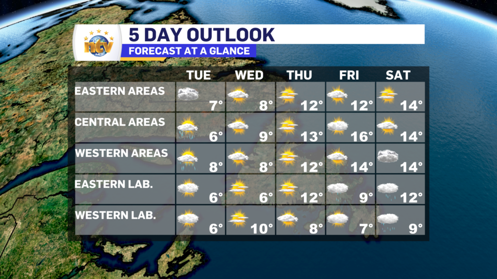
The remainder of the week will see generally quiet weather across the Province, with highs ranging from the single digits to lower teens. The next chance of rain looks to be late next weekend.
-
Your Latest Forecast!
Click here to visit the NTV Weather Centre to get your latest forecast!
-
Eddie’s Forecast; Some slight improvements for Friday, more noticeable this weekend
The area of low pressure that has driven all the wet weather across much of…
-

Eddie’s forecast; May starts like April ended
May starts like April ended… cold and damp for much of the Province. Eddie has…
