


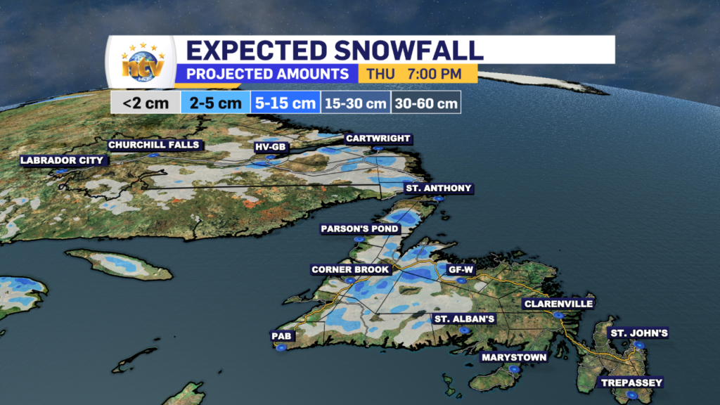
The area of low pressure driving the rain and snow across the Province will be moved eastward overnight and is in the process of ending the snow in Labrador. However, on the Island, the rain and high-elevation snow (west) is going to continue on and off through the day. However, it will become more widespread over eastern and northeastern areas this afternoon and evening.
Generally, any significant snowfall will be limited to the higher terrain, while the lower elevations will not see an overly high amount of snow. Through the day you’ll notice very little additional snowfall in Labrador, but there will be some on the GNP and possibly onto the Baie Verte Peninsula, too.
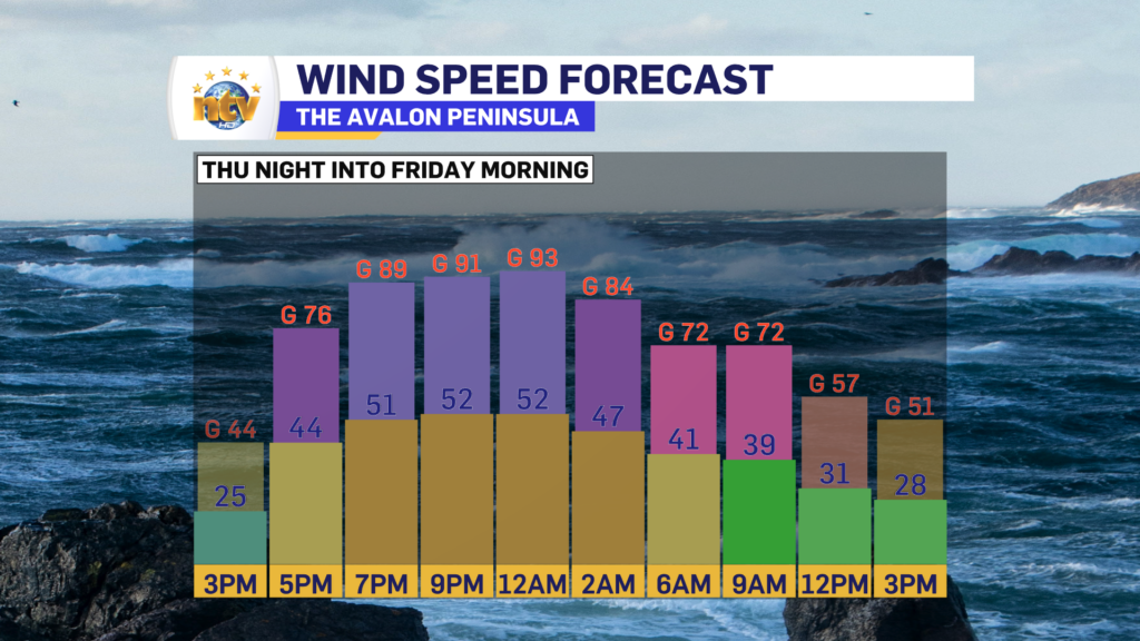
On top of that, some high winds can be expected Thursday afternoon and evening along the northeast coast, and later in the overnight on the Avalon. The wind speeds ease off later Thursday night or early Friday morning. A Wind Warning is in effect from the Bay of Exploits to the Bonavista Peninsula, but this may be expanded eastward to include the Avalon at a later time.
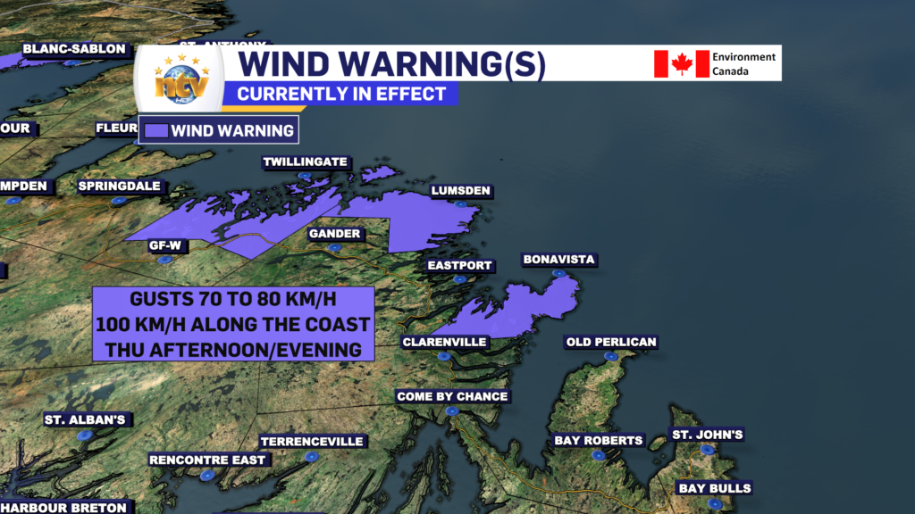
There will also be some large waves and possible storm surge with Thursday’s afternoon/evening high tide. A Special Weather Statement is in effect from White Bay to Cape St. Francis due to that threat, and you can read more about it by clicking here.
FOR YOUR LATEST FORECAST & TO SEE OUR LIVE INTERACTIVE RADAR, VISIT THE NTV WEATHER CENTRE!
-

Threat of wildfires on west coast higher this year, say forestry officials
As residents of the province prepare to head out into the woods for the Victoria…
-

Labrador West MHA wants water bomber back
With wildfires threatening Fort McMurray, Alta., again, Labrador West MHA Jordan Brown wants a water…
-

Province warns residents to be ready for forest fire season as wildfires threaten Fort McMurray
Evacuation orders and alerts remain in effect for Fort McMurray, Alta., as wildfires continue to…
