


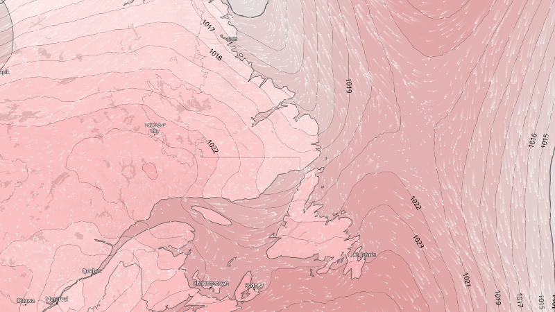
A surge of unseasonably warm air will make itself at home across the Province over the next couple of days. Temperatures on the Island and throughout much of the Big Land will reach the middle to upper 20s, to even lower 30s for afternoon highs. Humidex values will also creep into the upper 20s to lower 30s. The exception will be on Newfoundland’s south-facing shorelines, where upper teens to near 20 will be the rule in the onshore wind. Some fog will also be found in these areas.
Heat Warnings are in effect until later tonight or Tuesday for the following areas in Labrador:
- Upper Lake Melville
- Eagle River
- Norman Bay to Lodge Bay
- Cartwright to Black Tickle
Temperatures in these area will peak as high as 32 today and Tuesday, with tonight’s low being near 18. The heat will break Tuesday night.

A Heat Warning is in effect through Tuesday for the following areas on the Island:
- Terra Nova
- Gander & vicinity
- Bonavista North
- Grand Falls-Windsor & vicinity
- Green Bay-White Bay
- Bay of Exploits
Temperatures in these areas will peak as high as 29 today and Tuesday, with humidex values as high as 34. The low between Monday night and Tuesday will be near 17. Temperatures will turn somewhat cooler for all areas on Wednesday.

Heat warnings are issued when very high temperatures or humidity conditions are expected to pose an elevated risk of heat illnesses, such as heat stroke or heat exhaustion. Drink plenty of water regularly, even before you feel thirsty, to decrease your risk of dehydration. Thirst is not a good indicator of dehydration.
Never leave people, particularly children, or pets inside a parked vehicle.
-
The first half of the weekend is lookin’ great!
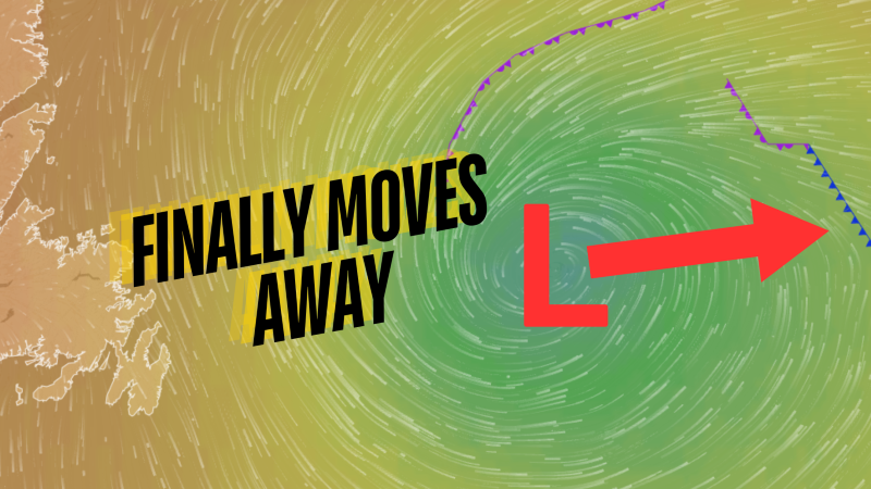
After nearly two weeks of drizzle, clouds and fog over eastern and central Newfoundland, the…
-
A brilliant Friday on tap for much of the Province!
The weather will turn around for eastern and central Newfoundland on Friday, setting the stage…
-
Thursday’s weather is a step in the right direction in the east, remains nice almost *everywhere* else!
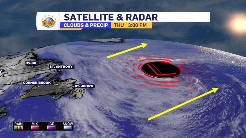
The area of low pressure swirling offshore for the last few days, helping to drive…
