


Sunday morning is starting off with widespread showers across much of the Island this morning. The showers have developed along and behind a warm front that is in the process of lifting through. Behind that warm front, you will notice a solid increase in the mugginess (if that’s a word) across most of Newfoundland.
Over the last few hours, this is a radar loop from MSC radar in Holyrood.
While it’s much calmer over central and western areas of the Island right now, there was a hefty showers that went through the Badger to Bishop’s corridor and moved off toward Birchy Bay and Back Harbour. There were even some lightning strikes recorded, so this was indeed a thunderstorm.
Here is a loop from the MSC radar on Marble Mountain.
Rest of Sunday
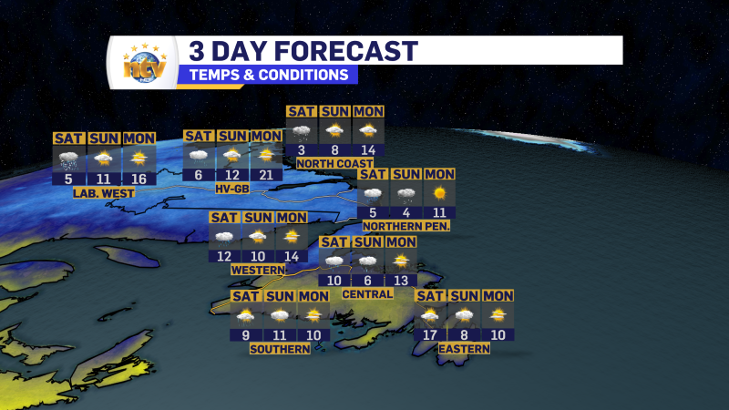
The rest of your Sunday will see an increase in the number of showers over the Island portion of the Province, along with an uptick in temperatures and humidity. Humidex values this afternoon will creep into the upper 20s to lower 30s for Central.
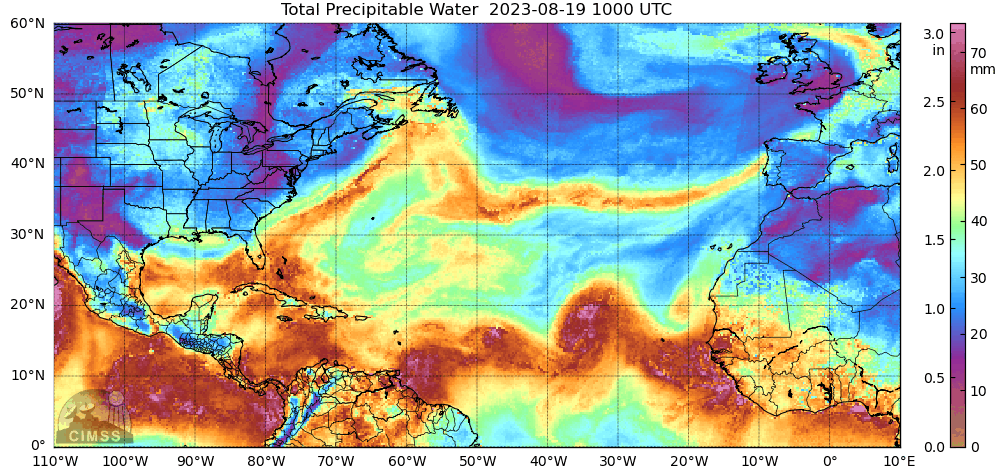
The amazing thing about that is temperatures will only be in the lower to middle 20s. This speaks to just how humid this air mass is. In fact, the air coming in has tropical origins as we can see from today’s precipitable water (PWAT) chart.
Here is a look at the expected high temperatures today across the Province.

Showers and rain become more widespread later today on the Island, let’s say after 1 PM NDT. And this area of rain will affect mainly central, northwest (GNP), and eastern areas into tonight and early Monday morning, while at the same time, another area of rain will move into Labrador West this evening and trudge northward for Monday morning.

More on that later. Have a great Sunday!
Eddie
-

The weather improves today but temperatures vary
Monday will be a nicer day across much of the Province compared to what we…
-
The weekend forecast is not all bad!
While the week ended on a cooler and rainy note, the weather will not be…
-
An unsettled, damp Friday is on the docket for today
A relatively weak but large area of low pressure has settled over the region. This…
