The Overview
An area of low pressure will stall, and move from east to west (called retrograding) over and south of the Island between Friday evening and Sunday before dissipating over the region between Sunday night and Monday. The slow movement of this low, along with the positioning, will allow significant amounts of rain to fall over much of the Island and parts of Labrador over the next few days.
On the Island, the heaviest rain will fall between tonight and late Saturday afternoon. The exception will be on the Great Northern Peninsula, where the rain will continue into early Sunday morning. Labrador will see rain move into the southeast Saturday and continue into late Sunday night or early Monday.
Futurecast, a combination of modeled satellite and radar data, will show this is forecast to play out and should give you a good idea of the timing of this all, in your particular region.

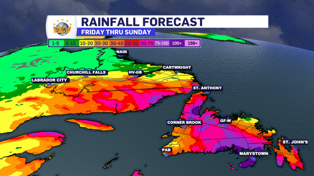
Rainfall amounts will be significant for parts of the southern, central, western, and interior parts of the Island between today and early Sunday morning. While in Labrador the heavy rain will fall between Saturday and late Sunday. On the Island, the heaviest rain will fall in the South where over 100 mm is possible. Amounts will be lower to the north, but still significant in spots. Rainfall Warnings are in effect.
Meanwhile, in Labrador, a widespread 20-40 mm will fall in the southeast between Saturday and late Sunday or early Monday. The image below shows how much rain can be expected in any particular area.


