


Post 2 – 6:45 PM (6:15 PM AST)
A Special Weather Statement is in effect from Sunday morning until Monday morning for much of the Island for the potential of rain, snow, wind, and storm surge. Read details on the alert here.
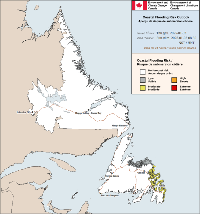
According to ECCC NL, there is a moderate risk of coastal flooding on Sunday morning between 10 AM and 12 PM with the high tide.
Post 1 – 6:42 AM NST (6:12 AM AST)
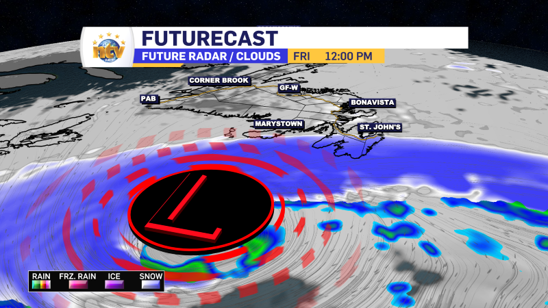
An area of low pressure will bring rain to the island and snow to Labrador today, tonight, and early Friday. The rain will be heaviest along parts of the South Coast and southwest coast, where a Rainfall Warning will be in effect until this evening. Up to 30 mm of rain is expected in that area. Rainfall amounts will be lower north and east.
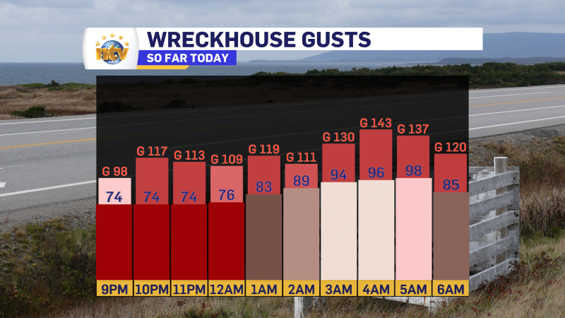
A Wind Warning is also in effect until this evening from Bay St. George to Gros Morne for wind gusts as high as 100 km/h in areas prone to enhanced southeasterlies. A Wreckhouse WInd Warning is also in effect until noon for wind gusts as high as 140 km/h. Winds have already been that high as of earlier this morning.
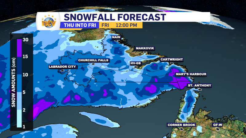
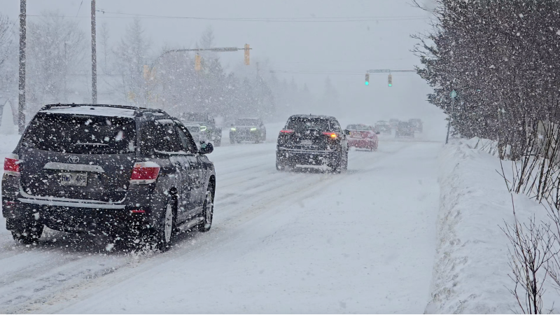
A Snowfall Warning is also in effect from this evening until Friday morning for Red Bay to L’anse-au-Clair for up to 25 cm of snow inland along parts of the TLH. Snowfall amounts will be less near the coast. And speaking of snow, parts of the higher terrain of western Newfoundland will also see snow today into Friday. Keep this in mind if you’re heading into the higher terrain.
-

NTV Weather Update | February 21, 2025
Post 2 – 2:58 PM NST (2:28 PM AST) A Winter Storm Warning is now…
-
Snowstorm forces early closures on Avalon
A winter storm shut down much of the Avalon Peninsula Friday afternoon, prompting early closures…
-
Snow and wind expected over Avalon Peninsula Friday
An area of low pressure will pass east of the Avalon Penisula on Friday, bringing…
