


Newfoundland Overview
Showers become more widespread across the Island overnight as we see an increase in moisture from the remnants of Gert spinning to the east of Nova Scotia and south of Newfoundland. Low dip into the upper teens to near 20 overnight. Expect areas of fog along southern shorelines.

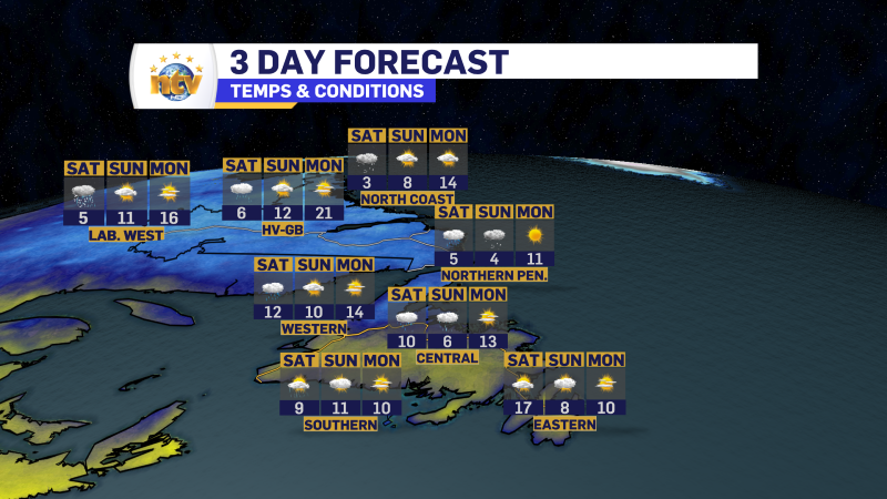
Thursday will see widespread showers across the Island, with highs in the lower to middle 20s. Humdex values will again be in the upper 20s to low 30s. The exception will be on the GNP, where some cooler air moves in, and highs will be into the upper teens.

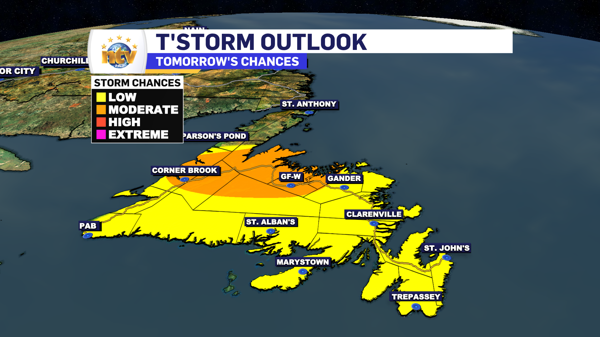
There will also be the risk of thunderstorms across the Island on Thursday, with the best chance being between Grand Falls-Windsor and Corner Brook. Any storms will produce locally heavy rainfall and potentially gusty winds.
Labrador Overview
A cold front pushes through Labrador overnight and that will bring rain to the north and west, and much cooler temperatures across the board. Lows by tomorrow morning reach the 7 to 10 range. A far cry from today’s upper 20s to lower 30s!

Tomorrow will see rain pushing into the southeast, while the rain ends in the morning in the north and west. There may be some break of sun in the north and west. Highs will be near 10°. That’s right… about 20° cooler than today!

LEE UPDATE
As of this writing, Less is a category 1 Hurricane in the tropical Atlantic. The storm is packing winds of 120 km/h and is heading toward the west-northwest at 23 km/h.

Lee is going to become a large and dangerous category 4, or higher, hurricane by the weekend. And the 5-day track shows the storm will maintain this west-northwest trajectory.
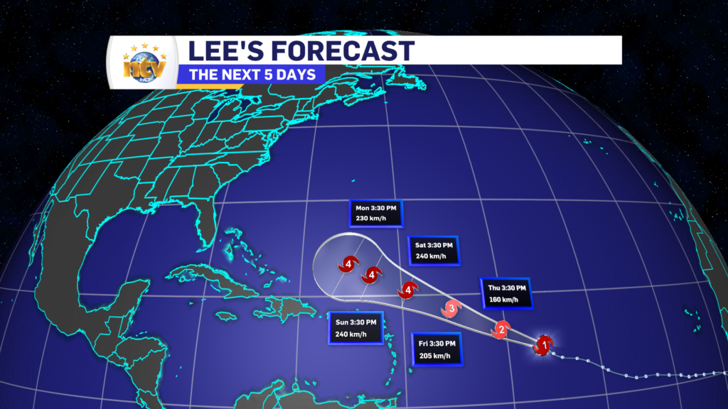
Beyond that, the forecast is quite uncertain. However, some guidance does indicate the storm could be near our region, in a weaker state, between 8 and 10 days from now. While it’s far too early to get into any specifics, it’s a good idea to keep an eye on this storm for the time being.
-

The weather improves today but temperatures vary
Monday will be a nicer day across much of the Province compared to what we…
-
The weekend forecast is not all bad!
While the week ended on a cooler and rainy note, the weather will not be…
-
An unsettled, damp Friday is on the docket for today
A relatively weak but large area of low pressure has settled over the region. This…
