


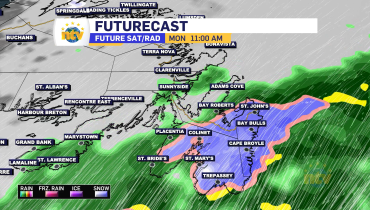


3 years ago
Heavy rain arrives this evening and continues through Thursday
An area of low pressure working through the Gulf of St. Lawrence this evening is pushing rain across the Island and a large part of southeastern Labrador. The rain will continue to work in as the night progresses and will become heavy at times for many areas as that happens. Rainfall Warnings are in effect […]
Read more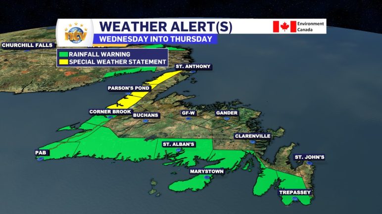
3 years ago
Wednesday morning update; Warnings expanded and rain is on the way
The Rainfall Warnings have been expanded by the Environment and Climate Change Canada Weather in Gander. The warning(s) now include the southern parts of the Island from the Avalon Peninsula Southeast to Bay St. George. Expect between 50 and 100 mm of rain in these areas by Thursday evening. Locally higher amounts are possible. A […]
Read more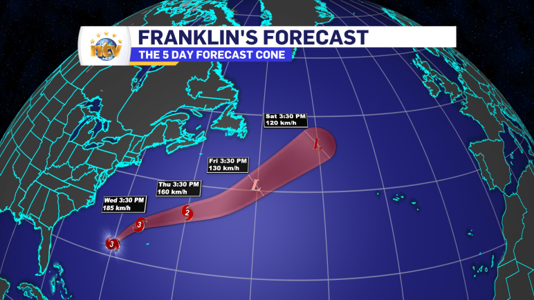
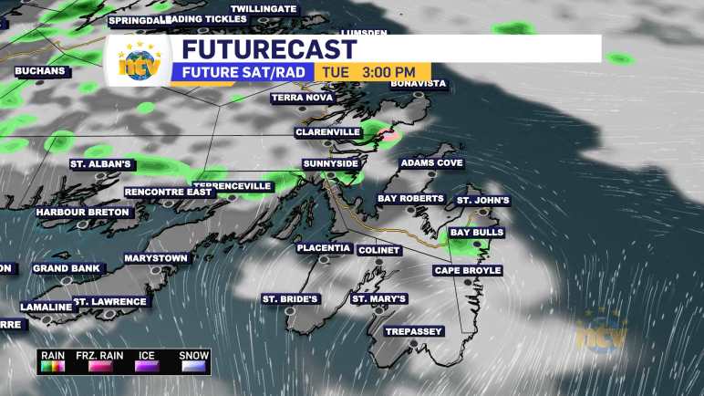
3 years ago
Wednesday & Thursday looking rainy for much of the Province, in part due to Hurricane Franklin
Generally quiet conditions will be found across the Province overnight, ahead of our next weather maker. The exception will be Labrador West and North, where showers will be found as a cold front sinks south. That cold front will move through much of the Big Land come Wednesday morning, and temperatures will fall into the […]
Read more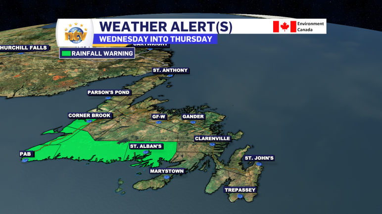
3 years ago
Environment Canada issues Rainfall Warning for parts of southern, western Newfoundland
The ECCC NL Weather Office in Gander has issued a Rainfall Warning for the following areas: Current details: Heavy rain is expected. Total rainfall: 60 to 100 mm, with locally higher amounts possible between Connaigre and Channel-Port aux Basques. With 30-60 mm in the forecast for Bay St. George and Corner Brook Locations: southern and […]
Read more