Cool streak continues, flurries, wet snow with rain possible for some Friday

Ryan Harding, NTV Weather Centre
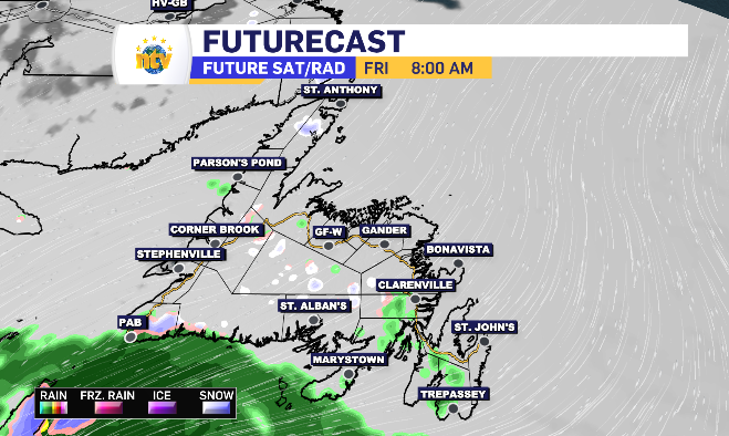
No tourism commercials are likely to be shot this weekend in Newfoundland, with almost full cloud cover there is likely to be some drizzle and perhaps even light and brief flurries coming and going throughout the day as the northeast wind has temperatures well below average.
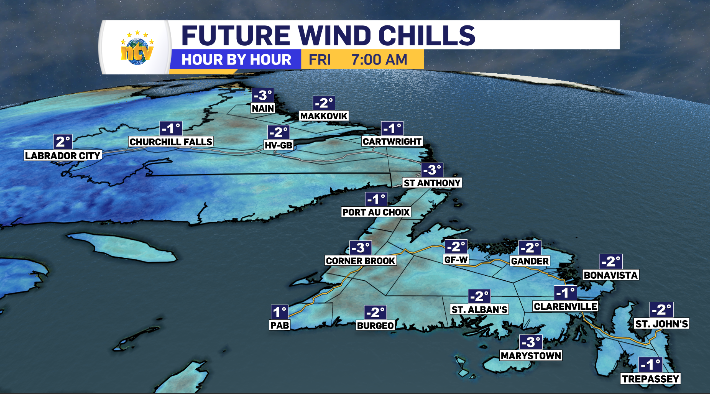
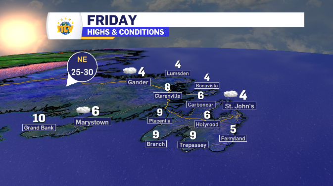
In fact, still, some northeast facing areas will have a wind chill below zero for the majority of Friday. The wind is pretty evenly distributed Friday in a 20-40 km/h range, until the afternoon when the eastern side of the island has the potential to creep closer to 50-60 km/h.
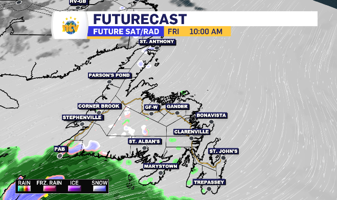
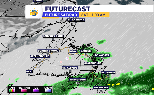
That increased wind is off the back of a low-pressure system bringing 5-10 mm of rain to the south-facing coastlines of Newfoundland. It’s worth noting that the system is coming in over a cooled land, meaning at the start, there may be periods of wet snow. The flurries potential is felt across Newfoundland, specifically closer to a northern coastline.
Friday evening, the rain reaches the Avalon and spends the night slowly moving north bringing overnight and early Saturday morning rain to the Metro region, extending into the Bonavista Peninsula, Kittiwake Coast, parts of Central and the Fogo Island region.
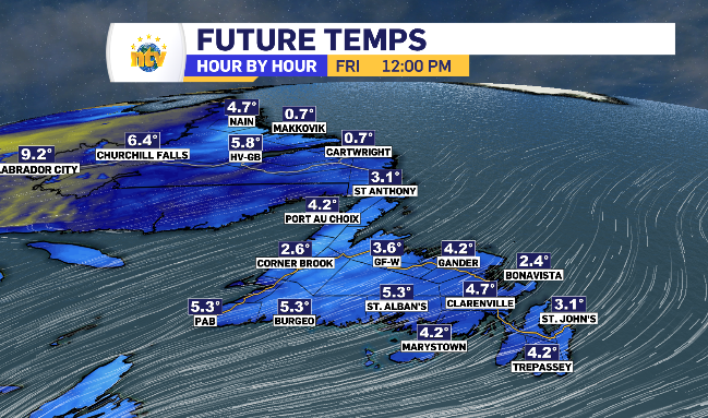
Newfoundland and Labrador’s daytime highs for Friday
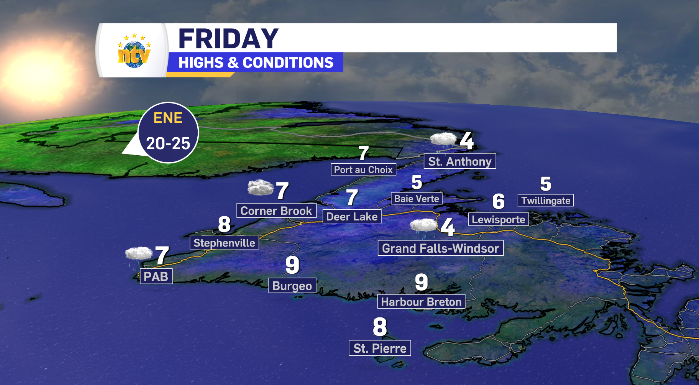
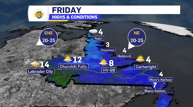
Warmer day ahead for inland Labrador while sun shines through Friday
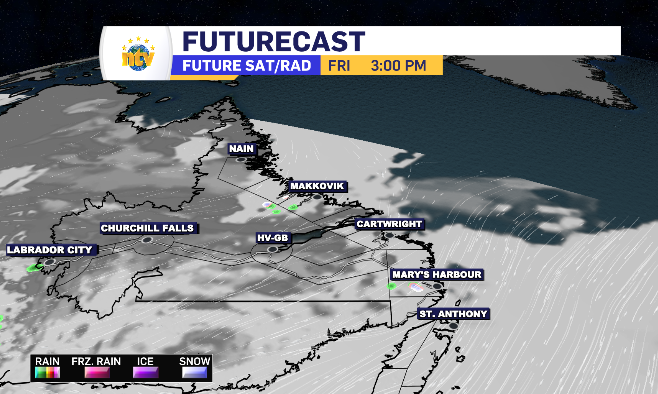
Coastal Labrador has the same fate, temperature-wise, as Newfoundland with limited highs do to the northeast wind and moments of drizzle with flurry potential. The difference being sun breaking through as the day rolls on.
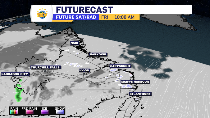
Meanwhile, the clouds eventually part for inland Labrador into the afternoon. The wind off the land isn’t quick as biting, allowing for Labrador West to grow into a double digit daytime high.