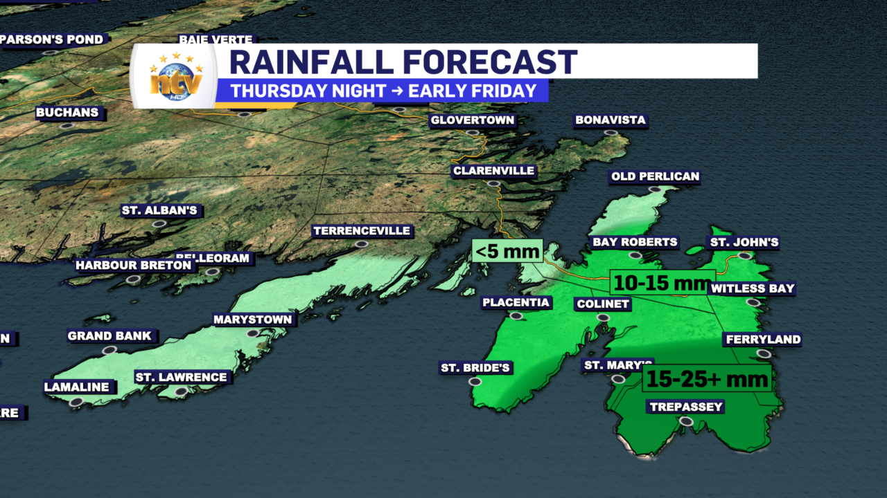
An area of low pressure will track just east of the Avalon Peninsula overnight into early Friday. This will spread some snow, ice pellets, freezing rain, and rain over roughly the island’s eastern half in the time frame. A Freezing Rain Warning is in effect for much of southeastern Newfoundland. Keep in mind that the lack of a weather alert doesn’t mean there will be no weather in your area. It just means the weather expected in your area will warrant an alert.
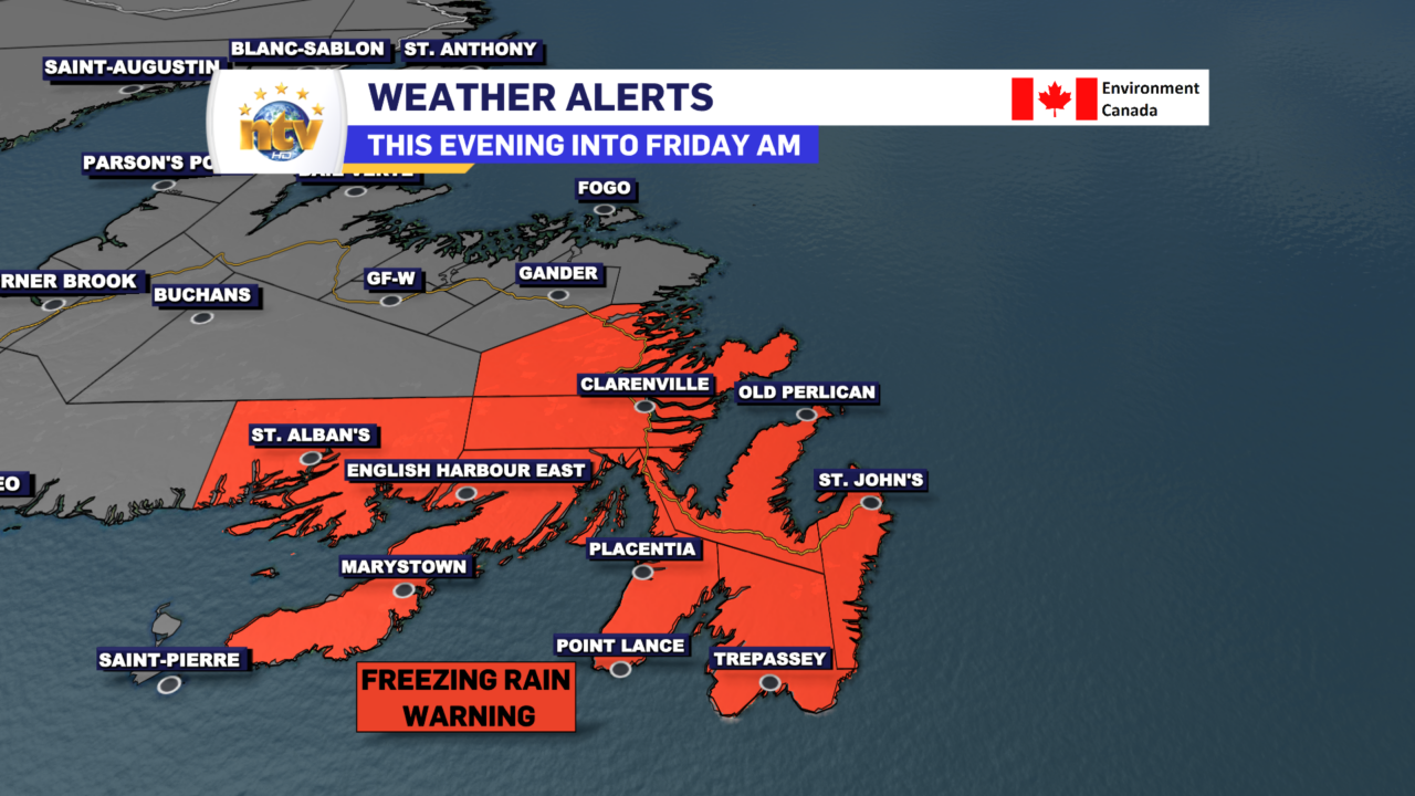
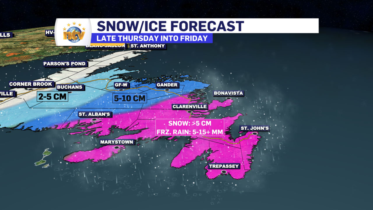
For the Avalon and Burin Peninsulas, snow this evening will quickly transition to ice pellets and then to freezing rain. The freezing rain will last for several hours or until the precipitation ends between 7 and 9 AM Friday. Some areas of the Avalon will see the freezing rain change to rain, while others will not. Regardless, freezing rain amounts will be 5-10 mm. This will be enough to coat the trees and power lines but shouldn’t be enough to down powerlines and cause widespread outages.
The Bonavista Peninsula and the Clarenville area will see a little more ice pellets and a little less freezing rain overnight.
Areas to the west will remain primary snow, and the snow will fall moderately at times tonight into early Friday before ending. Snowfall amounts will be in the 5-10 cm range.
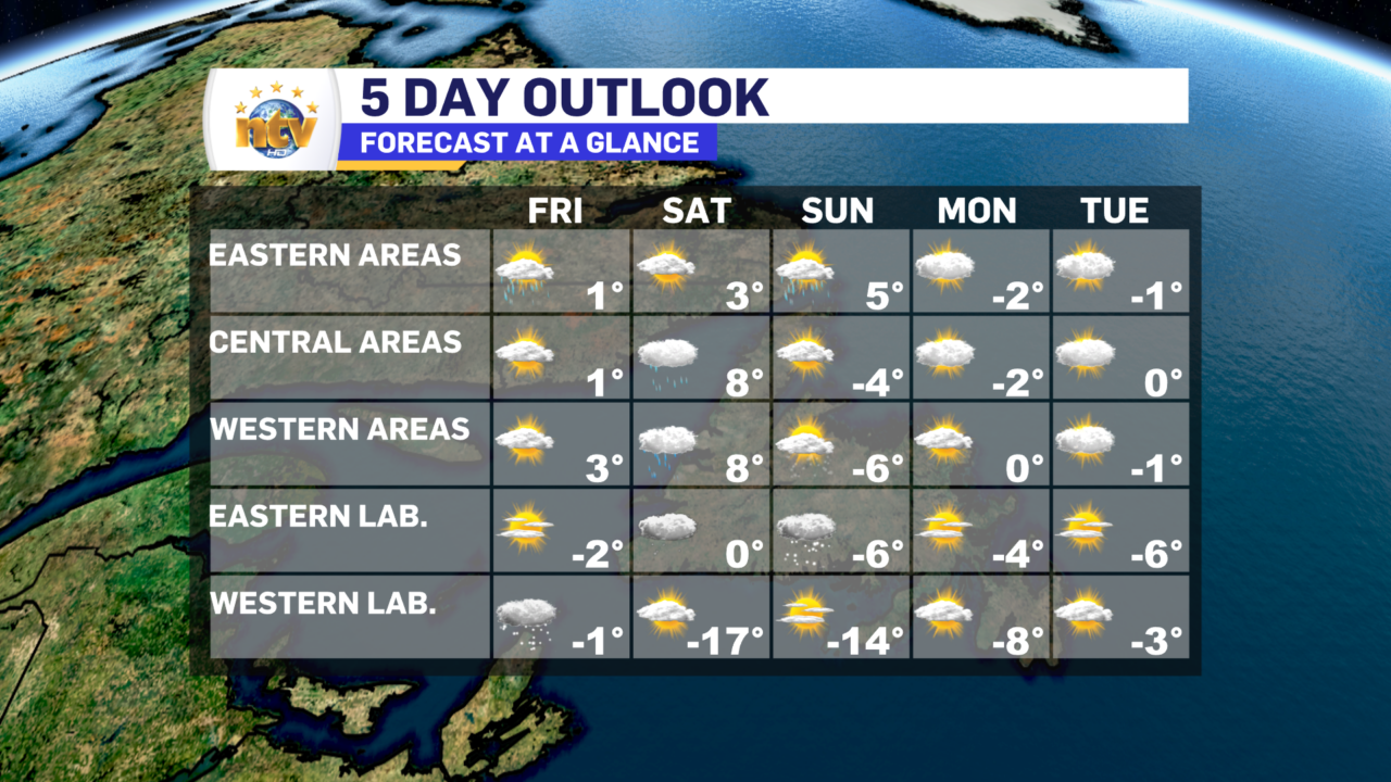
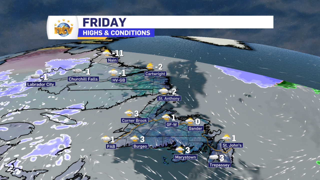
The weather improves Friday afternoon for much of the Island, with highs of 0 to 3. Most of us will have a sunny break by the second half of the day, even though the day will start on the messy side. Labrador will see highs near 0, except near -10 in the north. Light snow will fall in the west, while eastern areas will see partly cloudy to mostly sunny skies.
The next weather maker arrives Saturday and looks to be a mild system. Parts of western Newfoundland and the Southwest Coast will see heavy rain Saturday and mild temperatures (5° to 8°). The combination of the two may cause rapid snowmelt and flooding will be a concern in some areas. Only showers are expected in Central Newfoundland, and eastern areas remain dry. Highs will be closer to 3° in the east.
Labrador will see quiet weather on Saturday, but it will be a bit colder. Highs in the west will be in the minus teens, while the east will be near 0. Snow moves into eastern areas Sunday while the cold air pushes back to the east. The cold air pushes back across the Island Sunday, and readings will fall below freezing. Next week looks quiet. For now…
