


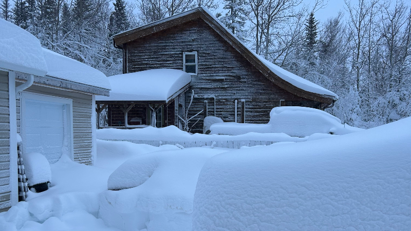
Our latest winter storm in the final stages on the Island. Some areas of the northeast coast, and back towards parts of Central are still seeing snow and that will end in the next few hours. Beyond that the weather on the Island will improve today and many of us will see some sunshine by the afternoon. Here are some storm totals for you so far, as of early this morning:
- St. John’s International Airport: 44.2 cm
- St. John’s East (East End): 53.6 cm
- Paradise: 61.8 cm
- Gander: 86 cm
- Conception Bay South: 48.5 cm
I’m sure I will have more snowfall totals to share with you later today.
The weather on the Island today will be better. It will be breezy, with highs near a few degrees under the freezing mark. Wind chills are near -10, and flurries may fly at times on the West Coast once we get past this morning.
Meanwhile, the snow will continue on the Labrador Coast this weekend. Highs winds, gusting as high as 80 km/h will create blizzard conditions at times. Highs will be a few degrees below freezing on the coast and the minus teens in the west.
We are looking at the potential of another round of snow for parts of eastern and central Newfoundland from late Saturday night into Sunday, and at the same time, the snow will continue on the coast of Labrador. I’ll have a more detailed update for you later today.

-

Threat of wildfires on west coast higher this year, say forestry officials
As residents of the province prepare to head out into the woods for the Victoria…
-

Labrador West MHA wants water bomber back
With wildfires threatening Fort McMurray, Alta., again, Labrador West MHA Jordan Brown wants a water…
-

Province warns residents to be ready for forest fire season as wildfires threaten Fort McMurray
Evacuation orders and alerts remain in effect for Fort McMurray, Alta., as wildfires continue to…
