


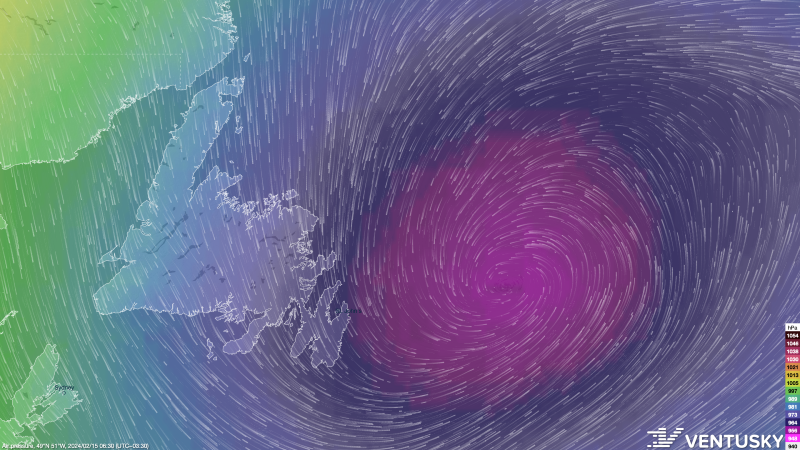
The area of low pressure driving our winter storm continues to lash the Island with snow and wind this morning. Based on current observations, the heaviest snow looks to be falling around the northeast coast of the Island and back into parts of Central, with lighter rates on either side. Here are some snowfall amounts so far:
- St. John’s International: 25 cm (Thru 5:30 AM)
- Gander Airport: 44 cm (thru 5:30 AM)
- St. John’s East: 36 cm (thru 10:30 PM yesterday)
- CBS: 36 cm (thru 10:30 PM yesterday)
- Paradise: 39 cm (thru 10:30 PM yesterday)
Winter Storm Warnings remain in effect for central, northeastern, and eastern Newfoundland today. They will remain in effect into Friday morning before expiring as the snow ultimately wraps up. Remember, Winter Storm Warnings are issued when multiple types of severe winter weather are expected to occur together. In this case, it’s snow and wind.
Closures and cancellations:
-City of St. John’s facilities will remain closed for the remainder of the day (February 15). This includes City Hall, recreation facilities and the residential drop off at Robin Hood Bay. The Robin Hood Bay Waste Management Facility remains open.
-ANC offices in St. John’s will remain operating remotely for the day (February 15, 2024) due to severe weather conditions in the region.
-Memorial University’s St. John’s, Marine Institute and Signal Hill campuses, including the Childcare Centre, are closed for the remainder of the day for all faculty, staff and students. Evening classes are also cancelled.

Snowfall amounts on the Island will be highest on the northeast coast. Amounts between Bonavista North, Gander, and Bay of Exploits will total over 60 cm by the time we are all said and done. Some locations will see as much as 75 cm come Friday morning. This will mainly be inland locations. The map below shows the total expected snowfall by the time tomorrow morning rolls around, going back to yesterday.

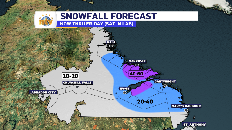
This morning, a Winter Storm Warning and Blowing Snow Advisory also remain in effect for the Labrador coast. And those will likely run through the weekend as significant snowfall, perhaps over 50 cm, will have fallen in some areas by that point.

Snowfall totals will be highest around Postville and Makkobik and a bit less south and north of there. However, the Mealy Mountains south of Lake Melville will also see hefty snowfall totals in the time frame.
The future radar animation below should help give you a better idea of the timeline of the snow across the Province over the next 24 hours or so.
Today, temperatures across much of the island will be on the “mild” side, with highs near, or within, a few degrees of either side of zero. Parts of Labrador, mainly in the southeast, will also see mild reading like that. However, it will be colder in the north and west, with highs nearer to -10º.
Check back throughout the day for further updates on NTV.ca, and don’t forget to check out the NTV Weather Centre!
-

Threat of wildfires on west coast higher this year, say forestry officials
As residents of the province prepare to head out into the woods for the Victoria…
-

Labrador West MHA wants water bomber back
With wildfires threatening Fort McMurray, Alta., again, Labrador West MHA Jordan Brown wants a water…
-

Province warns residents to be ready for forest fire season as wildfires threaten Fort McMurray
Evacuation orders and alerts remain in effect for Fort McMurray, Alta., as wildfires continue to…
