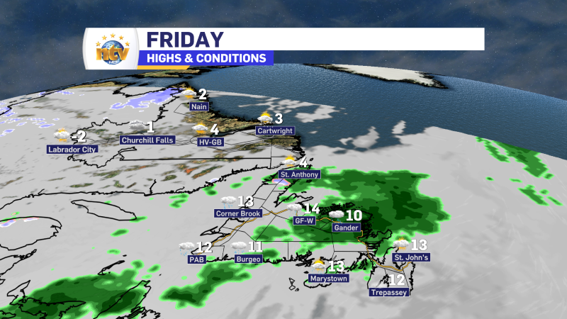
We are starting the new month off on the warm side of the spectrum on the Island with temperatures ranging from 5º in the north to 11º in the far southeast (Cape Race). Meanwhile the Big Land is seeing much cooler temperatures, with readings largely near or below freezing. The reason for the differential is a cold front between the two land masses. The animation below visualizes this very well!
Along that front, which stretches back into the Gulf, we are seeing some rain showers developing near the West Coast as yet another begins to develop. The showers, and areas of rain, near the West Coast stretch back to the New England states and Quebec.

The front will be slow to move south, so many areas will see a warm day on the Island while the cold air lurks in the Big Land, which will make a return for all areas of the Province on Saturday.

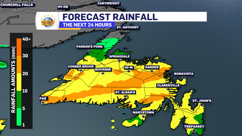
Another area of low pressure is going to develop along that front later today and will bring more rain and showers to much of the Island beginning later this morning on the West Coast and spreading into central later today. The rain will start to end on the West Coast this evening but will arrive in the eastern areas this evening. The rain will end for all areas on Saturday morning.

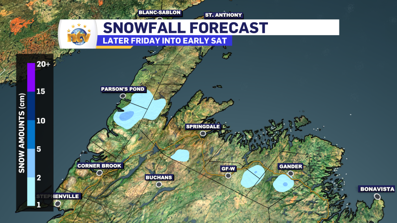
There will also be a little snow on the northwest side of the system tonight… so for parts of the Northern Peninsula, central and northwestern Newfoundland there will be a few centimeters of wet snow. This will be mainly be inland over higher terrain.

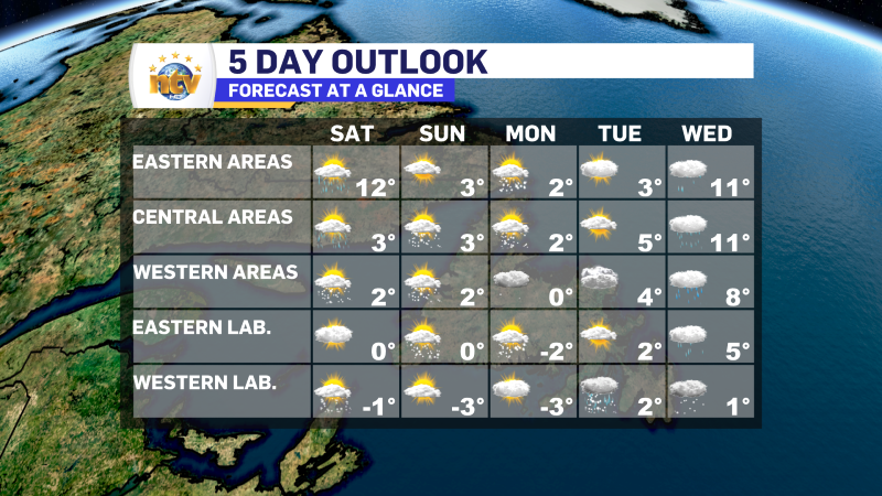
The weather for the weekend looks cooler, but generally calmer across the Province. I’ll have your full forecast later today!


