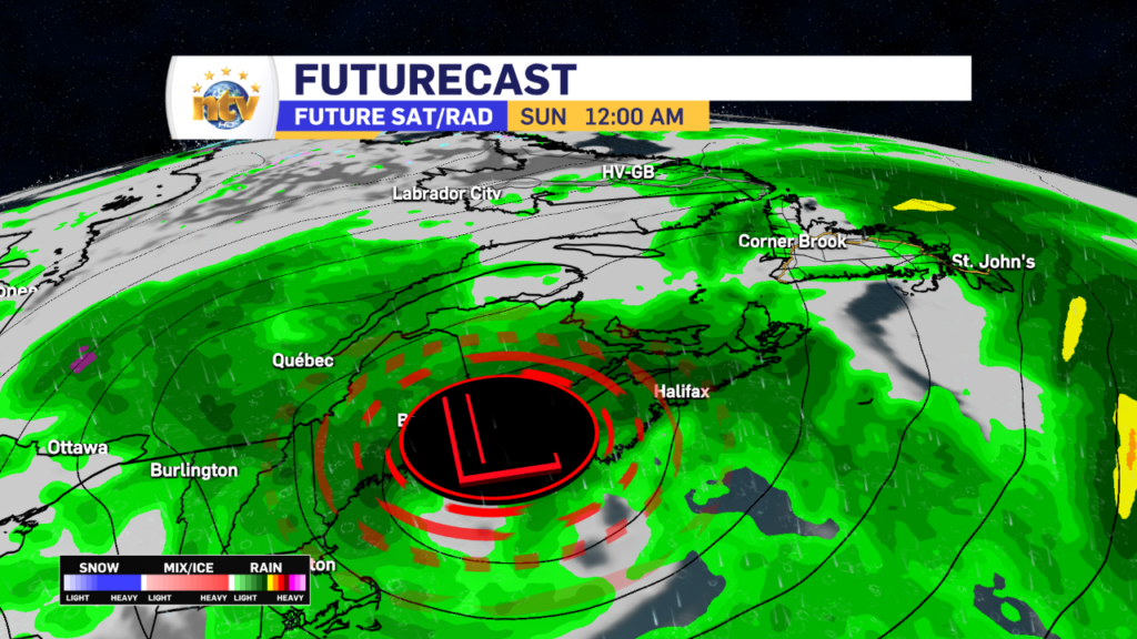
The area of low pressure that is driving the rain and gusty winds over the Island portion of the Province will be slow to pull away on Sunday. This will keep the rain on the go and gusty winds a factor throughout the day. On the plus side, by in large, the heaviest rain and highest wind speeds are done with. But the rain will continue over much of the Island into this evening, and in some cases into Monday. Future Radar times this out very well.

WEATHER ALERTS
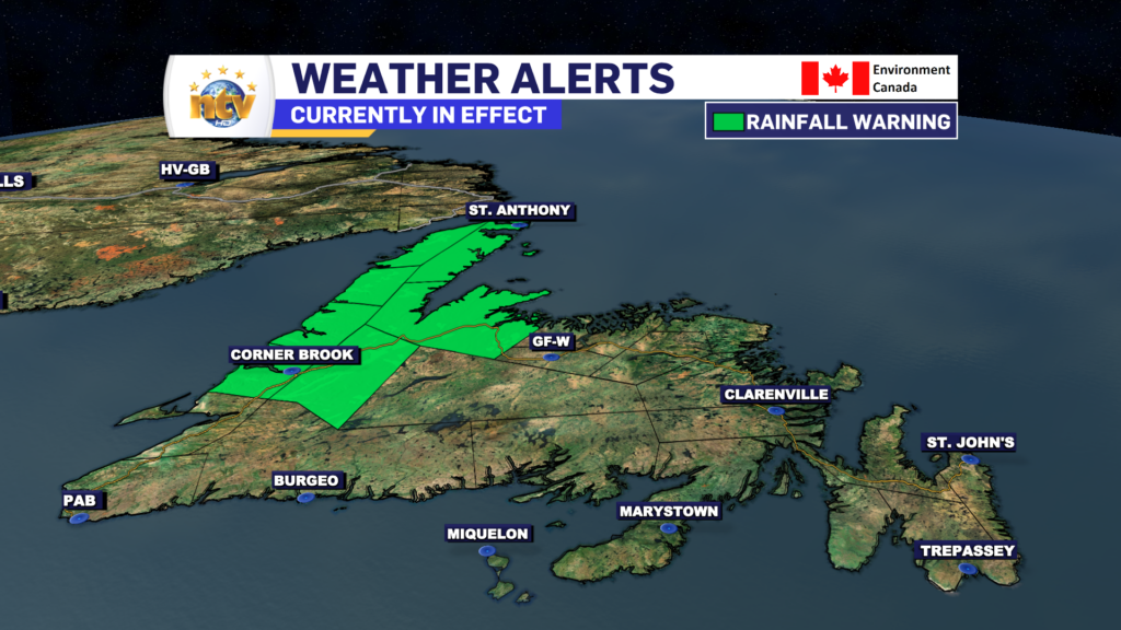
As of early Sunday morning, a Rainfall Warning remains in effect for much of central, interior, western, and northern Newfoundland. This will likely be ended this evening, as the heavy rain threat finally ends. You can find the details on these alerts right here.
THE RAIN
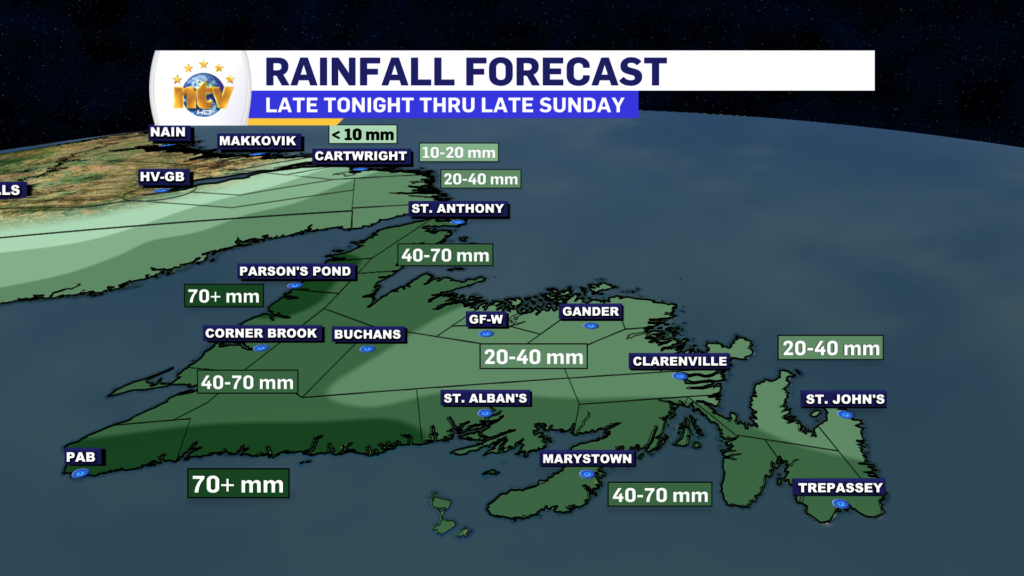
While much of the Island will see showers on Sunday, western and northwestern Newfoundland areas will see the heaviest rainfall throughout the day. Inside of that, the most intense rainfall rates will generally occur early Sunday morning. The rain will end for many areas late Sunday afternoon or evening, however for southeastern Newfoundland light rain will continue through Monday in onshore, northerly flow.
THE WIND
The wind speeds will be gusty for our Sunday but overall should be lower than Saturday’s peaks for areas of southern and eastern Newfoundland. Areas along the West Coast will notice an uptick in speeds today, and along the coast, gusts will be as high as 70 or 80 km/h from the north-northeast.

TEMPERATURES
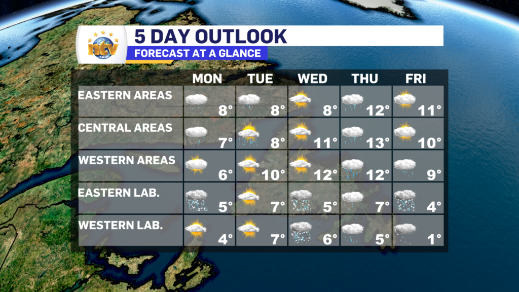
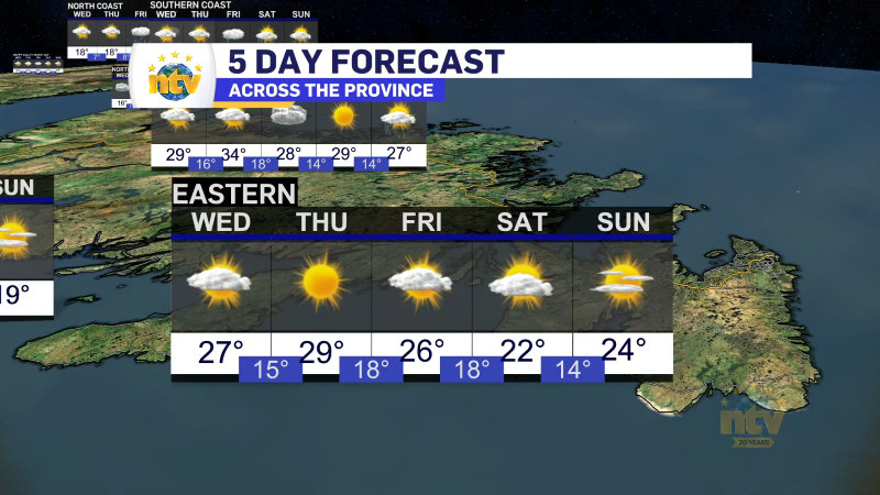
Temperatures will be in the teens on Saturday and Sunday, before falling to the single digits on Monday as cooler air moves in. Enjoy the warmth this weekend, because these may be the last teens we see for a good long while, based on the long-range forecast. Labrador will see cooler readings, too, over the weekend. But no major weather looks to be in play for the Big Land.
