


NTV Weather Update | April 2, 2025
Today’s Synopsis
The weather across the Island today will be much cooler than yesterday. High temperatures in some locations will be more than 15º colder! Rodney Barney, a Meteorologist with ECCC NL Weather Office in Gander, compiled yesterday’s maximums.
In addition, there will be intense flurries and occasional snow squalls along and near the West Coast throughout the day. Radar imagery from western Newfoundland suggests that it has already started.
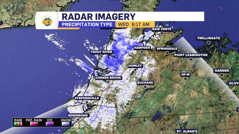
Webcam images suggest the same. The webcam below from the TCH in Corner Brook should be updated to the latest image every time this page is refreshed.
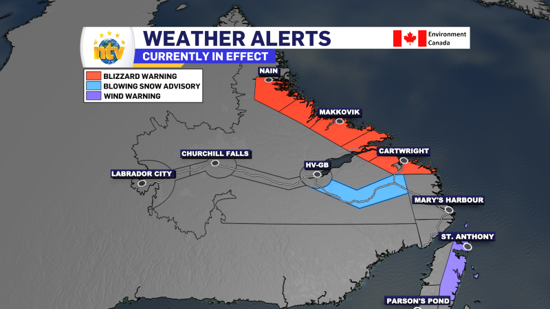
In Labrador, today’s big story will be snow and wind along the coast. A Blizzard Warning remains in effect from Cartwright to Nain until later today or tonight. This area can expect snowfall totals of near 40 cm in some areas going back to yesterday and wind gusts of 120+ km/h later today and this evening.
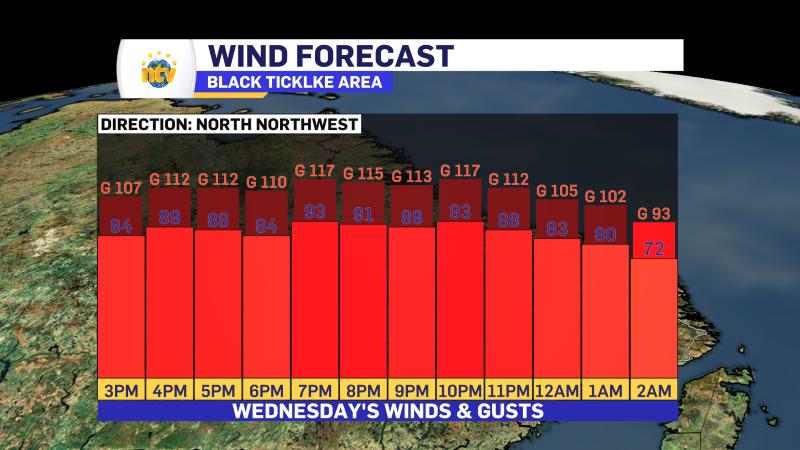
One of the areas I’m concerned about is Black Tickle. Forecasts indicate wind gusts may exceed 120 km/h in that location this afternoon and evening. The forecast is below.
I’ll be watching closely throughout the day, and any updates will be posted at the top of this page.