


A change in the wind direction should help keep the wildfire burning about 10 to 12 km from Labrador City away from the community for now. Yesterday’s high wind speeds (from the west southwest), low humidity and warm temperatures have been replaced by somewhat cooler temperatures, and a lighter wind from the north.
The image below is an estimated satellite location of where the fire is currently burning and the hot spots associated with it. The red dots are hot spots (or smaller fires). The cluster is where the bulk of the fire has been detected.

Notice how the fire is to the west of the town? If the winds remained from the west, the fire would get pushed in that direction. The wind today will be from the north, which will push the fire to the south, and tomorrow, the wind will be from the east, which will push the fire back to the west. All of these directions are beneficial because they will help keep the fire from getting any closer to the town.
Rain is currently in the forecast for Monday, and right now 10 to 15 mm is looking likely.
More updates to come.
-

Eddie’s Update | Weather improves on Sunday
The weather across much of the Province will improve today, with an increasing amount of…
-
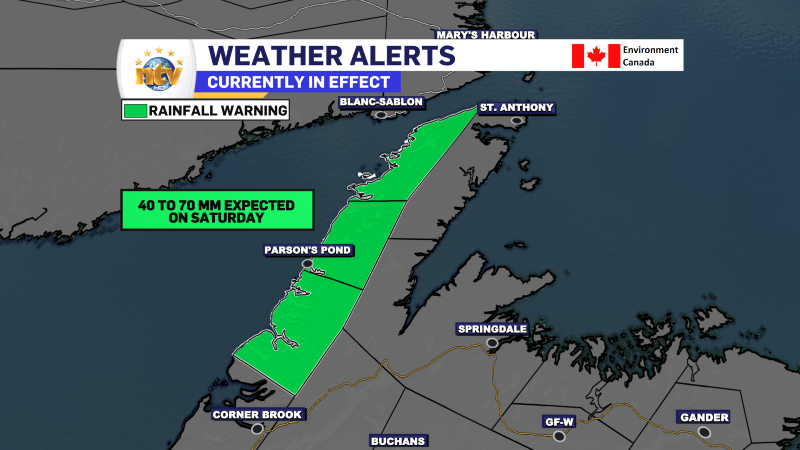
Rainfall Warning in effect today for parts of western Newfoundland and the Northern Peninsula
Heavy rain will fall over much of western Newfoundland and the Northern Peninsula on Saturday…
-

Rain chances and humidity increases for the weekend across the Province
The remnants of Tropical Storm Debby will swing through Newfoundland and Labrador this weekend. This…
