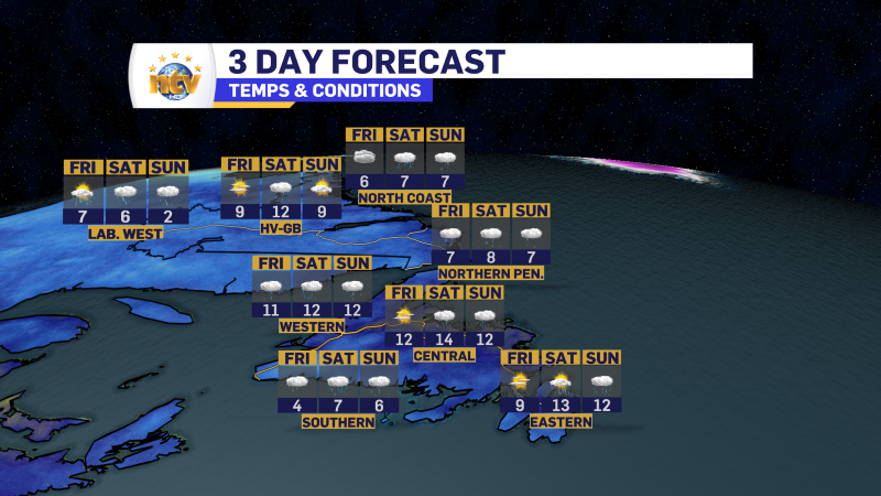
Over the next few days, lower single digits will be replaced with upper single digits and lower teens. We can thank this to a low going to our west and a high pressure centre to our to our southeast. The flow between the two is southerly. Sadly, with this warm-up, there will be a chance for rain. Initially, those chances will be over western Newfoundland and parts of Labrador Friday, and then over more of the Island Saturday into Sunday. At this point, I’ll happily take the rain with the warmth.
Rainfall will be highest over the southern area of the Island, where over 50 mm is possible between tomorrow and Sunday. Rainfall amounts will be a bit lower elsewhere. Or so it looks now. This does appear to be a weather pattern that may overproduce in the rain department– meaning there may be more than forecast based on the setup. Rainfall Warnings are now in effect for Burgeo – Remea and Channel-Port aux Basques for 50 to 80 mm of rain.
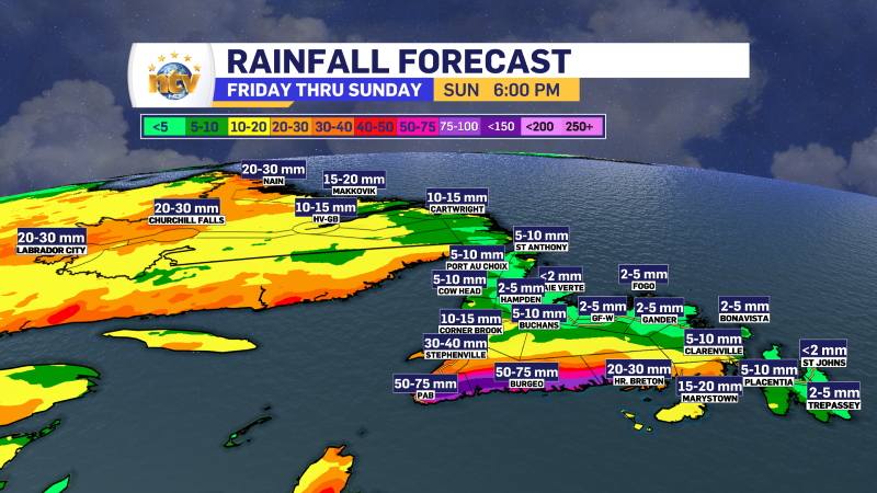
The rain in that area will begin this afternoon and continue into Sunday morning. Areas farther north and west from the South and Southwest Coast will see less rainfall, but locally amounts could be higher than the above map indicates.
I will have a more detailed updated on the weekend forecast later today.
-

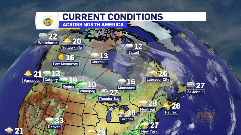
Unsettled for most of the province today
There will be a risk of some morning showers along the west coast of the…
-
Hot weather continues across the province
It will be another nice day across the Island portion of the province with a…