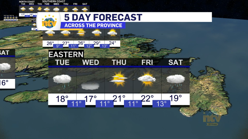
The weather across the Province will generally be unsettled today but not majorly disruptive. A large-scale blocking pattern in the North Atlantic will keep our flow from the north or north or north-northeast today. This setup will keep areas in onshore winds damp and chilly from the Torngats to the Avalon, while areas inland will be a tad warmer. Some areas of southwestern Newfoundland and Labrador West may actually see a few peaks of the sun at times today.

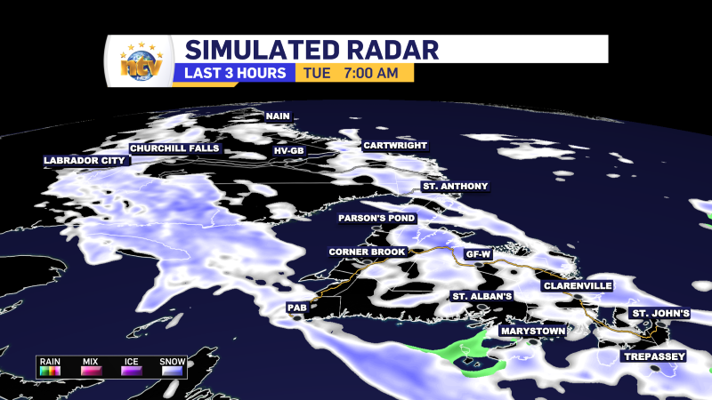
Locations in the onshore flow will see periods of rain and snow today, or showers and flurries. The snow will not add up to much, but at times it could be locally moderate. This will lead to a light accumulation on grassy and unpaved surfaces. Street and paved roads should remain wet as temperatures will be near or above freezing and the high sun angle in April will also help. Highs across the board will be near or above freezing today. Wind speeds will also be in the 20 to 40 km/h range for most areas.
Snowy Wednesday?
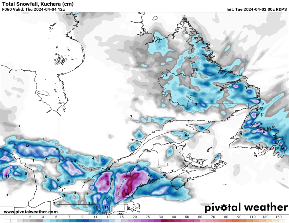
Another piece of energy will rotate across eastern and central Newfoundland tomorrow. This looks to be a bit more robust and will likely bring periods of snow to the aforementioned areas. While accumulations will not be overly significant, there is a high chance a large part of the Island from the Baie Verte Peninsula to the north half of the Avalon (including the Metro) see 5 to 10 cm of snow from Wednesday morning into late Wednesday evening. There is still much uncertainty in this forecast and I’ll have more detailed update for you later today.
-
Morning showers expected for Newfoundland
The weather today will largely be a carbon copy of Monday. Most areas will see…
-
Nice start to the work week after some morning showers
It was a stormy weekend across Island portions of the province, with several areas seeing…