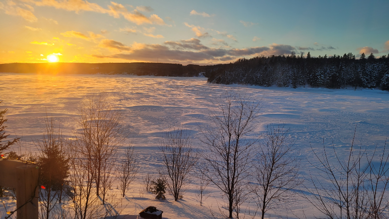
Image above taken by Betty Mullaly-Moulton in Loon Bay
An area of high pressure will build into the region for our Wednesday briefly. This will set us up for a sunny day across the Province with reasonably comfortable high temperatures and more moderate wind speeds.

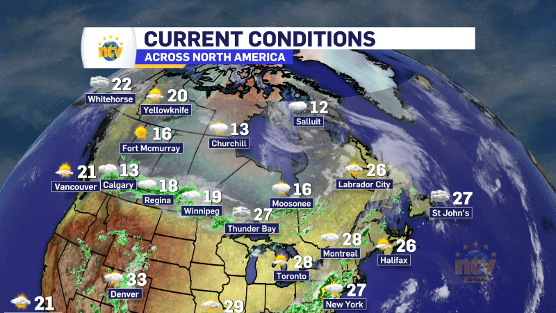
That high started to build in last night, which set us up for a relatively cold night, as readings this morning are into the minus single digits, teens and 20s across the region. Here is a snapshot of the morning temperatures as of 6:30 AM NST.

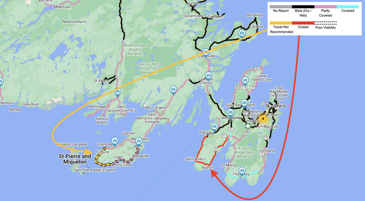
We were dealing with some snow squalls last night over the Southern Avalon and Burin Peninsula and because of that there are some roads that are either closed or travel is not recommended on this morning. Conditions in these area will improve later today.
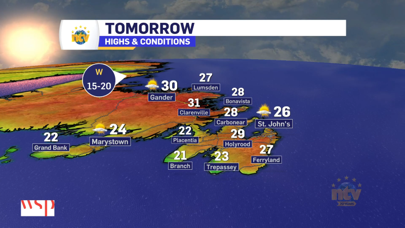
Expect a mix of sun and cloud, to mostly sunny skies across the Province today. Highs will recover into the minus teens in Labrador and minus single digits over most of the Island. Wind speeds will generally become lower as the day progresses, thanks to the area of high-pressure building in.
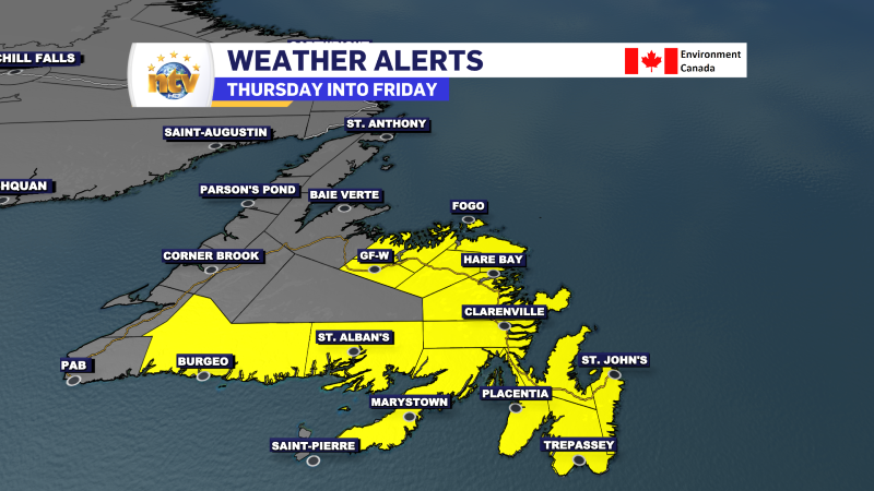
Our next weathermaker moves in later tomorrow and will be a messy one. A Special Weather Statement is in effect for various areas of central, southern, and eastern Newfoundland for the time frame. I’ll have an updated, detailed forecast for you later today.
-
Hot weather continues across the province
It will be another nice day across the Island portion of the province with a…