


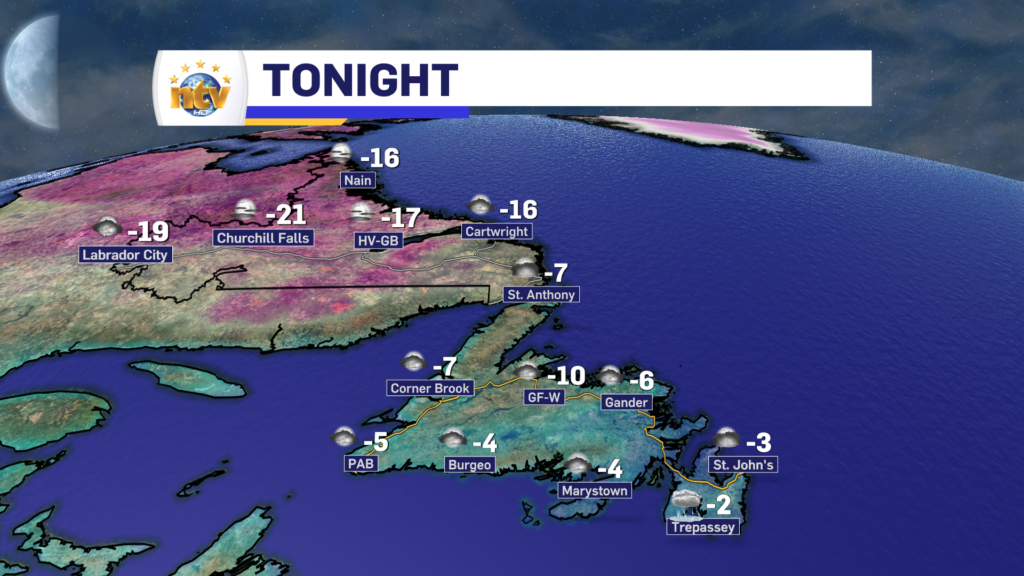
The weather across NL for the next 24 to 36 hours will remain quite calm ahead of, what looks to be, the first major snowfall of 2024 for eastern Newfoundland. Tonight will see partly to mostly cloudy skies on the Island, with lows of -3 in the east and south, -5 to -10 in Central and closer to -7 on the West Coast and GNP. Labrador will see partly cloudy to mainly clear skies, with lows into the minus teens and 20s.
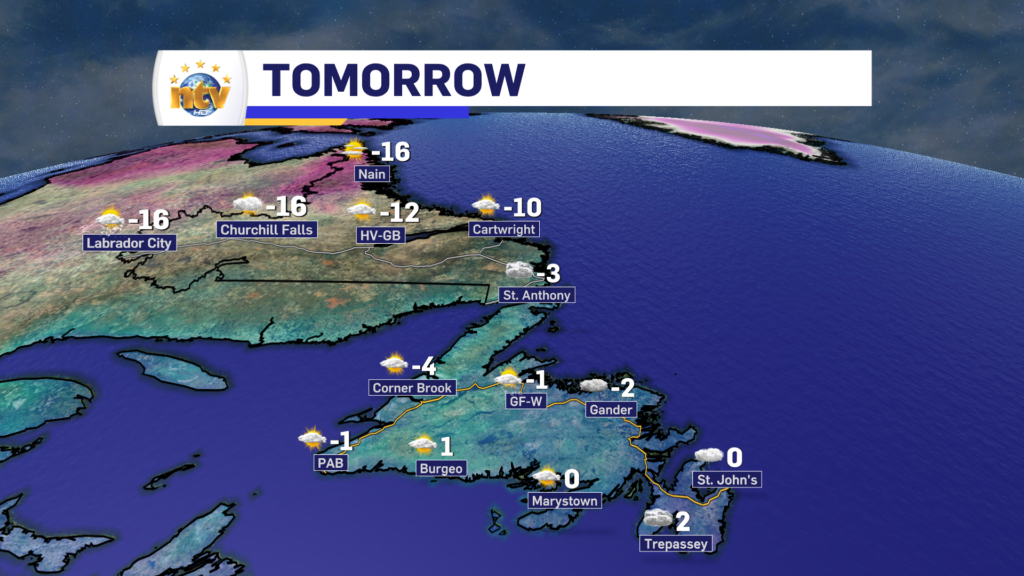
Thursday will be partly cloudy for areas of western and southern Newfoundland, while Central areas will see cloudy skies and a few flurries. Eastern areas will see pockets of freezing drizzle near north-facing shorelines while southern areas will see a mix of sun and cloud. It will be windy in the east, with northerlies gusting to 50 km/h. Highs will be near 0 in the east, central, and south, while west and onto the GNP highs will be closer to -3. Labrador will see sun and clouds with highs in the minus teens.
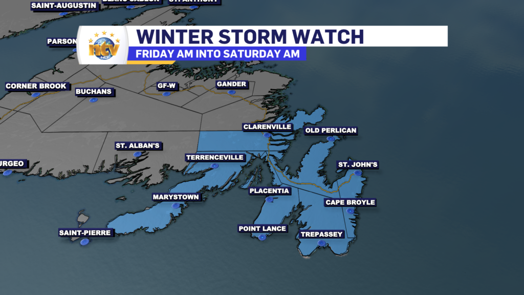
First Snowfall of 2024 for eastern Newfoundland
The first major snowfall of 2024 is set to move through the region between late Friday morning and very early Saturday morning. Significant snow is likely over from the Bonavista Peninsula to the Burin Peninsula and points east, where a Winter Strom Watch is currently in effect. These alerts will be upgraded late Wednesday night or early Thursday morning by Environment Canada.
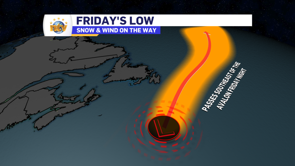
The snow will be from an area of low pressure that will pass southeast of the Avalon Peninsula Friday night. Typically, for lows that produce heavy snowfalls over this part of the Island, they need to be closer than this will be. However, while this will be an atypical track for heavy eastern Newfoundland snowfall, guidance is in fairly good agreement the snow will fall.
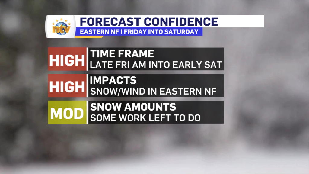
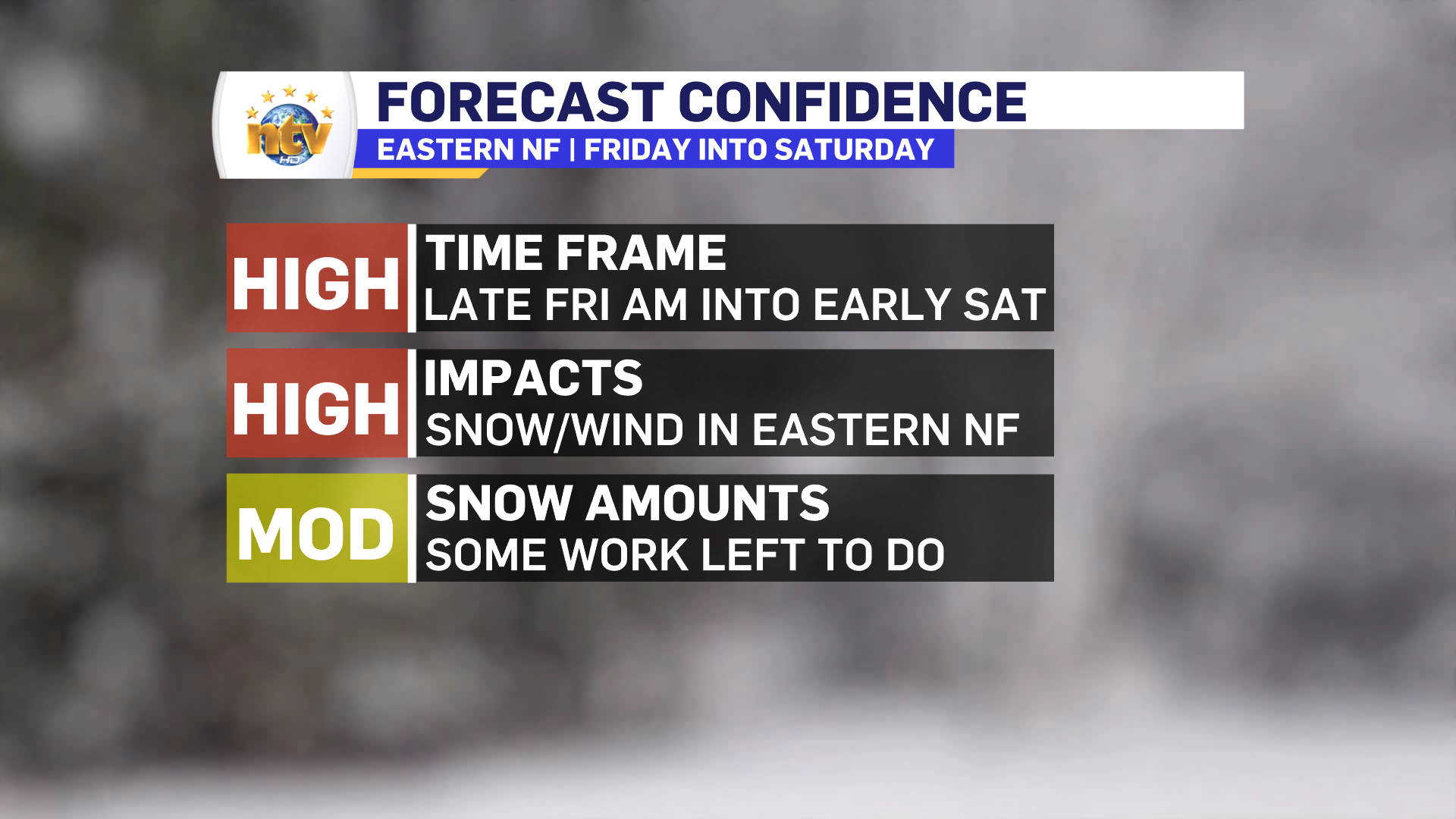
Timing of the System
The snow will arrive in eastern Newfoundland Friday morning and will end late Friday night or early Saturday morning, before sunrise for the most part. The heaviest snow will be from Friday afternoon into the evening, when rates on the Avalon may be as high as 4 cm per hour. During that time wind speeds will begin to ramp us as well.
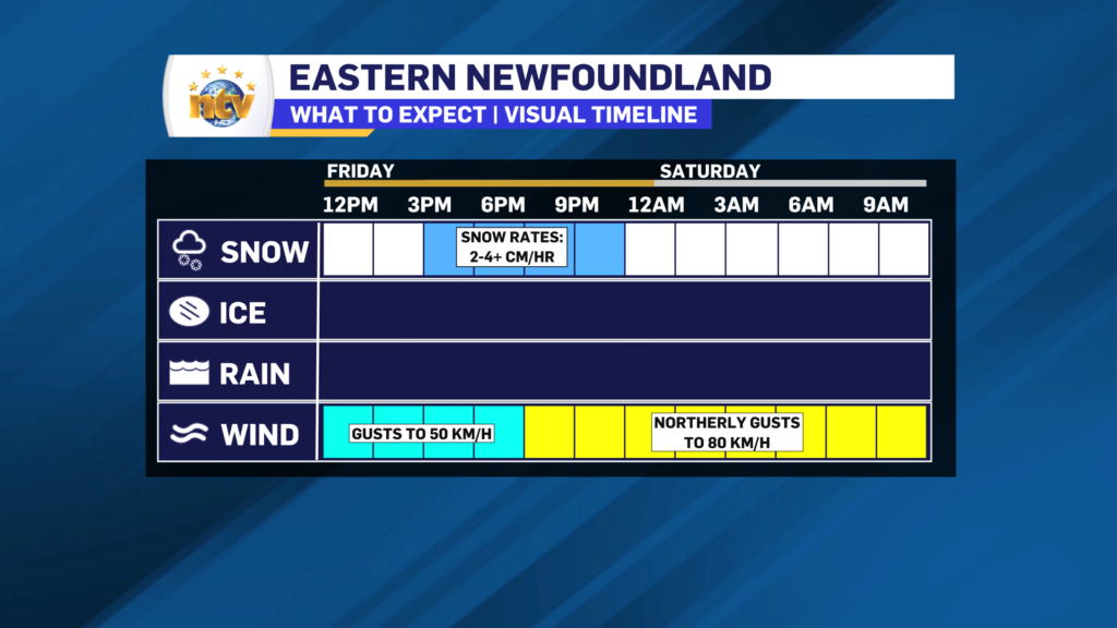
Blizzard, or blizzard-like conditions will develop over portions of eastern Newfoundland Friday afternoon and evening as the intense snowfall rates line up with the higher wind speeds.
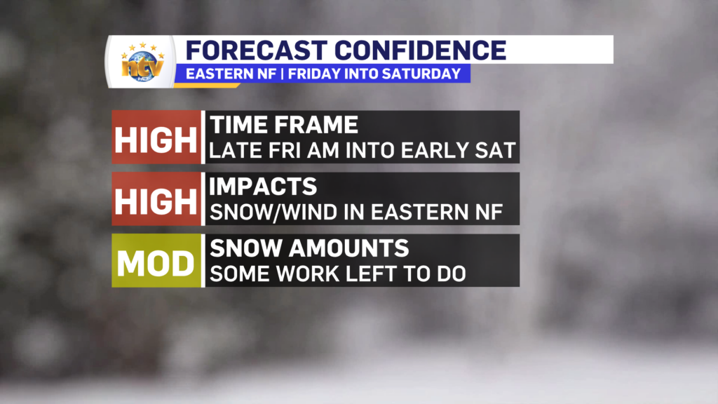
My confidence level for this storm is higher than it’s been for the last few. I am very confident the snow will arrive Friday morning and end in the evening. I’m also confident the snow will fall and the wind will make travel difficult during the period of heavy snowfall. What I’m a little less confident about is the snowfall amounts, as there is still a bit of disagreement in the modeling on just where the heaviest snow is going to be.
Snowfall Amounts
Chances are very high of significant snowfall on the Avlaon and areas just to the west. In fact, there is roughly 80-100% of seeing more than 15 cm on the Avalon between Friday morning and early Saturday morning. Those chances get lower as one moves west of the Avalon.
The heaviest snow is going to fall on the Avalon Peninsula, and as of Wednesday evening, amounts over that area and areas just to the west are predicted to be in the 15-30 cm range. I think the farther east you are on the Avalon, the higher the odds are that you’ll end up on the higher end of that scale, and the farther west you go, the higher the odds are that you’ll be on the lower end of the scale. My initial stab at snowfall shows this well. And I will likely make some tweaks to this Thursday to account for more certainly in the short range.

While there is still some uncertainty in the forecast, it’s become quite obvious we are in for a potent winter storm Friday into Saturday. Thursday will be a solid day to get your storm chips… assuming the forecast doesn’t change drastically. And we know this winter short-range trends have not bee Eddie’s friend.
Have a great night!
Eddie
-

Threat of wildfires on west coast higher this year, say forestry officials
As residents of the province prepare to head out into the woods for the Victoria…
-

Labrador West MHA wants water bomber back
With wildfires threatening Fort McMurray, Alta., again, Labrador West MHA Jordan Brown wants a water…
-

Province warns residents to be ready for forest fire season as wildfires threaten Fort McMurray
Evacuation orders and alerts remain in effect for Fort McMurray, Alta., as wildfires continue to…
