


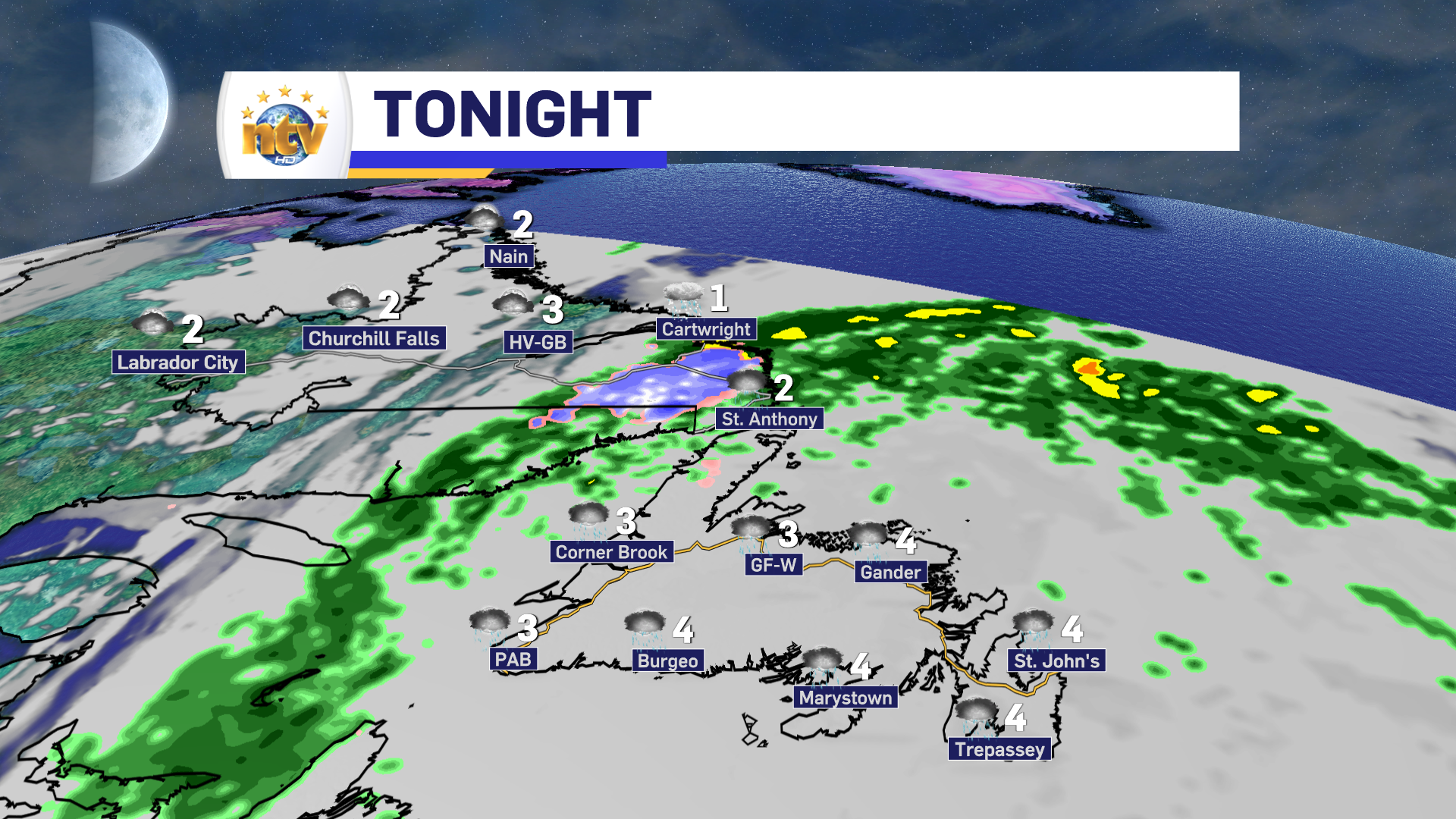
Friday Night’s Forecast
An area of low-pressure track over eastern Newfoundland tonight. This will keep areas of showers and rain on the go across much of the Island overnight. Parts of southeastern Labrador will see rain and snow overnight. Northern and western Labrador, however, will see mostly clear skies. Lows range from 2 to 4 on the Island and 1 to 3 in Labrador.
Saturday’s Forecast
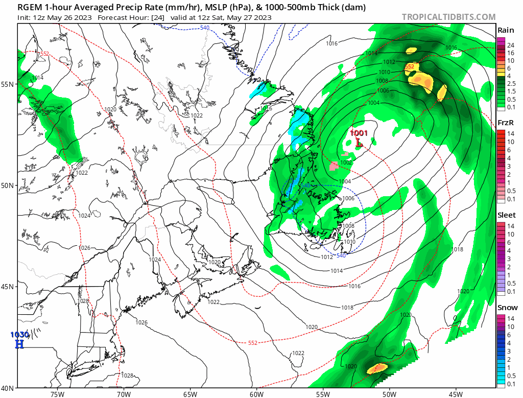
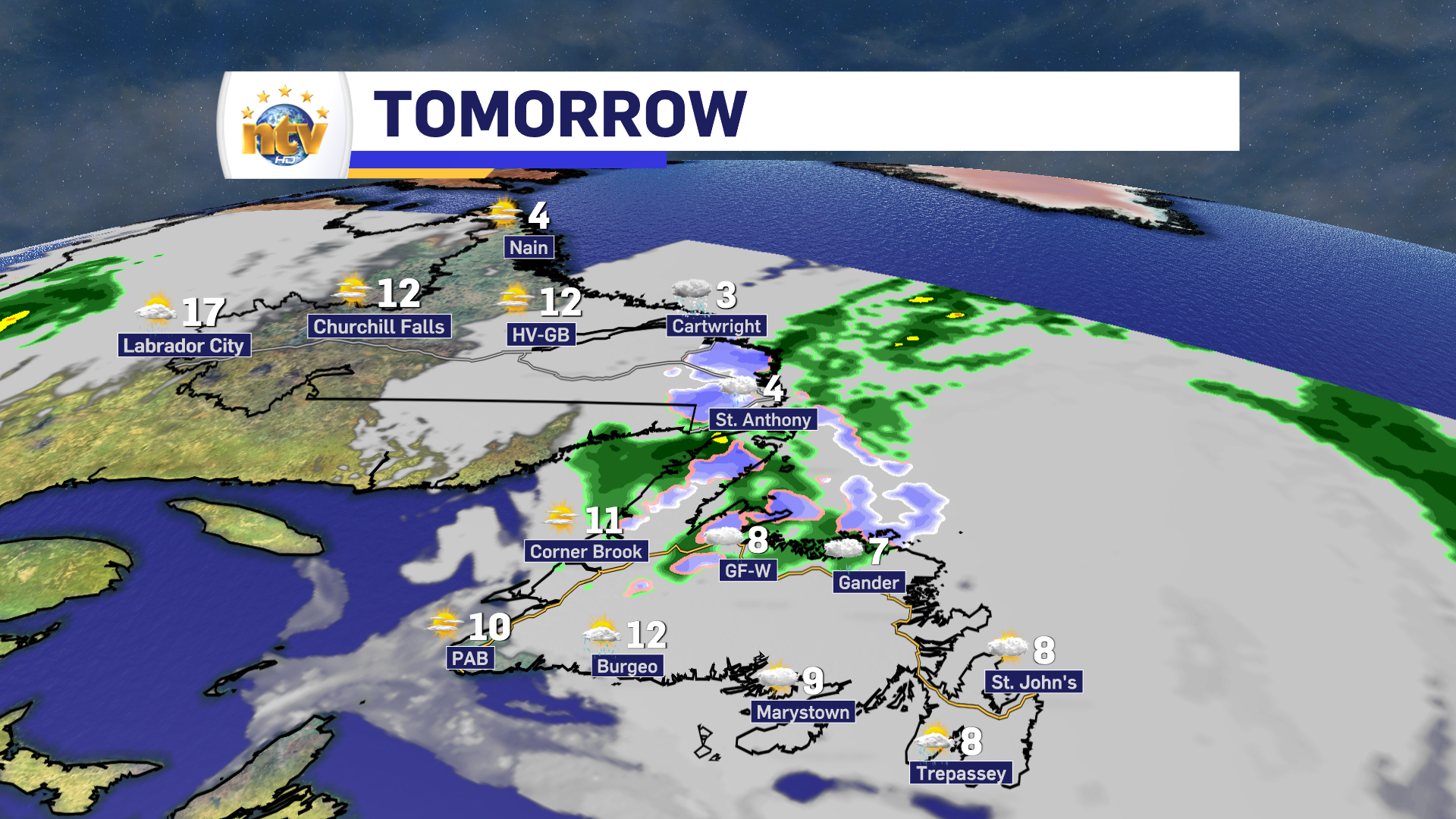
The area of low pressure that passes north of the Island tonight, will be slow to pull away on Saturday. This will keep areas of showers and rain on the go for much of Central and western Newfoundland, along with the Great Northern Peninsula. Eastern and southern sections of the Island will see more in the way of scattered showers. Along with the scatteredness of the showers, *should* come some sunny breaks. Southern Labrador will see rain and snow linger throughout the day. There will be some snow accumulation in the higher terrain, but most places on the coast will either see rain or rain and sloppy, wet snow.
Temperatures on Saturday will range from 8 to 12 on the Island and 3 to 17 in Labrador. Much of Labrador West will see sunshine, while eastern areas will see a bit more in the way of cloud cover.
Sunday’s Forecast
Sunday will see a decent day across much of the Island, with highs for many areas, including on the Avalon, into the mid to upper teens. It’ll be a bit different in Labrador, where rain and snow will fall as an area of low-pressure swings in from Quebec.
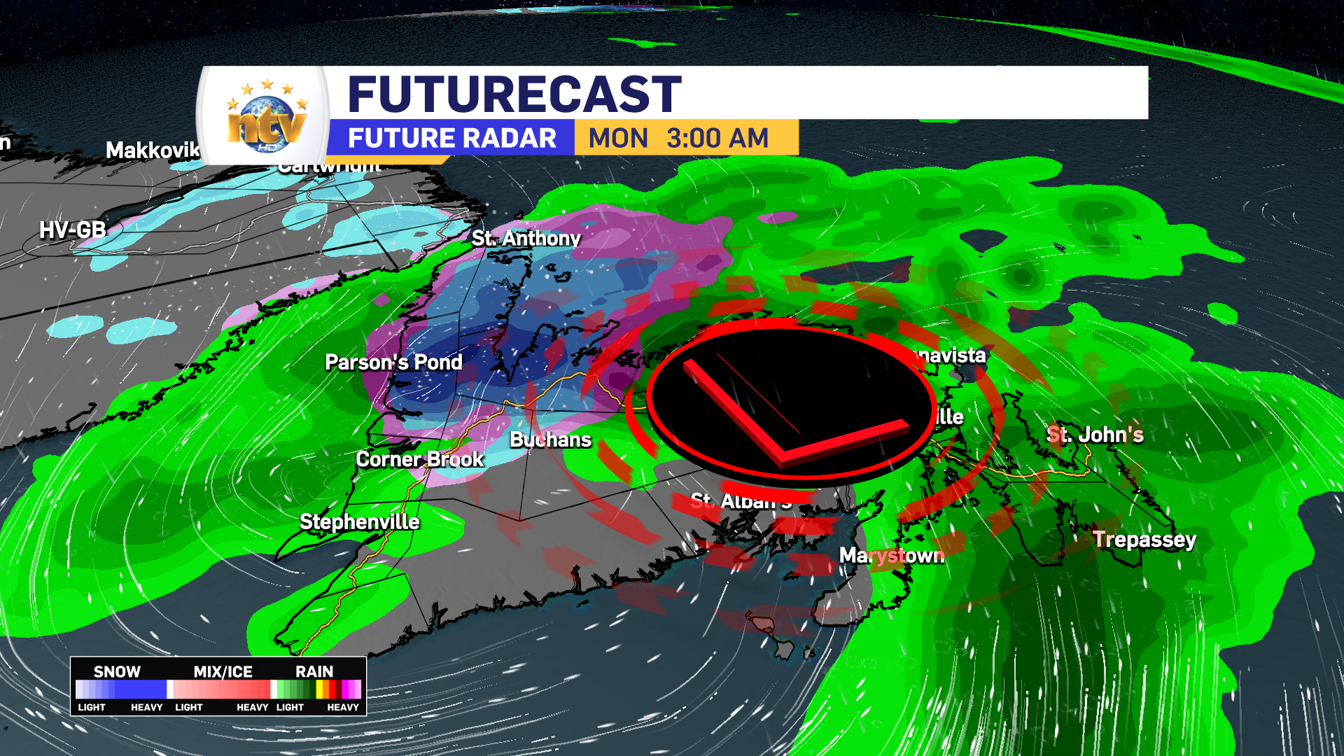
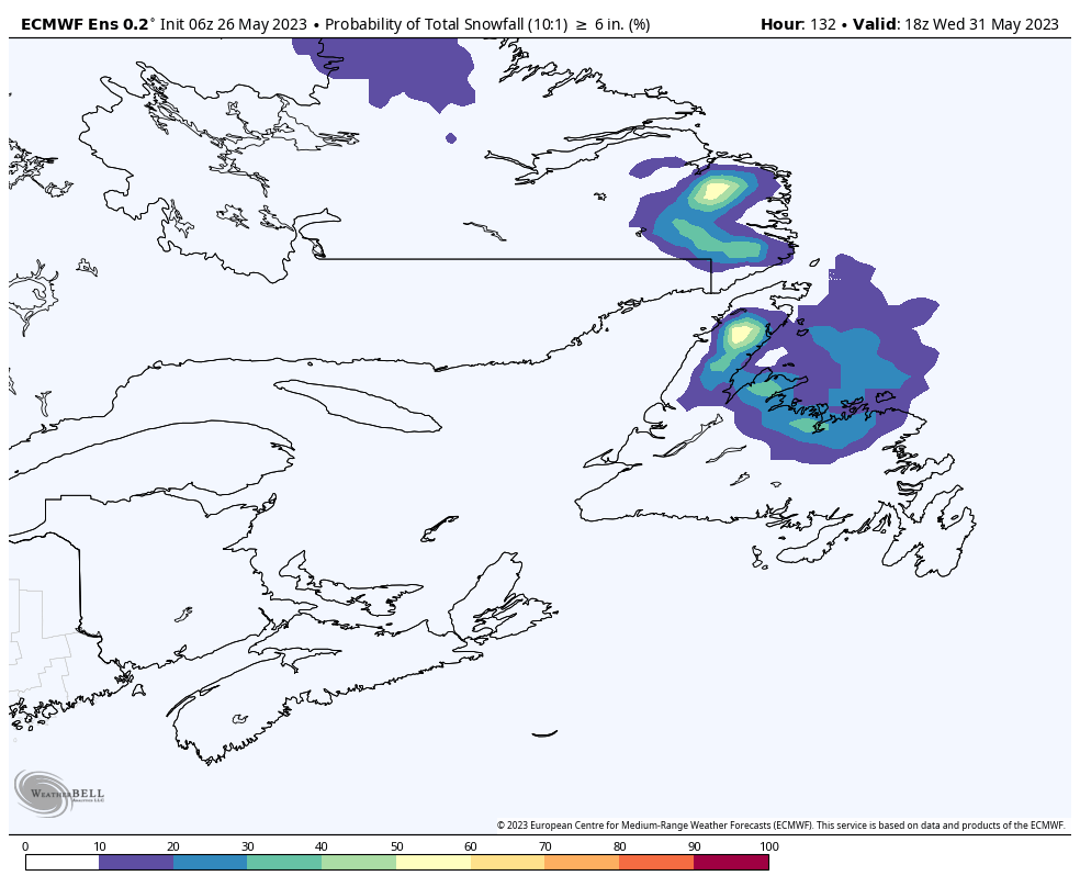
Snow early next week for the Island?
The area of low pressure that drops into Labrador will settle over the Island Sunday night and Monday. This low will have enough cold air with it, that snow will likely fall over the western and central portions of the island Sunday night into Monday. The question right now is a) where is the heaviest snow going to fall and b) how much will there be?
As of now, it looks like the heaviest snow is going to be on the Northern Peninsula and into Central, where computer guidance currently indicates there is a 20 to 40% of more than 15 cm. Beyond that, it’s hard to say which locations will see that, but the standard, “inland over higher terrain,” looks like a good bet.
There are still details to work out on this one, and I’ll have more on that over the weekend. Have a great one!
Eddie
-
Nicer weather arrives to end the work week!
The weather will generally improve across the Province overnight as an area of low pressure…
-
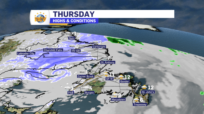
Rain, snow, and ice linger into Thursday across N.L.
Here is Eddie’s forecast from tonight’s NTV Evening News Hour
-
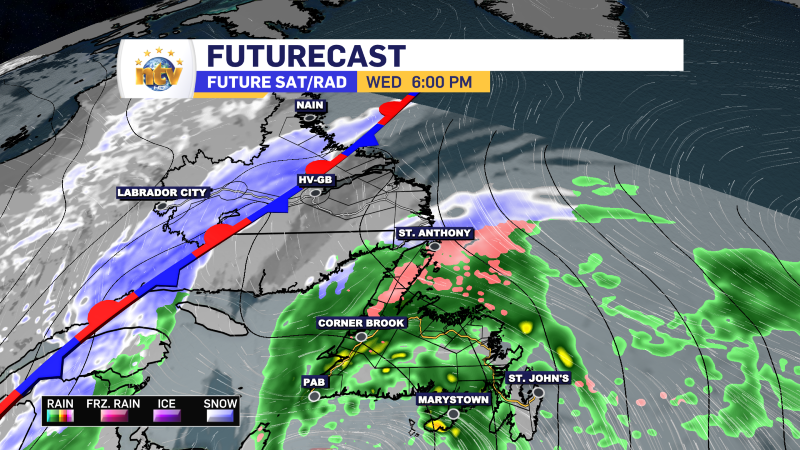
Tuesday evening’s forecast; more rain for the Island and snow for the Big Land
The Big Picture & Small Details The windy conditions we’ve seen for much of the…
