


Saturday’s Forecast
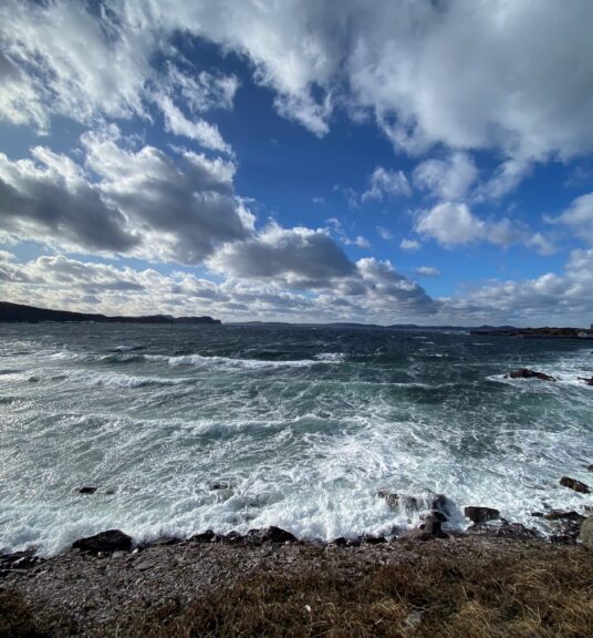
Mainly cloudy on the Island, with areas of flurries near north-facing shorelines. This includes the Avalon Peninsula and the St. John’s area. Highs will be near -2. Areas of the West Coast and the South Coast should be dry, with a few breaks of sun.
Labrador will see a few flurries on the coast, otherwise, it’s partly cloudy to mostly sunny with highs of -3 in the southeast coast to -12 in the north and west.
Sunday’s Forecast and the Long Range
A few more flurries will be found across the Province on Sunday, but that’s about it. Monday and Tuesday look similar. Temperatures will moderate a bit but for most areas of the Island will be a few ticks below freezing and Labrador will see highs in the minus teens.
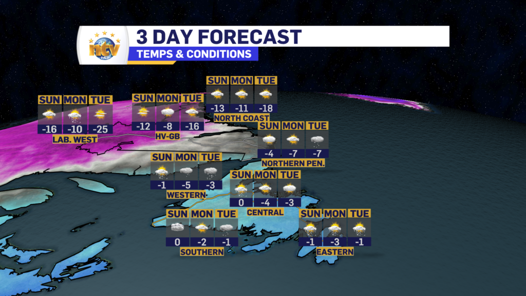
A surge of arctic air will slide into the Province late Tuesday into Wednesday, and that will send readings into the minus 30s in Labraodr by Tuesday morning, with highs Tuesday into the minus 20s. Things rebound a bit for Wednesday. On the island, the arctic air comes in Tuesday night and temperatures will drop into the minus teens by Wednesday morning. Wednesday will see highs near -10. We will rebound a bit for Thursday as this air mass is transient in nature.
-

Eddie’s forecast; May starts like April ended
May starts like April ended… cold and damp for much of the Province. Eddie has…
-
Not much change in the weather for Wednesday
An area of low pressure continues to spin southeast of Newfoundland and Labrador and remains…
-
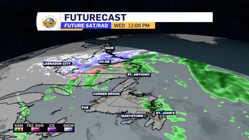
The RDF continues into Wednesday… but there are some literal bright spots in the forecast
Get all the details in Eddie’s forecast from tonight’s NTV Evening News Hour!
