


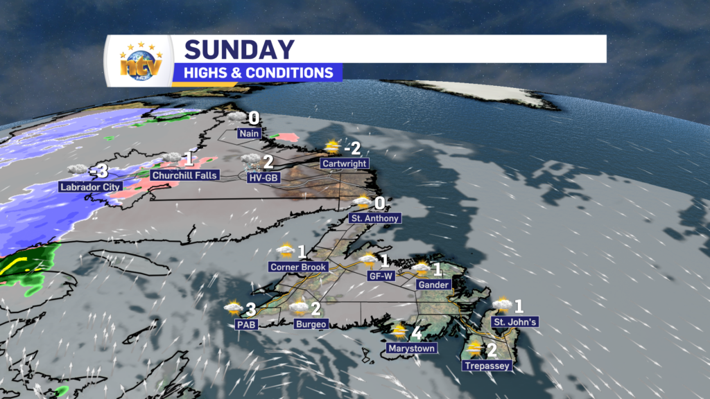
Sunday’s Forecast
Partly to mostly cloudy on the Island, with near 1. Labrador will also see a milder day, with highs reaching a couple of ticks below the freezing mark for afternoon highs. Snow will move into Labrador West in the afternoon as our next weather-maker moves in
The Next One
An area of low pressure will roll across southeastern Labrador Monday night through Tuesday. This will bring snow to northern and western Labrador and rain to the Island portion of the Province and southeast Labrador.
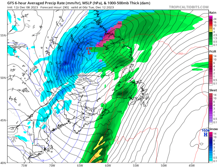
This system will also bring with a substantial warmup to the Island portion of the Province and southern Labrador between Monday and early Tuesday. Temperatures will surge to near 10° south of the warm front, which will lift through Monday. But with this will come rain and a period of gusty wind speeds.

Colder air will return later Monday and Tuesday as the area of low pressure passes and the cold front pushes across the region (pictured below). Snow flurries and squalls return to the West Coast by Tuesday afternoon, and a return to more seasonable temperatures can expected for much of next week.

-

Threat of wildfires on west coast higher this year, say forestry officials
As residents of the province prepare to head out into the woods for the Victoria…
-

Labrador West MHA wants water bomber back
With wildfires threatening Fort McMurray, Alta., again, Labrador West MHA Jordan Brown wants a water…
-

Province warns residents to be ready for forest fire season as wildfires threaten Fort McMurray
Evacuation orders and alerts remain in effect for Fort McMurray, Alta., as wildfires continue to…
