


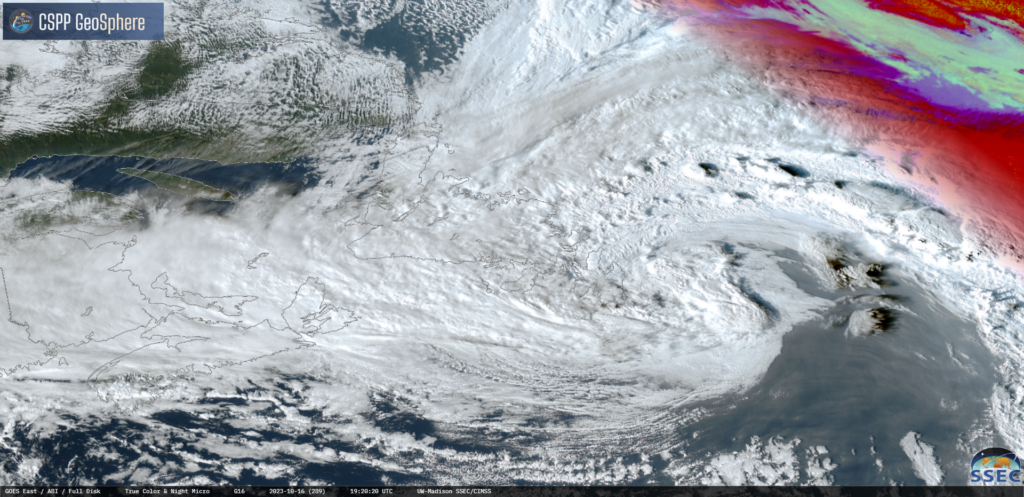
The area of low pressure that, by in large, brought a miserable day to most of Newfoundland is going to slowly depart overnight. This means areas of southern, eastern, central, and northeastern Newfoundland have to deal with rain and gusty winds into the early morning of Tuesday.

On top of that, temperatures are only going to be in the mid-single digits overnight, so it will feel even colder. For lack of a better term, it’s going to be a dirty old night out there. Futurecast shows the timing of the rain moving in, and out early Tuesday, very nicely, and can be seen below.
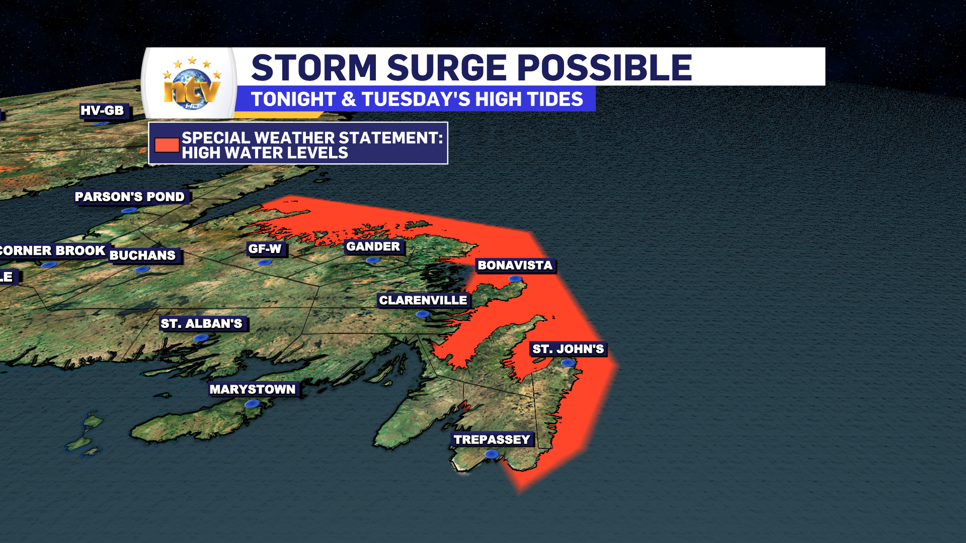
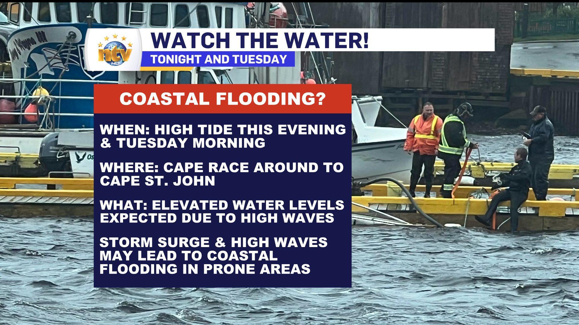
As the low slowly pulls away, there is going to be some high wave action along the east and north-facing shores of the Island from Cape Race (Southeast Avalon Peninsula) to Cape St. Johns (Baie Verte Peninsula). This high wave may generate higher than normal high tides tonight (7 PM to 10 PM) and Tuesday morning (7 AM to 10 PM) for the areas mentioned above. ECCC has issued a Special Weather Statement addressing the potential of minor coastal flooding. Those with interests in these areas, such as fishing vessels, should heed the alert and monitor your assets closely.
Beyond the rain, wind, and waves on the Island, parts of Labrador saw their first frozen precipitation of the season early this morning (October 16, 2023). According to Rodney Barney, a Meteorologist with the ECCC NL Weather Office in Gander, this is the latest on record.
First reported frozen precip of the season in western #Labrador (officially a drizzle/snow mix).
— Rodney Barney (@rcbstormpost) October 16, 2023
This makes Oct 16, 2023 the latest in any season Wabush #YWK has gone before reporting its first snow.
Previous latest first-snow date was Oct 2 (in 1975).
Data since 1961.#nlwx https://t.co/bcqpuVHrCu
THE FORECAST
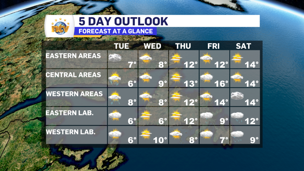
The weather improves for Tuesday on the Island, however, clouds will remain for eastern and northeastern areas, while areas to the west should see some sunshine by the afternoon. There will be some scattered showers in the wake of the departing low. Highs range from 6 to 9 and winds will be as high as 30 km/h from the north.
Labrador will see partly cloudy to mostly sunny skies, with highs in the 3 to 7 range.
The remainder of the week will see generally quiet weather across the Province, with highs ranging from the single digits to lower teens. The next chance of rain looks to be late next weekend.
-

Hot and humid start to the weekend
The Island will see sunny skies to start today. There are a few fog patches…


