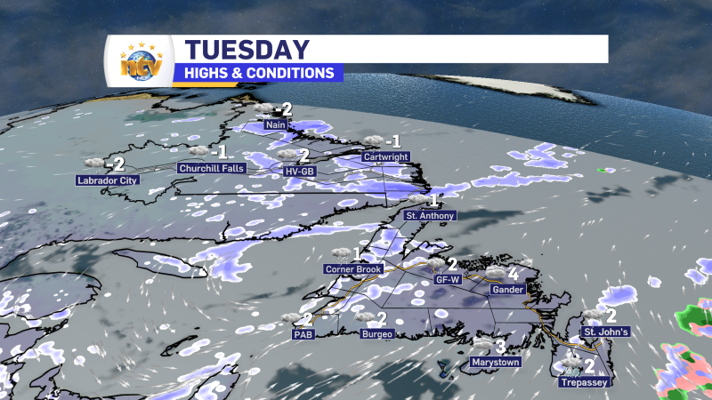
A couple of areas of low pressure are going to “bother” the Province with some unsettled weather today. We have our main low swirling north of the Island and a secondary low about to pass east of the Avalon Peninsula. Between these two, we can expect areas of showers, flurries and even some snow across much of the Province today. However, in most areas, amounts will not be significant, and the weather will not be overly impactful.
Today’s Outlook
As you head out the door this morning, beware of black ice. We had snow and rain yesterday, followed by temperatures dipping to near-freezing overnight. There will definitely be some slick spots underfoot so use extra caution on any area that looks wet.
Across the Province, temperatures will generally be near or a couple of ticks above the freezing mark. There will be areas of flurries and light snow or rain showers on the West Coast and snow ongoing on the coast of Labrador. Eastern areas will see periods of rain and/or wet snow as an area of low pressure tracks to our east. Futurecast (below) show what we can expect today rather well, and takes you though the day hour by hour.

Beyond today, the weather looks quiet for Wednesday across the region. Thursday will see another low moving in. This will bring more rain and snow to much of the Island and snow to southeastern Labrador. This looks to arrive during the second half of the day Thursday. I’ll have more details on this later today.

I’ll have your next forecast update for you later today!


