


Snow flurries and squalls will continue on the Island through Friday. The most intense squalls will be found on the West Coast, South Coast, Burin and Avalon Peninsulas. Areas under the squalls will see blizzard conditions for short periods. Areas under persistent squalls will also see rapidly accumulating snowfall. To make matters worse, wind speeds will gust as high as 100 km/h over exposed coastal areas of the Island overnight and Friday from the west. This will further reduce visibility, and at times, it may be near 0. The weather in these areas will slowly improve on Friday, as the wind direction changes in the afternoon and ends the intense snow squalls.
Coastal areas of Labrador and back to the West will also see overnight and Friday. The areas of snow will become less numerous as the day goes on, and it will finally end tomorrow night.
The weekend looks much calmer across the Province. Be sure to watch my forecast (above) to get all the details!
-

Eddie’s forecast; May starts like April ended
May starts like April ended… cold and damp for much of the Province. Eddie has…
-
Not much change in the weather for Wednesday
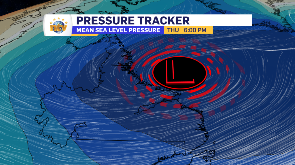
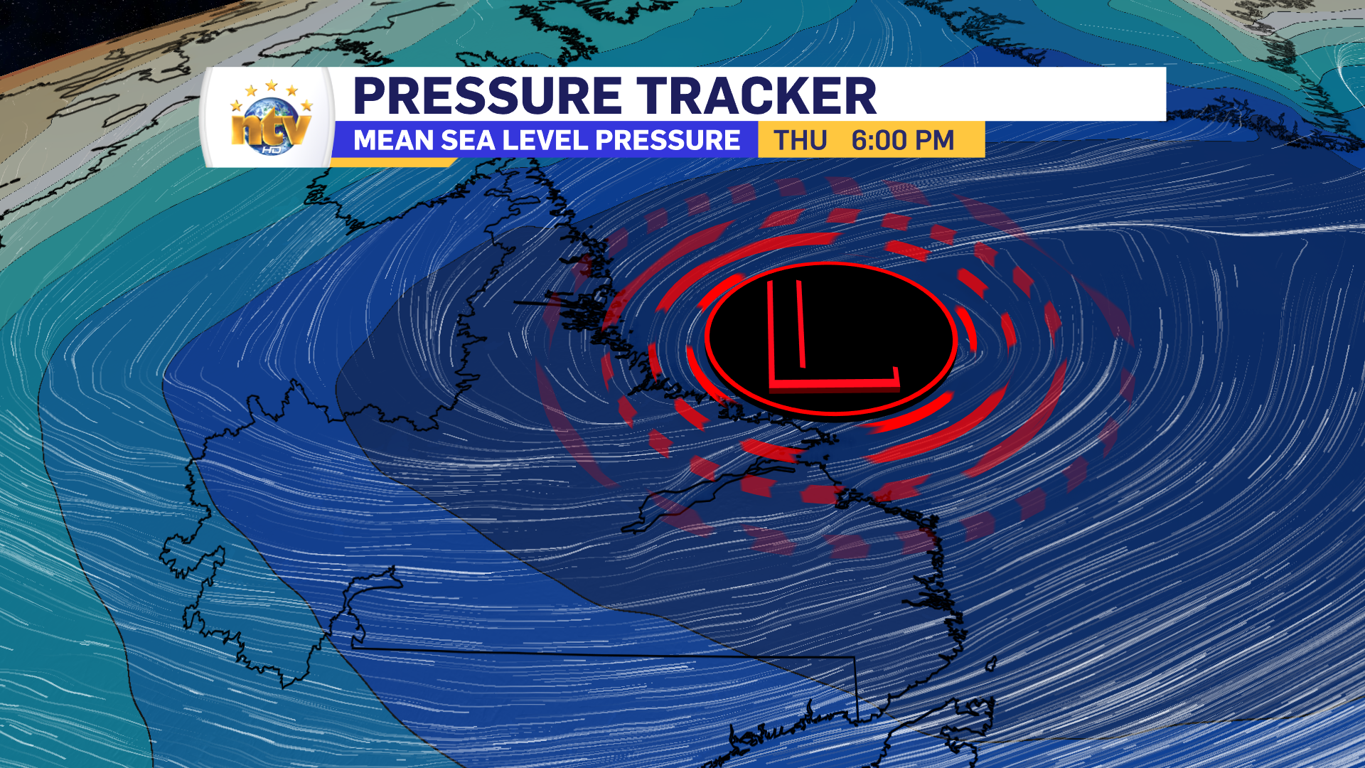
An area of low pressure continues to spin southeast of Newfoundland and Labrador and remains…
-
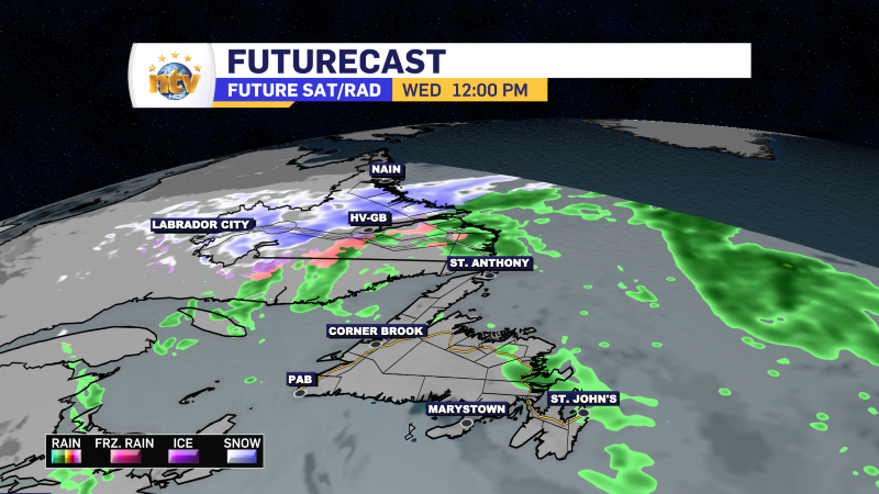
The RDF continues into Wednesday… but there are some literal bright spots in the forecast
Get all the details in Eddie’s forecast from tonight’s NTV Evening News Hour!
