


Warmer air moves across the Province overnight ahead of a weak area of low pressure currently tracking across Quebec. Temperatures will rise overnight, and by morning, most areas will be hovering a few ticks below freezing on the Island and between -6 and -10 in most of Labrador. The animation below shows that well.
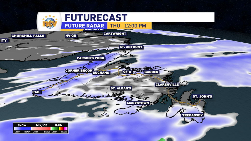
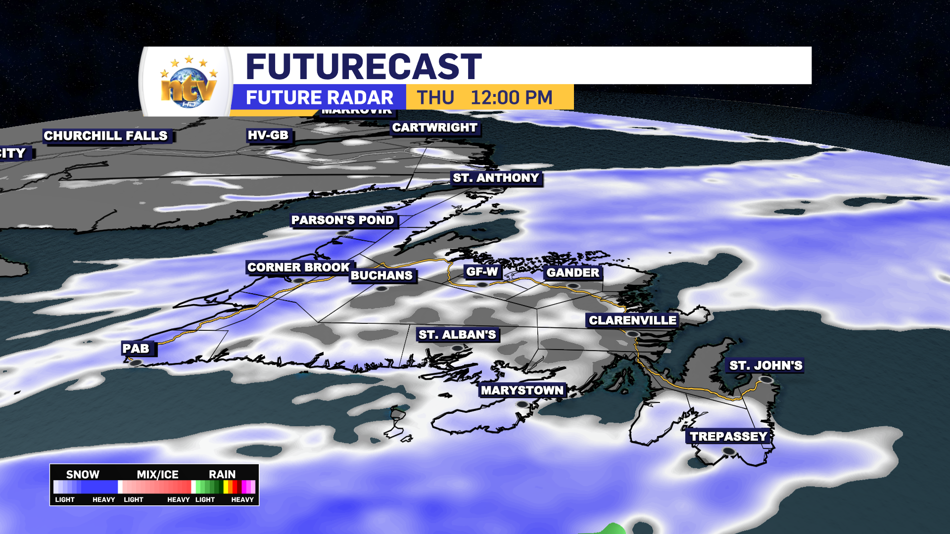
On top of that, snow will move into Labrador overnight and move out early Thursday before moving across the Island Thursday into Thursday evening. The snow that we see will be more nuisance-type stuff, but some areas will see as much as 5 cm. Parts of the West Coast will see more, specifically in the higher terrain.


Temperatures on Thursday will peak near 0 over most of the island and -10 in much of Labrador. Temperatures in Labrador will fall sharply Thursday afternoon. That same drop-off will happen Thursday night on the Island. Friday morning lows will be into the minus teens, across much of Newfoundland and minus 20s over much of Labrador.
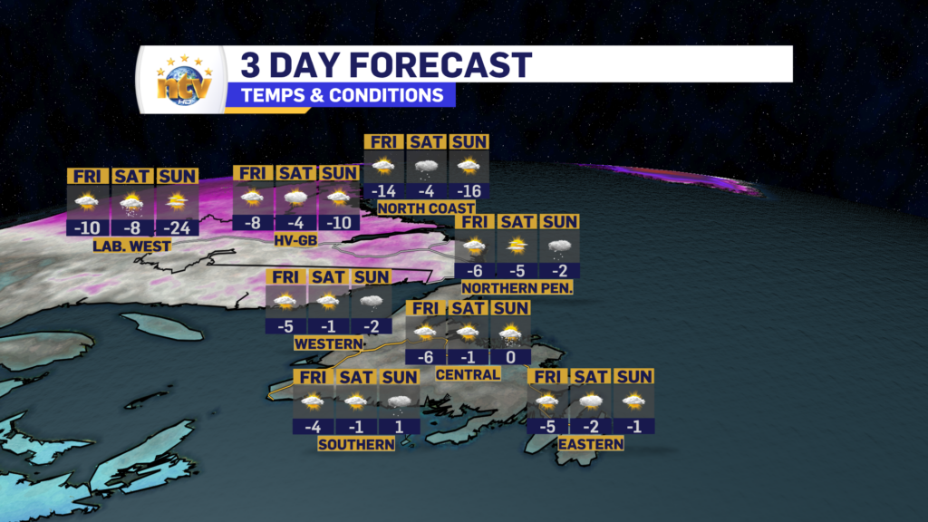
Friday, Saturday, and Sunday look quiet, with seasonable highs. Another cool snap looks to arrive Monday, and then there is the potential for some over parts of eastern Newfoundland during the middle part of next week.
This weather pattern looks to remain dry and cold, while our neighbors to the west may see warmer than normal readings.
-

Threat of wildfires on west coast higher this year, say forestry officials
As residents of the province prepare to head out into the woods for the Victoria…
-

Labrador West MHA wants water bomber back
With wildfires threatening Fort McMurray, Alta., again, Labrador West MHA Jordan Brown wants a water…
-

Province warns residents to be ready for forest fire season as wildfires threaten Fort McMurray
Evacuation orders and alerts remain in effect for Fort McMurray, Alta., as wildfires continue to…
