


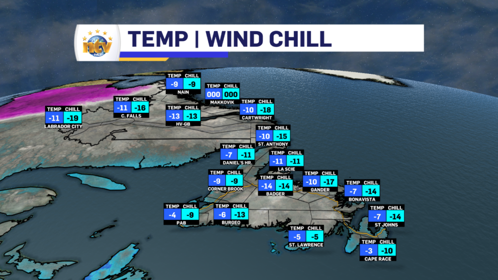
The day is certainly starting off on the cold side over much of the Island, with temperatures well between -5 and -14. The coldest readings are being observed in the lower elevations of the Exploits and Humber Valleys. Meanwhile, Labrador is closer to -10, which is generally where the highs this time of year are supposed to be. Here is a look at temps and chills as of 5:30 AM NST.
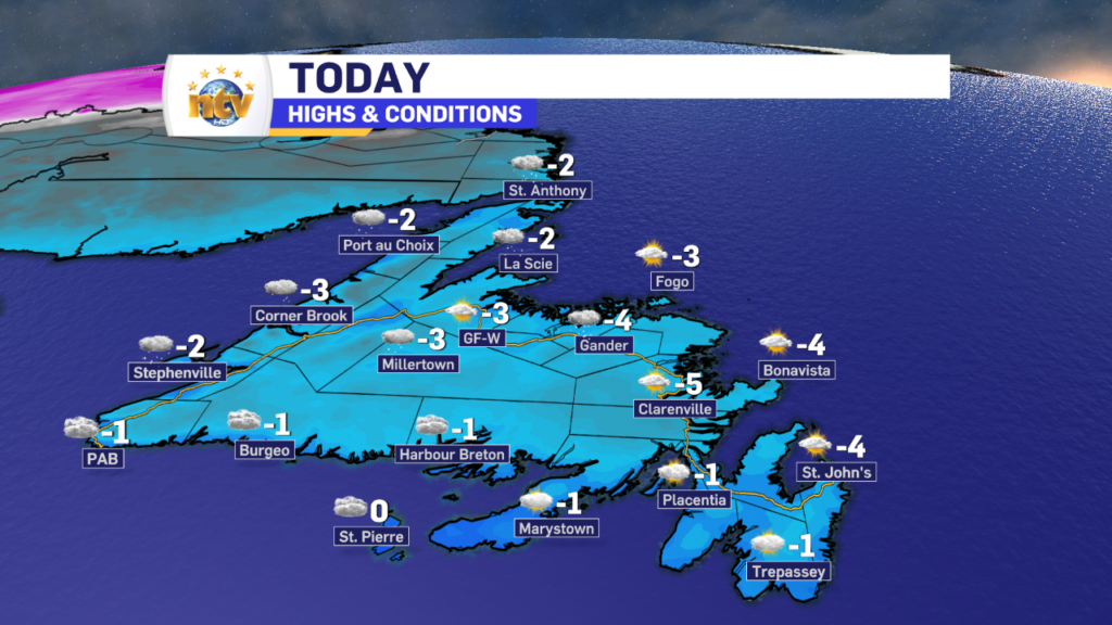
Today will see mostly sunny to partly cloudy skies over much of the Island, which will be a nice change of pace from the last couple of days. The exception will be the West Coast and GNP where cloudy skies will prevail, and areas of light snow and flurries will become more numerous this afternoon and evening. I do expect the snow to be overly heavy, but it may make for some short stints of difficult travel through the higher terrain and in areas of blowing snow. Temperatures climb to within a few degrees of 0º but will generally stay below.
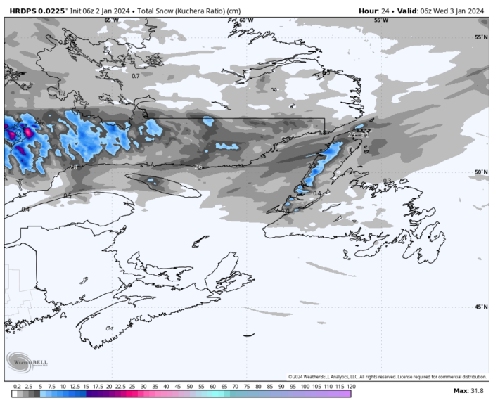
Snowfall will not be significant today, but some areas of the higher terrain in the Long Range Mountains and some locations along the coast will be up 5-10 cm between later today and tonight. Most areas will be under 5 cm, however. And beyond that, many areas will see less than 2 cm by Wednesday morning. The HRDPS model shows this well (below).
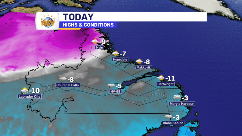
Labrador will see a mix of sun and cloud today, and temperatures not move much from what they are this morning. While lows were much above normal, highs today will be closer to where they should be given the time of the year.
The Longer Range
A series of lows is set to pass near, or east of, the Avalon Peninsula this week. The first of which will be Thursday, the second of which will be later Friday into Saturday, and the third will be early next week. At this time, it looks like the first low will bring a more glancing blow to the region with some rain and wet snow. The second low *could* bring more significant snowfall to the Avalon, but there is a strong signal most of the heavy snow may end up offshore. The third system is just something to watch for the time being. At this moment, it’s impossible to predict snowfall amounts, despite what your weather apps may show you. Keep in mind anything outside of 48 hours is generally unreliable in our part of the world. Stay tuned!
-

Threat of wildfires on west coast higher this year, say forestry officials
As residents of the province prepare to head out into the woods for the Victoria…
-

Labrador West MHA wants water bomber back
With wildfires threatening Fort McMurray, Alta., again, Labrador West MHA Jordan Brown wants a water…
-

Province warns residents to be ready for forest fire season as wildfires threaten Fort McMurray
Evacuation orders and alerts remain in effect for Fort McMurray, Alta., as wildfires continue to…
