


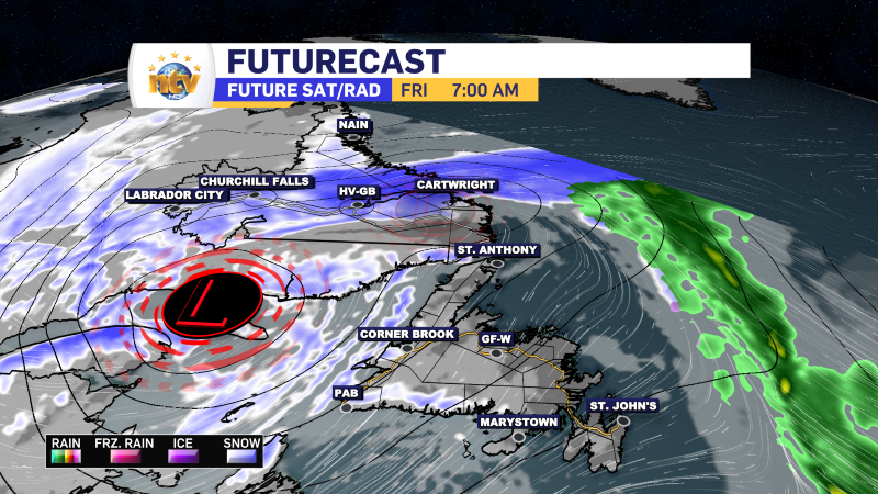
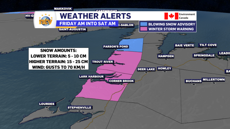
The next phase of this system will be the transition to a colder day on Friday, with areas of flurries Island-wide. The flurries will be the most intense on the West Coast, where snow squalls will develop on Friday. Some of the squalls will be intense, and driving in some areas will be reduced in areas of falling and blowing snow. Temperatures Friday will be near or a bit below freezing for highs. Friday will also be breezy, with wind speeds on the West Coast gusting as high as 70 km/h over exposed areas. A Winter Storm Warning and a Blowing Snow Advisory have been issued by the Gander Weather Office for the area.
Temperatures Friday will be near freezing for most of the Island, with areas of the West Coast staying near or below and other areas near or above.
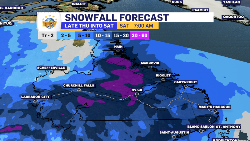
Meanwhile, in Labrador, snow will arrive overnight and will continue in many areas of the north and west through Friday and into Friday night. Wind speeds along the coast will gust as high as 80 km/h. Winter Storm and Snowfall Warnings are in effect, along with a Blowing Snow Advisory.

Beyond tonight and tomorrow, the weather across much of the PRovince will be quiet for Saturday. The next system arrives Sunday which will bring rain and snow to the Island and potentially more snow to Labrador. Stay tuned for details on this!
-

Threat of wildfires on west coast higher this year, say forestry officials
As residents of the province prepare to head out into the woods for the Victoria…
-

Labrador West MHA wants water bomber back
With wildfires threatening Fort McMurray, Alta., again, Labrador West MHA Jordan Brown wants a water…
-

Province warns residents to be ready for forest fire season as wildfires threaten Fort McMurray
Evacuation orders and alerts remain in effect for Fort McMurray, Alta., as wildfires continue to…
