


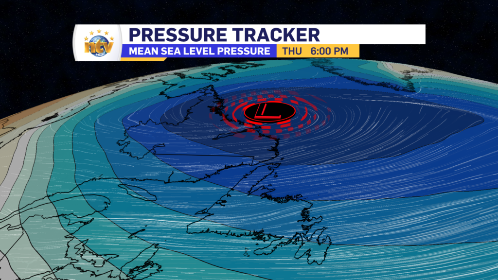
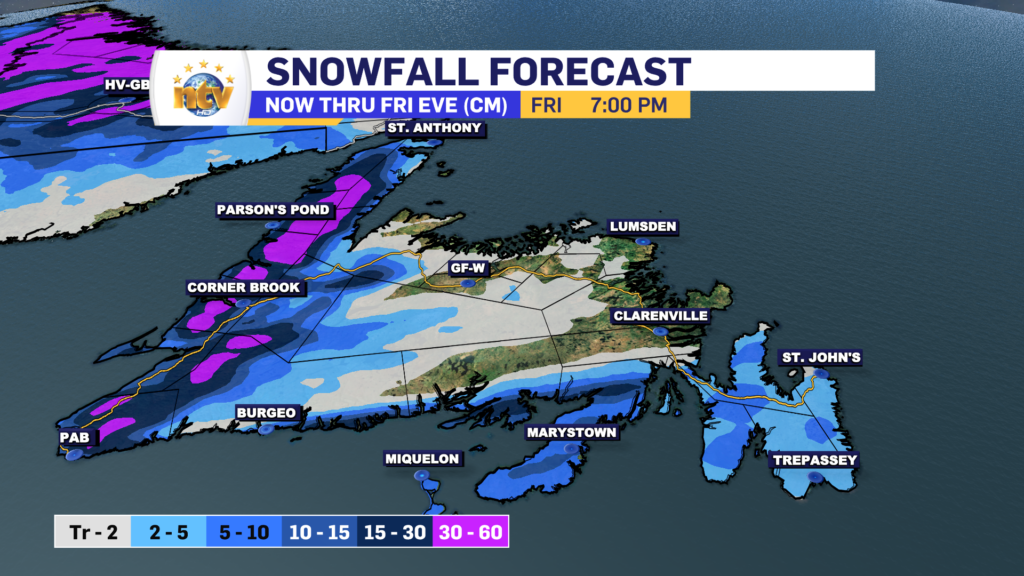
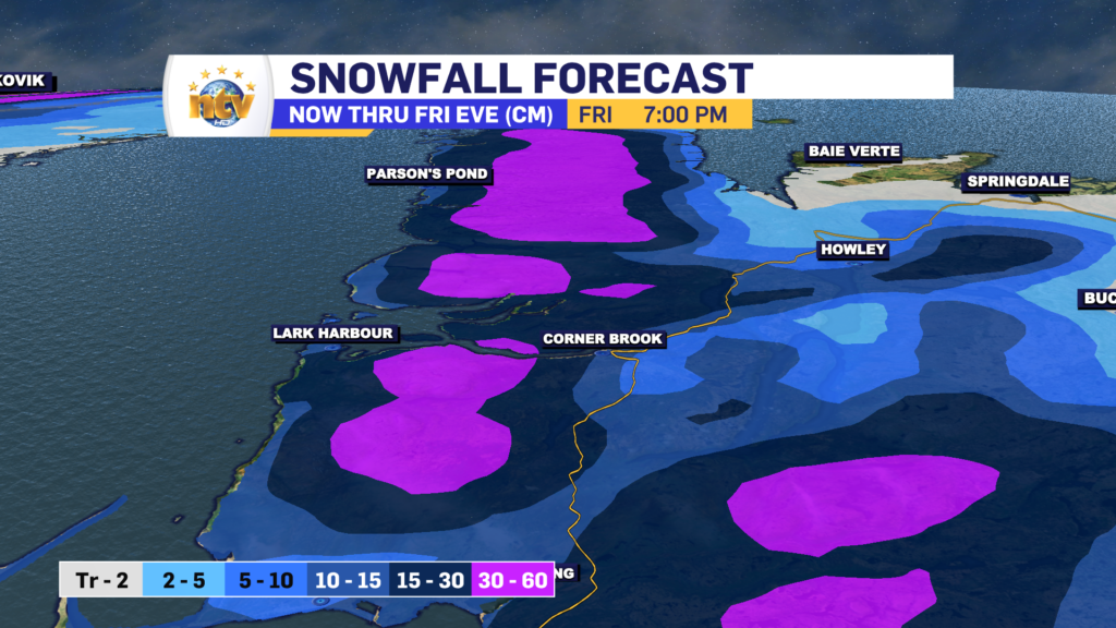
An area of low pressure will intensify as it wraps up in the Labrador Sea on Thursday and Friday. This will keep snow ongoing for much of Labrador and will drive intense snow squalls over western, southern, and eastern Newfoundland through the same time frame.
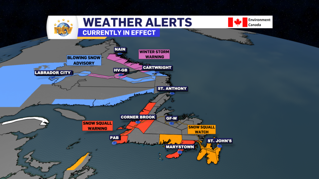
Winter Storm Warnings and Blowing Snow Advisories are in effect for Labrador and Snow Squall Watches and Warnings for parts of Newfoundland. Remember, a warning means that type of weather is occurring, and a watch means that type of weather is possible.
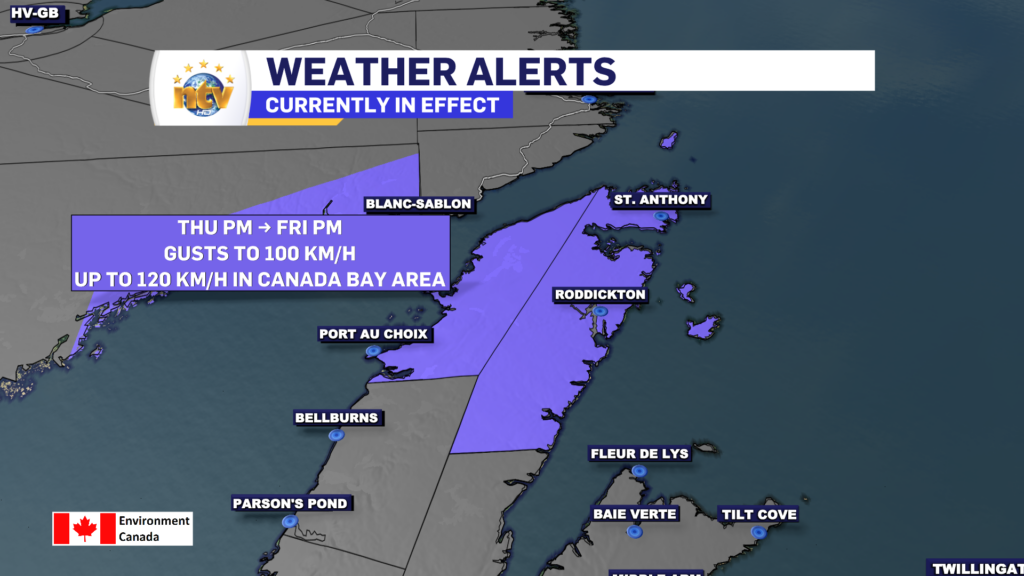
Wind speeds will also ramp up over parts of the Big Land and Newfoundland on Thursday, and they will stay elevated through Friday. I expect widespread gusts of 80 km/h, with some areas seeing winds gusting to 100 km/h. A Wind Warning is in effect for the Northern Peninsula from Thursday afternoon through Friday afternoon
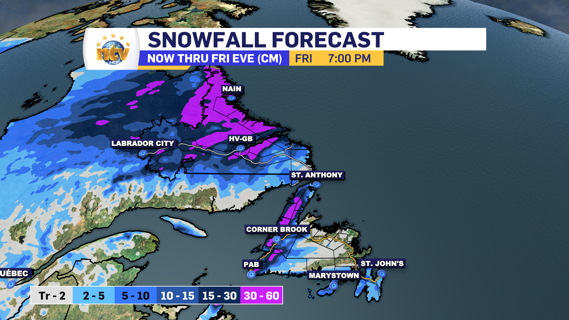
Snowfall amounts will be significant along the coast of Labrador over the next 2 days, with nearly 30 cm of new snow expected for much of the coast. Amounts will decrease as one moves into Labrador West. However, with the wind and freshly fallen snow and falling snow, blizzard conditions will be found for many areas over the next 2 days.

On the Island, the snow squalls will bring heavy snow to some areas. The tough thing to say is where exactly the heavy snow will be found, and outside of the high terrain of the West Coast, it’s very difficult to say. The reason is snow squalls are small in nature, and one place may see 20+ cm, and an area a few kilometers down the road may see hardly anything. The important thing to know is that when you’re under these things, it will be like a full-fledged blizzard, and travel through many locations is going to be difficult.
-

Eddie’s forecast; May starts like April ended
May starts like April ended… cold and damp for much of the Province. Eddie has…
-
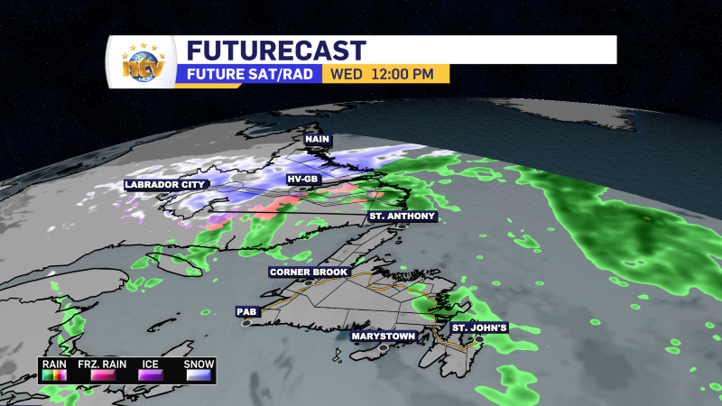
Not much change in the weather for Wednesday
An area of low pressure continues to spin southeast of Newfoundland and Labrador and remains…
-
The RDF continues into Wednesday… but there are some literal bright spots in the forecast
Get all the details in Eddie’s forecast from tonight’s NTV Evening News Hour!
