


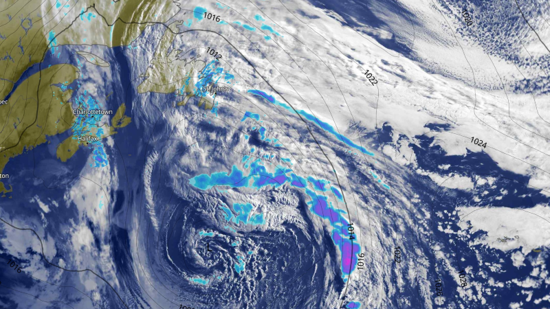
The Overview
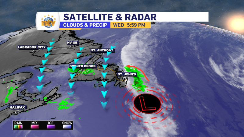
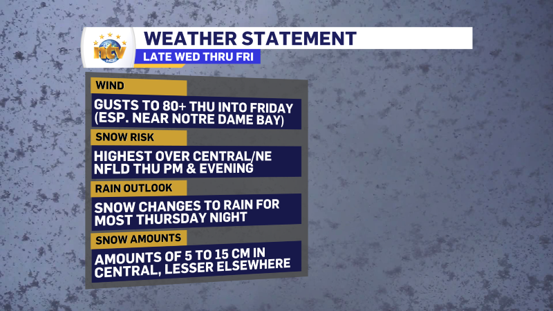
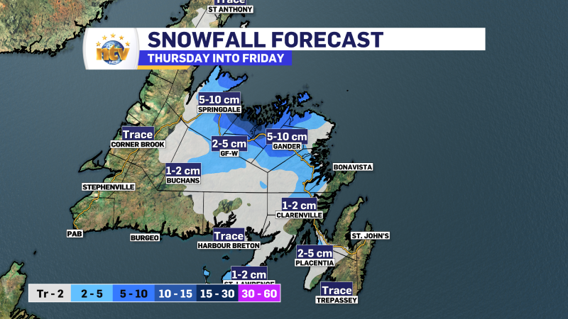
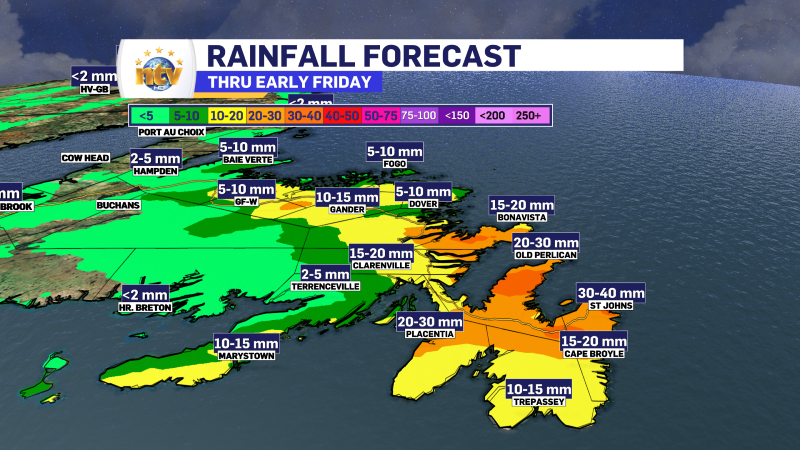
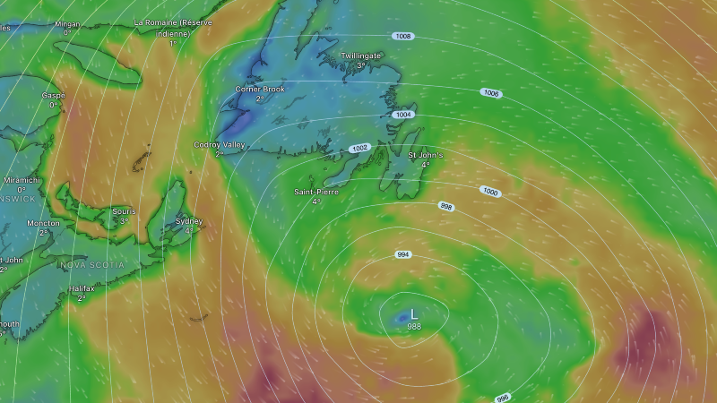
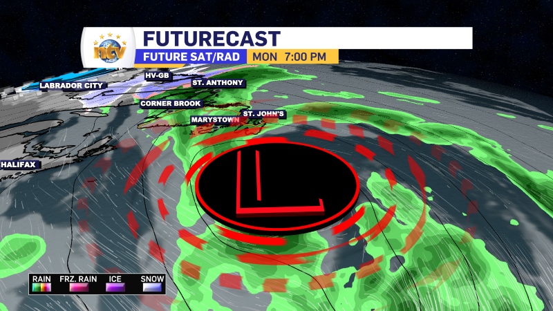
Another area of low pressure will target eastern, northeastern, and central Newfoundland on Thursday and Friday. This low is tapping into some colder air, so the precipitation type will not be plain old rain, like the last couple of systems to swing through. We are going to see a mix of rain, ice pellets and snow across in the mentioned areas through this evening or early Friday. By Friday morning, most of what is falling will be in the form of rain as “warmer” ocean air envelopes most of the Island. At this point, snowfall amounts will not be significant for most areas. Some locations, mainly inland over higher terrain, will pick up as much as 10 to 15 cm of snow. At the moment, the most likely spot for that will be in the south of the coast and north of the TCH in Central.
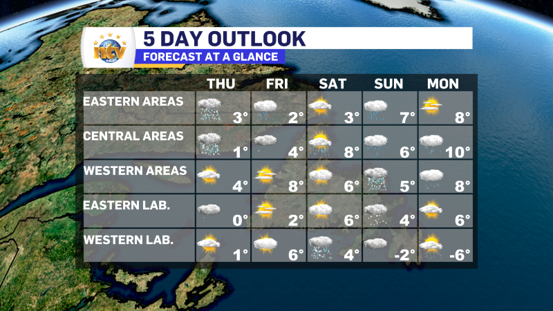
Thursday’s Forecast
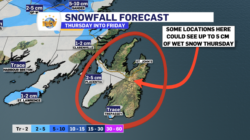
The Avalon and Burin Peninsulas will see rain or snow in the morning, changing to rain in the afternoon. Snowfall amounts will be in the 2 to 5 cm range inland over higher terrain. Areas along and near the coast will see very little, if any, snow accumulation. Most snow accumulation will also be on grassy and/or unpaved surfaces. Highs will be near 2. Wind speeds gust as high as 60 km/h from the north.
To the west of the Avalon and into Central Newfoundland, expect snow in the morning to transition over to ice pellets and freezing rain and eventually rain during the afternoon. Areas near and west of Bishop’s Falls may remain mostly snow. Expect 2 to 5 cm of snow, except up to 10 cm inland over higher terrain. Areas along the coast will more than likely see very little accumulation. Expect highs of 1 to 3. Wind speeds gust as high as 60 km/h from the north.
The South Coast, West Coast, and Northern Peninsula will see very little active weather. In fact, some locations will see a mix of sun and clouds. Highs will be 2 to 4 in this area.
Friday’s Forecast
Periods of showers will persist over central, northeastern, and eastern Newfoundland throughout much of the day. Highs will be near 2°, and wind speeds will gust as high as 70 or 80 km/h from the north. The wind chill will be as low as -6°.
The South Coast, Burin Peninsula, West Coast, Northern Peninsula, and even parts of Central will see the skies turn mostly sunny as the day progresses. Highs will be in the 2° to 4° range in this area. It will also be breezy, with wind speeds gusting near 50 km/h from the north.
The Long Range
Saturday looks quiet across much of the Province. There is a chance of rain and snow in Labrador West. Highs will be in the 3 to 8 range on the Island and 4 to 6 range in Labrador. Any snow will arrive in Labrador West later in the day.
Sunday, there will be a chance of rain for the eastern two-thirds of the island. The western third will see a chance of rain and snow or just snow in some areas. The snow could be significant depending on the track of another low-pressure center. Parts of southeastern Labrador may also see snow on Sunday. Highs will be in the 5 to 7 range on the Island and the -2 to 4 range in Labrador.
Expect lingering showers or flurries Monday, with highs of 8 to 10 on the Island. Eastern Labrador will remain sunny and mild with a high near 6. Colder air looks to arrive in the west, and temperatures will fall to near -6° for highs.
-
More RDF for the Island Tuesday, while parts of Labrador see both rain and snow
Our Tuesday morning starts off on the drizzly and rainy side across much of the…
-
Lots of rain, drizzle and fog this week… and even some snow in the Big Land!
A slow moving area of low pressure is going to bring lots of rain, drizzle…
-
Rain, drizzle, fog, ice and snow will be found across N.L. to start the week
A slow-moving area of low pressure sitting southeast of Newfoundland this morning is driving rain,…
