


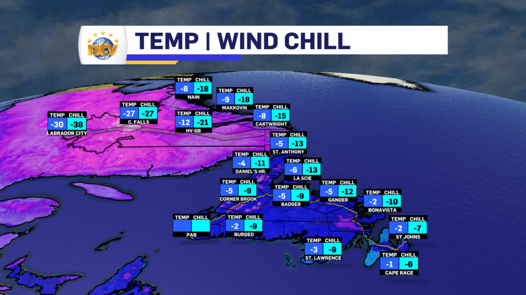
Our Thursday morning is starting off on the cold side across much of Newfoundland and Labrador. As of 6:42 AM NST, temperatures on the Island are in the single digits below freezing, while temperatures in the Big Land are into the minus teens, and minus 20s and some areas (Wabush) getting very close to -30ºC. Wind chills are even lower. Bundle up as you’re heading out the door.
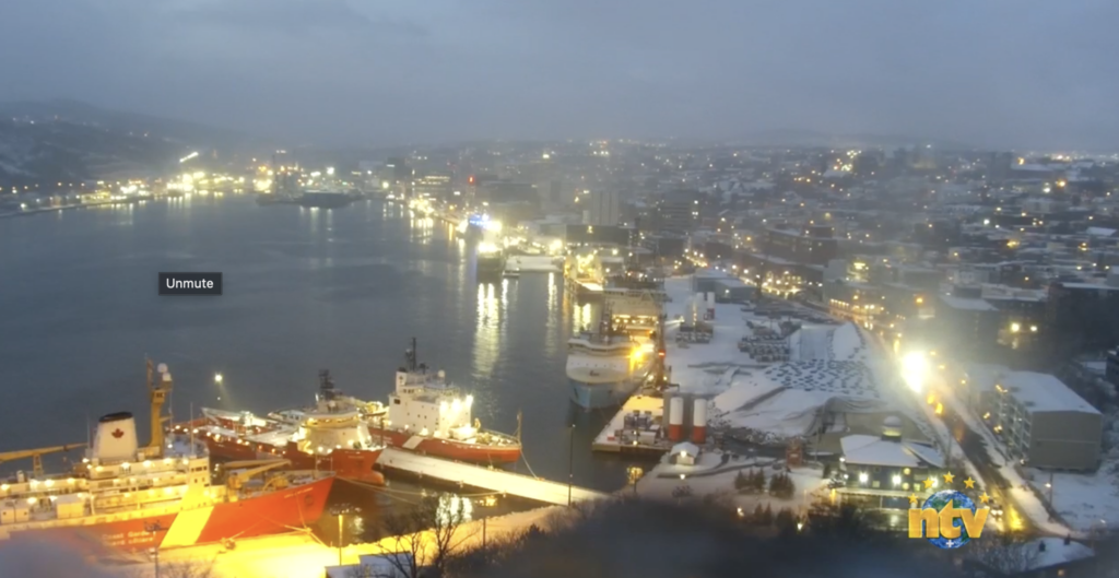
We are also seeing areas of snow flurries and snow squalls up and down much of the West Coast, along parts of the South Coast, Burin, and Avalon Peninsulas this morning. The most intense squalls look to be on the West Coast and are located between Rocky Harbour, Corner Brook and as far south as Bay St. Groge this morning. Our NTV SkyCam in Corner Brook shows the intensity of the snow very well, and this is a short clip from 6:46 AM this morning.
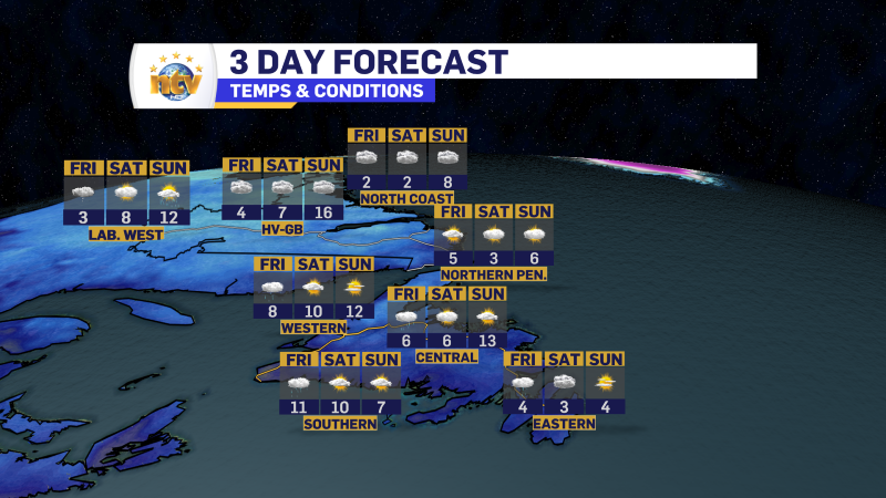
Today will see areas of partly to mostly sunny skies across much of the Province. However, areas along the West Coast of the Island will be under mostly cloudy skies and in and out of the snow flurries and squalls all day. Locally significant amounts are possible, especially in the higher terrain. The South Coast and parts of the East Coast will see some sun today as well, but also there will be some flurries and/or snow squalls and they will be briefly locally intense at times. Central will see the most sun today.
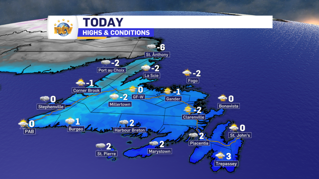
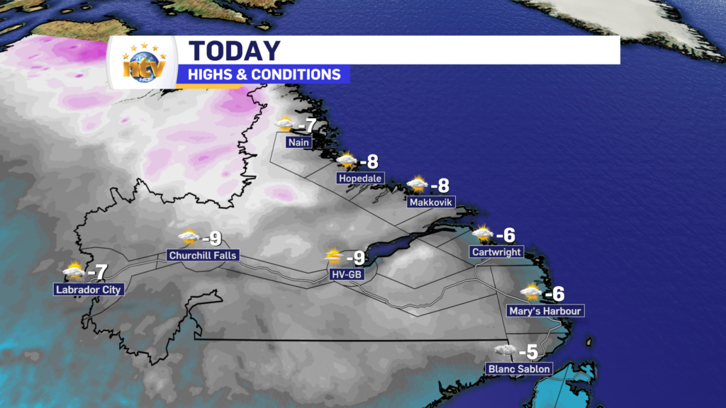
Labrador will see generally sunny skies today, with temps recovering somewhat nicely by the afternoon. And speaking of the afternoon, there will be some flurries moving into western areas later today.
Have a great day and be sure to check the NTV Weather Centre for YOUR location’s forecast!
-
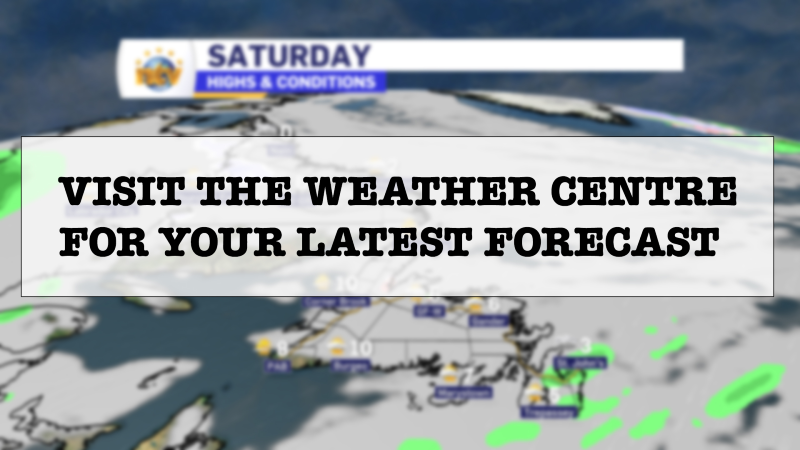
Your Latest Forecast!
Click here to visit the NTV Weather Centre to get your latest forecast!
-
Eddie’s Forecast; Some slight improvements for Friday, more noticeable this weekend
The area of low pressure that has driven all the wet weather across much of…
-

Eddie’s forecast; May starts like April ended
May starts like April ended… cold and damp for much of the Province. Eddie has…
