


NORTHERN LIGHTS ALERT FOR THURSDAY NIGHT. READ ABOUT IT HERE!
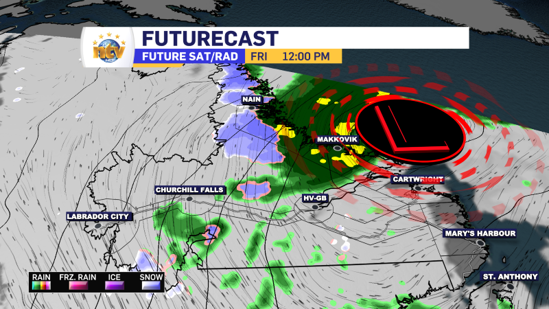
An area of low pressure will take aim at Labrador’s north coast for the next few days. Areas from Nain to Hopedale are expected to see heavy amounts of rain (80 to 100+ mm) between Thursday and Sunday, and wind gusts in excess of 80 km/h during the day Friday. Wind and Rainfall Warnings are in effect. Find details on that here. The same low will also keep areas of rain and showers and even wet snow on the go for much of Labrador into Saturday. On the Island, the westerly flow around the back side of the low pressure centre will bring widespread showers over the next few days. When not under showers, expect a mix of sun and cloud.
The area of low pressure will depart by the second half of the weekend, leading to a quieter period of weather across the Province on Monday. Another, more potent, low is set to move in Monday night or Tuesday. This will have some cold air to work with over Labrador and could bring the first significant snow of the season to northern and western regions. Meanwhile, we will see a windy and wet day on the Island, with temperatures surging into the teens.
The Forecast: Newfoundland
TONIGHT: Skies turn partly cloudy over much of the Island, including on the Avalon where heavy rain is falling this evening. There will be a chance of showers over the West Coast and Southwest Coast. Lows of 5 to 9. Winds from the west at 15 to 30 km/h.
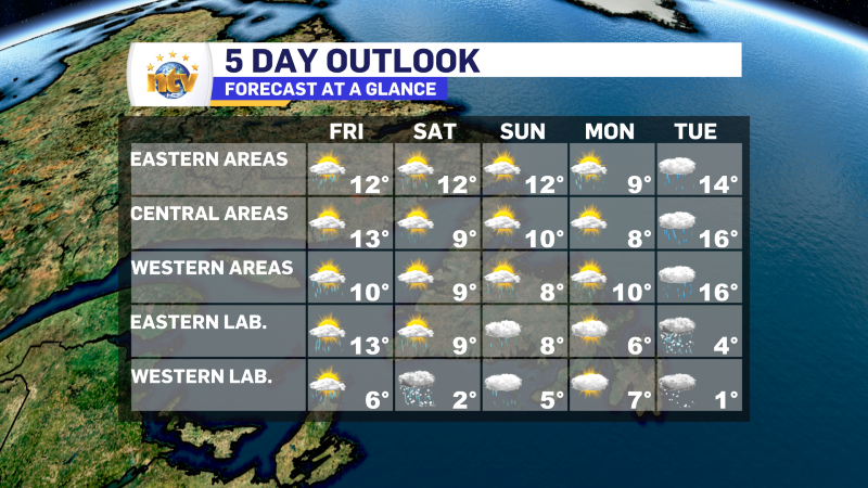
FRIDAY: Partly cloudy with passing showers. The showers will be most numerous on the West Coast. Highs of 10 to 12. Wind from the west at 20 to 40 km/h.
SATURDAY: Partly cloudy with passing showers. The showers will be most numerous on the West Coast. Highs of 10 to 12.
SUNDAY: Partly cloudy with passing showers. Highs of 8 to 12.
MONDAY: Partly cloudy with a chance of rain by afternoon. Highs of 8 to 10.
TUESDAY: Chance of rain. Warmer and breezy with highs in the middle teens.
The Forecast: Labrador
TONIGHT: Periods of rain along the north coast. The southeast will see partly cloudy skies. Goose Bay back to Labrador West will see periods of rain and showers, at times mixed with wet snow in the west. Lows of 2 to 5. Breezy in the north and west.
FRIDAY: Periods of rain in the north and the west. Windy along parts of the coast with gusts to 100 km/h. Sun and cloud will be found from Cartwright to the Straits. Highs of 6 to 13, coolest north and west.
SATURDAY: Periods of rain along the coast and rain mixed with wet snow in the west. Highs near 2 in the west to 9 along the coast.
SUNDAY: Showers. Highs of 5 to 8.
MONDAY: Mostly cloudy with a high near 7.
TUESDAY: Chance of snow, or rain mixed with snow north and west. Highs near 1. Chance of rain from Goose Bay to Cartwright points south. Highs near 4.
-
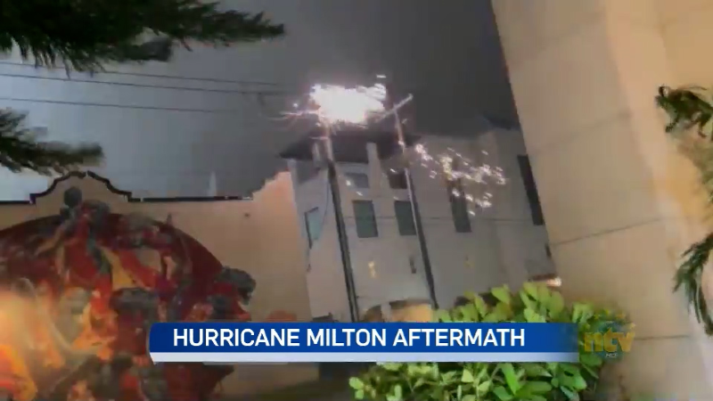
N.L. residents in Florida describe Hurricane Milton aftermath
Hurricane Milton has left at least ten people dead, and millions without power in Florida,…
-
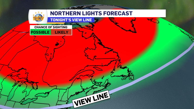
Northern lights *may* be very active over the entire Province tonight!
The northern lights may be active over much of the Province tonight due to a…
-
Weather improves today behind departing rain
Newfoundland’s Forecast Thursday Periods of rain on the Avalon Peninsula, with generally a mix of…
