
The weather across NL today will be quite calm in comparison to our Maritime neighbors. We can expect cloudy skies on the Island, with areas of dense fog for some eastern and northeastern areas where winds are onshore and easterly to begin the day. As the day goes on, the wind direction should shift to more a southerly or southeasterly one, which should dissipate some of the fog for eastern areas but will cause it to become more widespread in the south. Showers arrive on the West Coast and the Southeast Coast, in association with Lee later today. Highhs on the Island reach the upper teens to lower 20s.
Meanwhile, in Labrador today expect increasing cloud and highs in the single digits in the north to teens inland and in the southeast.

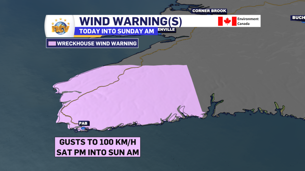
While most of the Island will not see severe wind speeds, the Wreckhouse is the exception. A Wreckhouse Wind Warning is in effect from this afternoon into Sunday morning for gusts of 100 km/h.

POST TROPICAL STORM LEE UPDATE
As of the 6:30 AM NDT advisory, the National Hurricane Centre based in the United States has classified Lee as a Post-Topical Storm. While the naming convention makes it seem like it may be a less powerful storm, that’s not the case. It will still bring severe impacts to Nova Scotia, New Brunswick, PEI and parts of Quebec as the day goes on.

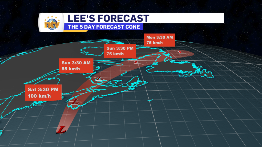
Lee will make landfall later this morning or early this afternoon somewhere in western Nova Scotia. However, ultimately, it will not matter as the storm is so large impacts are going to be felt well away from the centre.

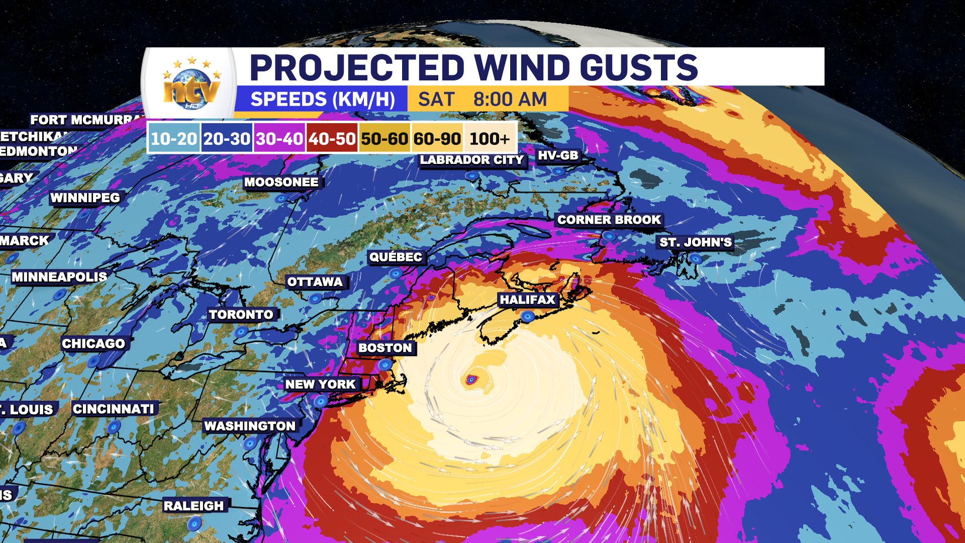
Tropical Storm, to Hurricane force wind gusts will be felt along the coast of Nova Scotia today. Gusts may peak as high as 120 km/h in some areas east of Lee’s center. That does include the Halifax area. High waves and storm surge are also a concern along the coast with today’s high tide. Heavy rain will also fall north and west of Lee’s centre, where over 100 mm will fall in some locations. The weather in the Maritimes will dramatically improve later today and tonight as Lee departs.

In NL, the impacts we see from Lee will be decidedly less severe. However much of western Newfoundland and parts of southeast Labrador will see heavy rainfall later tonight and Sunday. Parts of Labrador will see over 50 mm of rain. Some areas along the West Coast, GNP and southeast Labrador will see wind gusts to 60 or 80 km/h, however, that’s nothing unusual with most lows that swing through.

As with any system that has a large circulation, especially tropical ones, storm surge and high water levels is a concern. Areas along the South Coast of Newfoundland from near Burgeo to Cape Race should keep an eye out for higher than normal water levels with Sunday night and Monday morning’s high tide. I do not expect major coastal flooding, but minor water issues are possible in some areas.
Stay tuned for more updates!


