


Post 3 – 6:54 PM NST (6:24 PM AST)
Rain and snow will develop across much of the Island overnight while snow arrives in southeast Labrador. The full forecast from Monday’s NTV Evening News Hour will be attached to this post shortly after 7 PM, and you can get all your forecast details in the video.
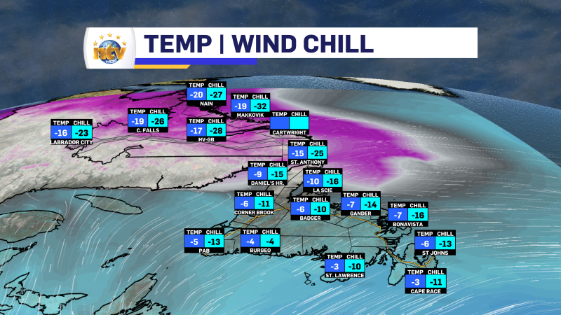
Post 2 – 2:16 PM NST (1:46 PM AST)
Radar shows area of light snow and flurries becoming a little more widespread across the Island early this afternoon. This activity may ease a bit before a more substantial around of snow and rain arrive later this evening.
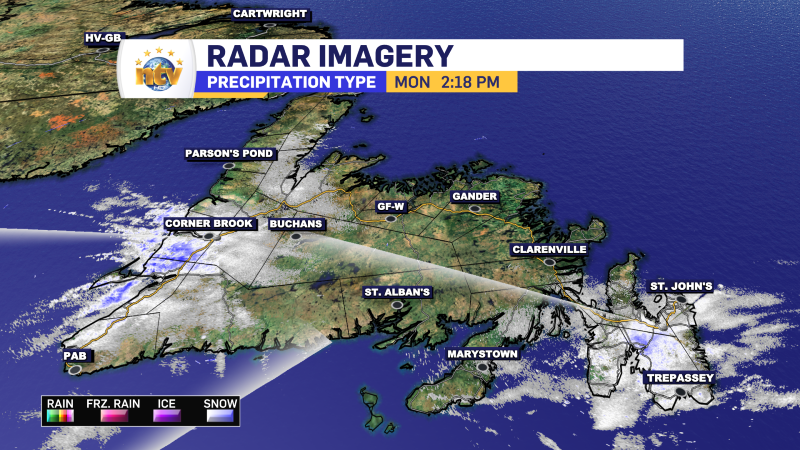
Temps are still chilly across the board but have come up a little bit this afternoon. And the wind chills aren’t as low as this morning.
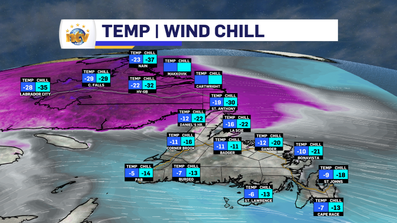
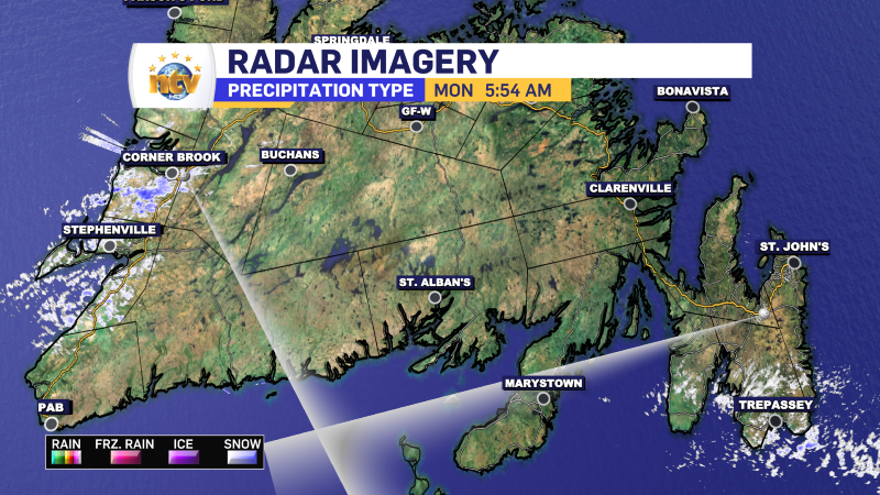
Post 1 – 6:14 AM NST (5:44 AM AST)
We are off to a cold start across much of the Province at this hour of the morning. Temperatures are in the minus single digits to near minus 20 on the Island and generally minus 20s in Labrador. Wind chills are significantly lower than air temperatures in many areas. For instance, in St. John’s, the temperature is -9º with a wind chill of -18º. With higher gusts, wind speeds are generally sustained around 20 to 30 km/h.
The intense snow squall and flurry activity from the late last week and the start of the weekend have ended for the time being. That said, we are still seeing some flurries this morning over parts of western, southern, and eastern Newfoundland. Radar imagery from both Holyrood and Marble Mountain confirms this. However, areas farther up the Northern Peninsula and along the South Coast may be seeing flurries, too, but they cannot be “seen” by the radar beam in those locations.
Today’s Forecast
An area of low pressure will move from Quebec toward Labrador West throughout the day. This low will spread light snowfall into the western portion of the Big Land later this morning or early this afternoon. The same low will also help drive some light snowfall over southern and western parts of the Island early this afternoon, which will move northward into the West Coast, Central, and areas in eastern as far north as the TCH by evening. Highs today will reach the mid-minus single digits over most of the Island and the minus teens in Labrador.

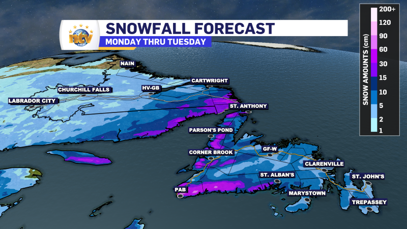
That same low will bring another round of snow to most areas overnight into Tuesday morning. However, along the South Coast, Burin, and Avalon Peninsulas and farther northwest through most of Bonavista Bay and southwest into the Gander area, the snow will change to rain by sunrise Tuesday after a couple of centimeters of accumulation. The snow will be more intense through western areas, Green Bay – White Bay, the Great Northern Peninsula and southeast Labrador.
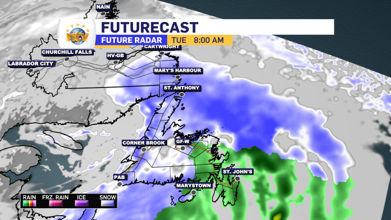
Snowfall amounts will be 2 to 5 centimetres for areas that change to rain, and in Labradro West, while the rest of the Island will see 5 to 10 centimetres. Southeast Labrador may see as much as 15 cm as the snow will linger there through much of Tuesday.
Tuesday afternoon may see another little burst of post-cold frontal snow for eastern areas, but I’m not sold on that just yet. I am sold on the onshore snow machine turning back on for the West Coast, which means more intense flurries and snow squalls from Tuesday afternoon through at least Wednesday.
-

Hot and humid start to the weekend
The Island will see sunny skies to start today. There are a few fog patches…


