


What to Expect
An area of low pressure will stall out over Quebec tonight and linger there through the weekend before filling (dissipating). The position of this low will send a surge of warm air into the Province, along with a fair bit of rain. While many areas will see periods of rain over the weekend, the South Coast of the Island will see the highest amounts, with 50 to 80 mm in the forecast. Areas of Newfoundland north of the South Coast and Labrador will also see rain, but generally, amounts will not be as high. A Rainfall Warning remains in effect for Burgeo – Ramea and Channel-Port aux Basques through early Sunday morning.
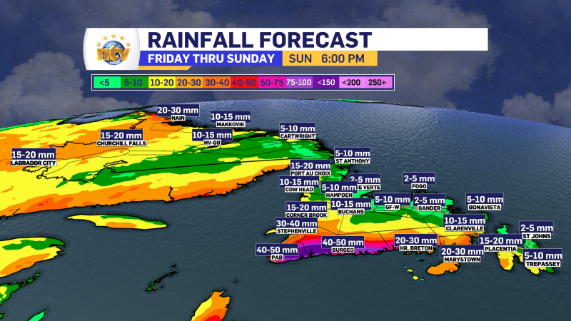
The rain will be focused on southern and southwestern Newfoundland on Saturday. Then, on Sunday, the heavy rain band will shift away from that area toward the Burin and southern Avalon Peninsuas. The Gander Weather Office may expand Rainfall Warnings to include some areas.

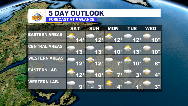
While the rain will be a big deal for some areas, the widespread warmth will be a bigger deal for others. Temperatures across much of the Province will be in the lower and middle teens this weekend. This will be the warmest stretch of weather since the fall. The exception will be areas in onshore, southerly winds where readings will be cooler due to onshore flow. The cold ocean air gets pushed onshore, resulting in colder readings than areas inland and farther north.
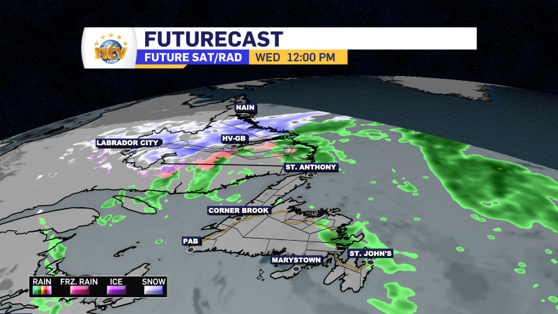
The weather will improve later on Sunday. However, another round of rain will move through Sunday night into early Monday, and this will primarily affect eastern and central Newfoundland with some rain. Another round of showers will move across much of the Island Tuesday before quieter weather overtakes much of NL for Wednesday.
-

Eddie’s forecast; May starts like April ended
May starts like April ended… cold and damp for much of the Province. Eddie has…
-
Not much change in the weather for Wednesday
An area of low pressure continues to spin southeast of Newfoundland and Labrador and remains…
-
The RDF continues into Wednesday… but there are some literal bright spots in the forecast
Get all the details in Eddie’s forecast from tonight’s NTV Evening News Hour!
