


The area of low pressure driving the weather across the Province is in the process of departing. However an area of rain has to clear eastern Newfoundland through the course of the morning, the snow still needs to end in parts of Labrador, and the wind speeds will take a while to calm down.

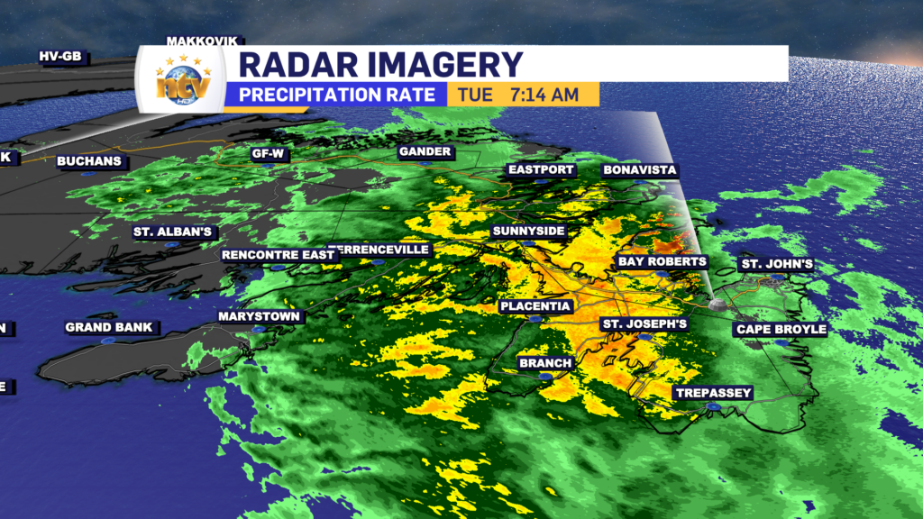
The radar shows the main rain band this morning is approaching the Avalon Peninsula from the west. As this moves through, the rain will be briefly heavy for a couple of hours over eastern Newfoundland with up to 20 mm in the forecast. Locally higher amounts are likely, especially in the south.
The rain is ahead of a cold front and the cold front will sweep across the Island from west to east today. Behind the front, much cooler air will move in. So today, unlikely a normal day, will see temperatures fall. This will happen earliest on the West Coast and last on the Avalon. Future radar, and the plotted temperatures show this very nicely.
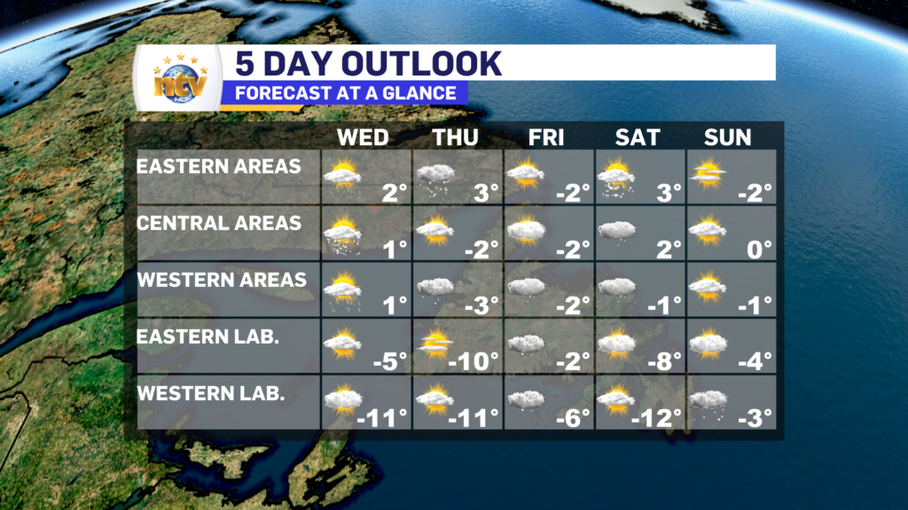
Wednesday and Thursday look calmer compared to today, as does the remainder of the week and the weekend. There do not appear to be any major weather makers in play for at least the next 5 days. However, a few weaker pieces of energy will move through and this will drive areas of flurries and/or showers across parts of the Province. The West Coast will see on and off onshore flurries for the next few days, that will pile up in some locations.
-
Your Latest Forecast!
Click here to visit the NTV Weather Centre to get your latest forecast!
-
Eddie’s Forecast; Some slight improvements for Friday, more noticeable this weekend
The area of low pressure that has driven all the wet weather across much of…
-

Eddie’s forecast; May starts like April ended
May starts like April ended… cold and damp for much of the Province. Eddie has…
