


The Overview
An area of low pressure will meander through the Gulf of St. Lawernece over the next 24 hours, before finally crossing over the Island late Thursday into early Friday. The presence of this low is driving rain across much of the region this afternoon, and the rain will only increase in coverage overnight and Thursday.
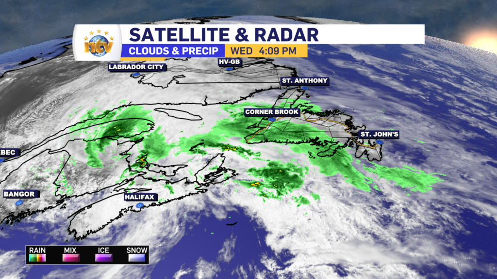
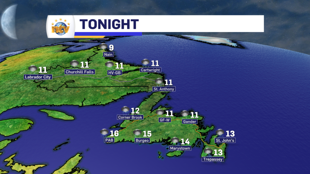
The rain will become moderate to heavy at times over much of the Island tonight, and that will linger through the day on Thursday. There is a slight risk of some embedded thunderstorms, but I don’t anticipate them to be widespread at this time. The rain will taper to showers Thursday afternoon from south to north. The showers will not fully end until early Friday morning.
The showers will increase in southern Labrador late tonight and that will turn into heavier rain Thursday afternoon. The rain in southern areas of the BIig Land will linger into late Friday.
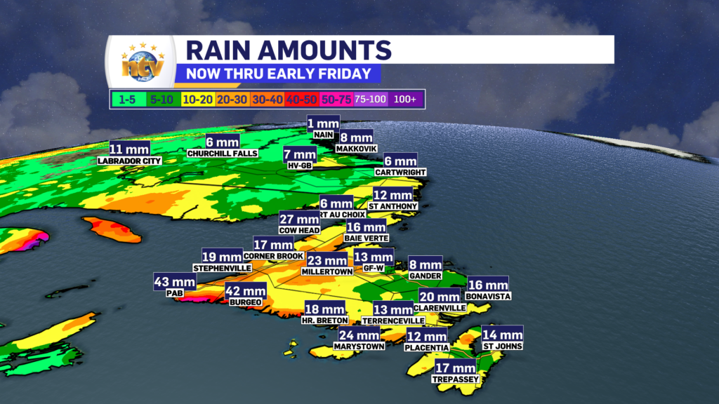
Rainfall amounts by early Friday morning will be in the 15-30 mm range for a large part of the Island, with lower amounts in Labrador. The rainfall projection below highlights that well.
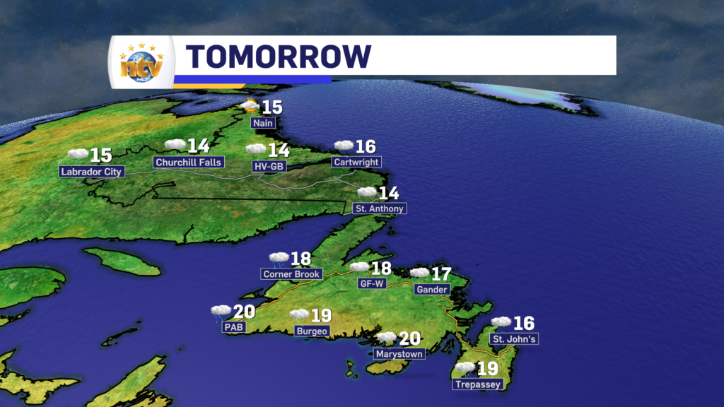
Lows tonight will generally be in the lower to mid-teens on the Island and lower teens to near 10° in Labrador. Thursday will see temperatures similar to the last couple of days, with highs in the mid-teens to near 20 across N.L. There will not be a lot of sunshine during the next 24 hours.
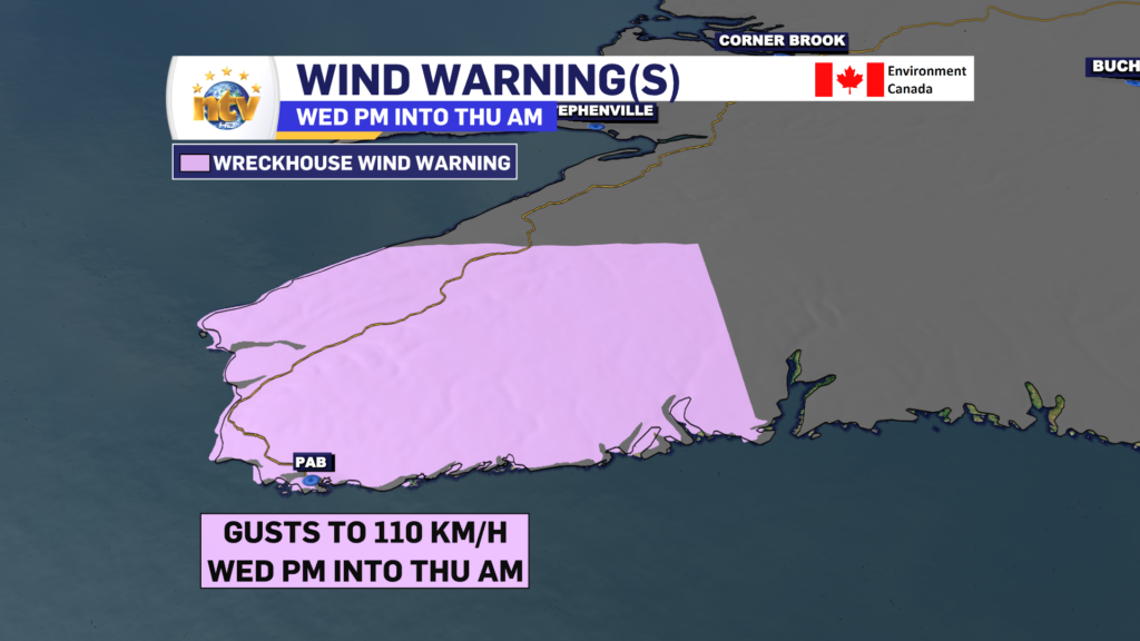
Wind speeds in the Wreckhouse area will continue to be a problem through early Thursday. A Wreckhouse Wind Warning remains in effect until that point, and gusts will be from the southeast as high as 110 km/h.
The Extended
Friday will start on the calm side but will feature scattered showers across much of the Island and parts of Labrador. Skies will be partly to mostly cloudy across the Province. Highs will be mid-teens through the Big Land to lower 20s over much of the Island.
Another area of low pressure will roll through Friday night into Saturday. This looks to bring another bout of heavy rain to the West Coast, and parts of southern Labrador in that time frame. Areas north and east of the low, look to largely miss out on the heaviest rain. This next low may impact ferry crossings to Nova Scotia during that time frame.
Sunday will see a nice recovery across much of the region, with sun and cloud and highs back to the 20s for much of the Island and near 20 for parts of Labrador.

FOR YOUR LATEST WEATHER, BE SURE TO CHECK OUT THE WEATHER PAGE
-

Threat of wildfires on west coast higher this year, say forestry officials
As residents of the province prepare to head out into the woods for the Victoria…
-

Labrador West MHA wants water bomber back
With wildfires threatening Fort McMurray, Alta., again, Labrador West MHA Jordan Brown wants a water…
-

Province warns residents to be ready for forest fire season as wildfires threaten Fort McMurray
Evacuation orders and alerts remain in effect for Fort McMurray, Alta., as wildfires continue to…
