


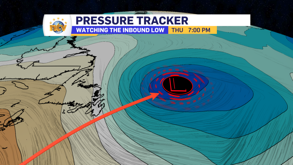
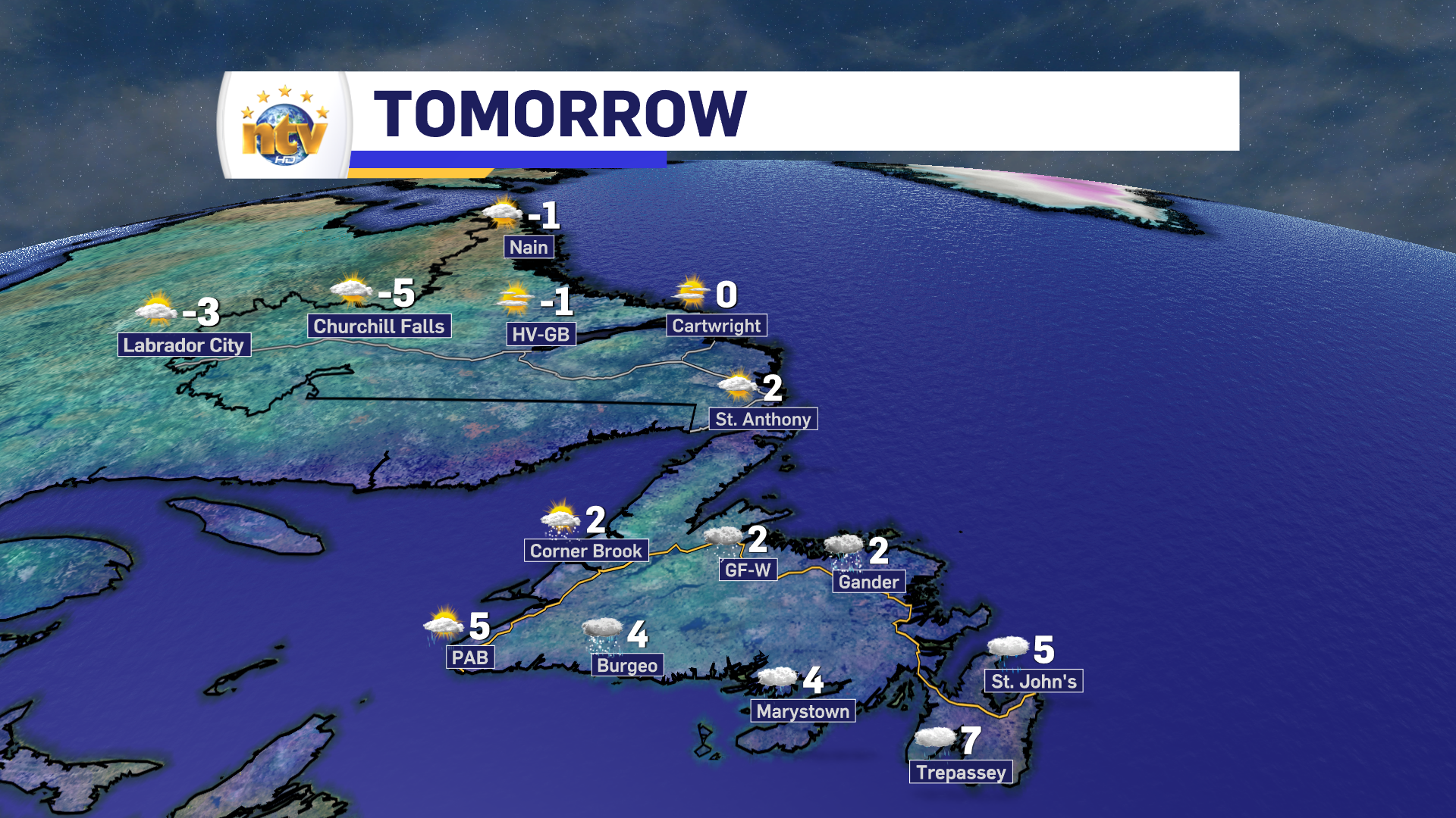
A deepening area of low pressure is going to track near, or over, the Avalon Peninsula between tonight and Thursday evening. This will spread rain and snow across the Island through Wednesday evening, and that will continue through much of Thursday for many areas.
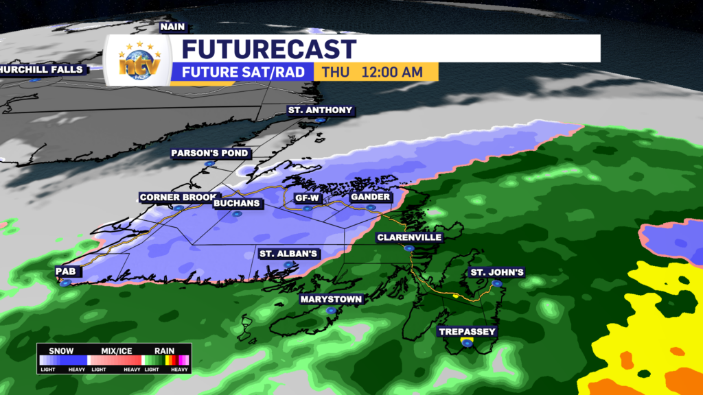
Due to cold air being in place north and west of the track, this low is going to bring both rain and snow to the Island overnight and through the day on Thursday. At this point, it looks like the rain/snow line is going to set up somewhere between Gander and Fogo Island, and stretch back toward the southwest to just west of the Connagire Peninsula. Areas west and north of that line will see snowfall, some significant, and areas just east will see heavy rainfall. Coastal areas of southern and central Newfoundland, even west of the rain/snow line, will likely see rain as well or a sloppy mix of rain and snow. Futurecast times out the movement and location of the rain and snow quite well.
Rain and snow amounts look to be significant in some areas. The snowfall forecast is a bit tricky because temperatures will be hovering near 0° for a large part of the area that sees snow. That means the snow will be wet and heavy and amounts will be significantly higher with elevation. Areas just inland from the ocean and the lower elevations in the Exploits Valley will likely end up 5 to 10 cm of wet snow. Areas inland and over higher terrain may see 15 cm, or more, of dense, cement-type snowfall. The snow will arrive tonight and end by mid-morning or early afternoon Thursday.
Areas of eastern and southeastern Newfoundland that see rain will see as much as 30 mm, with locally higher amounts possible, between tonight and Thursday afternoon. Areas along the South and Northeast coast will also see significant rainfall, where just inland, heavy snow will fall.
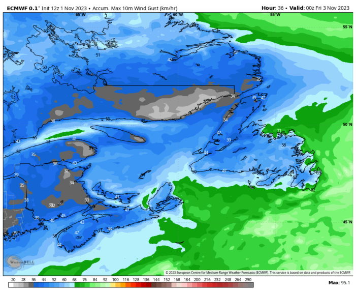
Wind speeds will pick up overnight and Thursday and will gust as high as 70 to 80 km/h over parts of the Avalon and Bonavista Peninsulas, and westward along the coast of the northeastern and central Newfoundland to the eastern tip of the Baie Verte Peninsula.
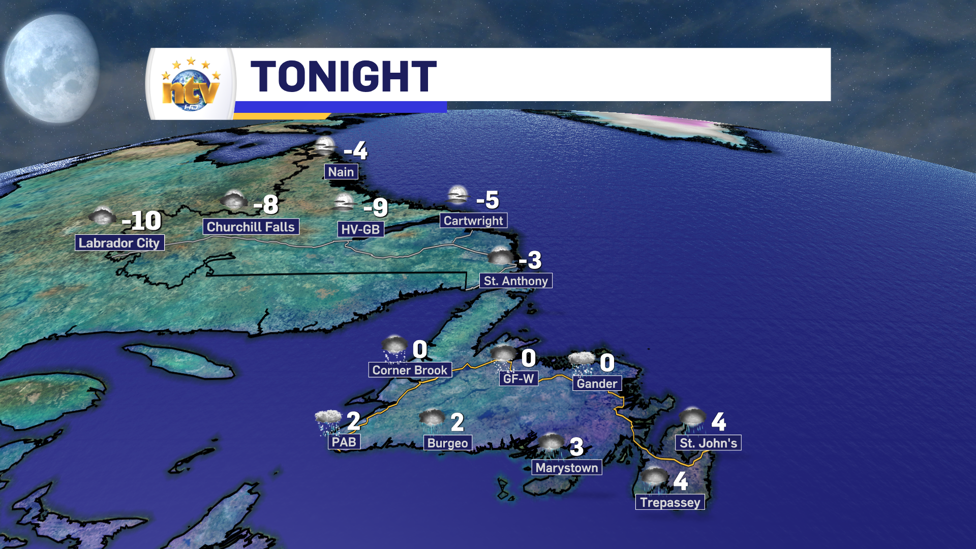
Temperatures overnight and Thursday will be near freezing for the western half of the Island and well above for the eastern half. Meanwhile, Labrador will see a clear and cold night and a sunny and relatively cold Thursday.
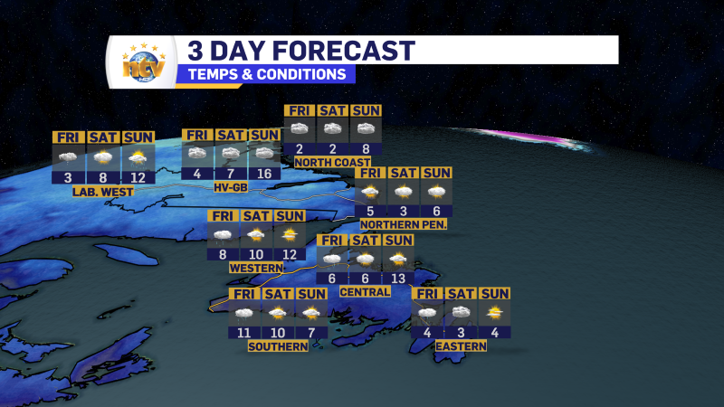
The weather across the Province will improve for Friday with sunshine and highs well above freezing on the Island and near or just above throughout most of Labrador. The weekend brings rain chances for the Island and snow and rain chances for Labrador. Visit the WEATHER CENTRE to get the forecast for YOUR area.
-
Your Latest Forecast!
Click here to visit the NTV Weather Centre to get your latest forecast!
-
Eddie’s Forecast; Some slight improvements for Friday, more noticeable this weekend
The area of low pressure that has driven all the wet weather across much of…
-

Eddie’s forecast; May starts like April ended
May starts like April ended… cold and damp for much of the Province. Eddie has…
