


The weather across the Province will generally remain relatively uneventful over the next 24 to 48 hours. Other than scattered flurries for coastal Labrador and portions of Central and eastern Newfoundland and onshore flurries for parts of the West Coast, not much will be on the go. That being said, it will be chilly and breezy as we are still stuck between a high to our west and a strong low to our east.

Tonight & Tuesday
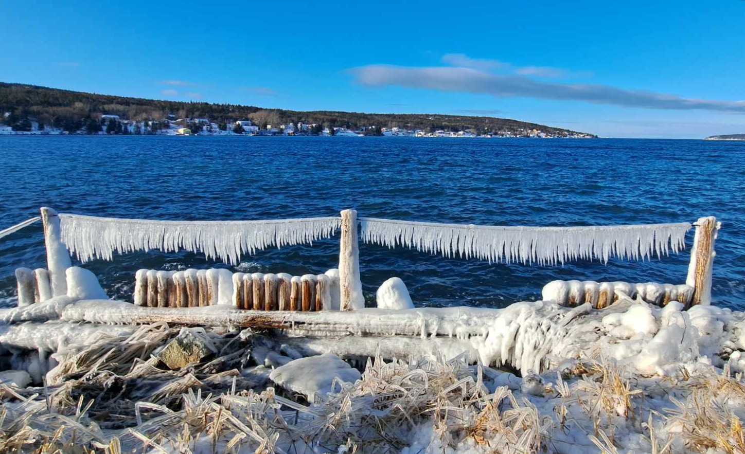
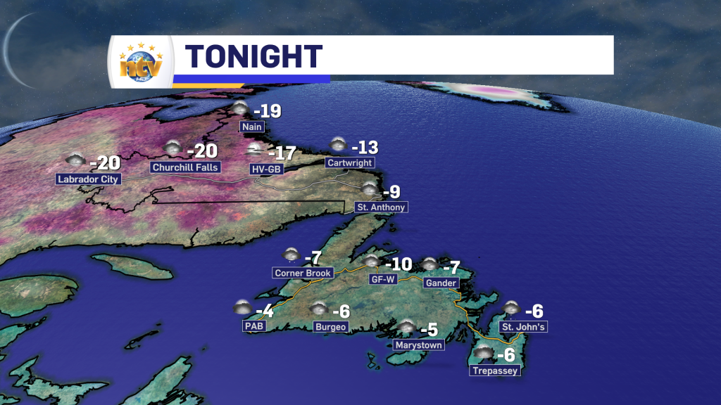
Scattered flurries will be found over eastern and central Newfoundland, with more persistent flurries on the West Coast of the Island. Some pockets of freezing drizzle will be found overnight in northeastern and eastern Newfoundland, including the St. John’s Metro. The ice will make things quite slick in spots, so take caution. Especially when walking. Otherwise, expect partly to mostly cloudy skies. Lows will be -5 to -10, with wind chills into the minus teens. Northwesterlies gust as high as 50 km/h.
Tuesday will see flurries over eastern Newfoundland in the morning, giving way to a mix of sun and clouds. Meanwhile, central and southern areas will be mostly sunny, while the West Coast and parts of the Northern Peninsula will see scattered flurries. Highs will be -3 to -5, except as low as -8 on the Northern Peninsula. Wind chills will be in the minus teens. Westerlies gust as high as 50 km/h.
Labrador will see partly cloudy to mostly clear skies overnight, with lows of -15 to -20. Wind chills will be into the -30s with westerly winds gusting as high as 60 km/h along the coast and 50 km/h inland.
Tuesday will be mostly sunny with highs of -11 in the east and -18 in the west. Wind speeds along the coast will gust as high as 60 km/h, while western areas will gust as high as 40 km/h.

Wednesday and Thursday
Wednesday will start quietly across the Province. However, a potent low will be approaching from the southwest late in the day. This will spread snow into Labrador West by mid to late afternoon and possibly onto the southwest coast before sunset. Highs Wednesday will be near -6 on the Island and -10 in Labrador.
This low will track into Labrador on Wednesday night and Thursday. Due to this track, Newfoundland will be on this low’s “warm” side. That means snow will move across much of the Island Wednesday night, but in many areas, it will change to rain before ending or end as drizzle as we get a shot a warmer air working in. Highs on Thursday, Island-wide, will be as warm as 3°. Temperatuers in Labrador will be milder, but remaining between -3 and -10.
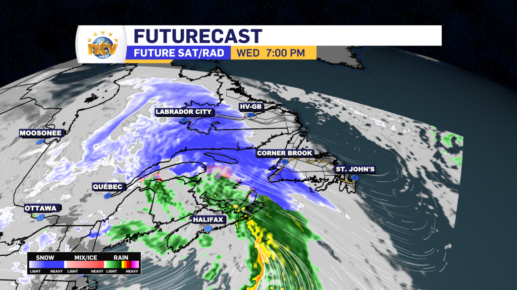
Snowfall on the Island from this low will generally be on the light to moderate scale, with as much as 10 to 15 cm falling on the West Coast and parts of the South Coast. At this point it looks like 5 cm will fall over much of Central and eastern areas.
The snow will be more significant in Labrador, where it will start late Wednesday and will not end until late Friday or early Saturday. While it’s still early, areas from Churchill Valley to easter Quebec look to see amounts in the 20-40 cm range, with amounts of 5 to 15 cm from the coast back to Goose Bay. Remember that this can change as we move closer to the end of the week.

Friday and the weekend
As of now, Friday and Saturday will be calmer on the Island, while snow and flurries persist in Labrador.

-

Threat of wildfires on west coast higher this year, say forestry officials
As residents of the province prepare to head out into the woods for the Victoria…
-

Labrador West MHA wants water bomber back
With wildfires threatening Fort McMurray, Alta., again, Labrador West MHA Jordan Brown wants a water…
-

Province warns residents to be ready for forest fire season as wildfires threaten Fort McMurray
Evacuation orders and alerts remain in effect for Fort McMurray, Alta., as wildfires continue to…
