


A potent area of low pressure will bring a dose of heavy snowfall to southeastern Labrador, while parts of the Island will see a bout of rain, and many places will see wind. For Labrador, Winter Storm and Wind Warnings are in effect, as well as a blowing snow Advisory for parts of the coast and Eagle River.
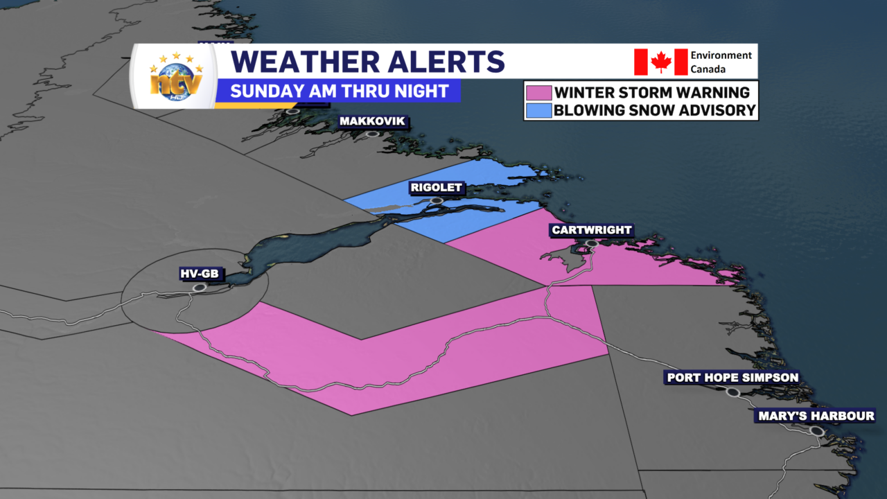
Areas under the Winter Storm Warning will combine snow and wind. Wind gusts along the coast will gust as high as 110 km/h. Areas inland will see gusts as high as 90 km/h.
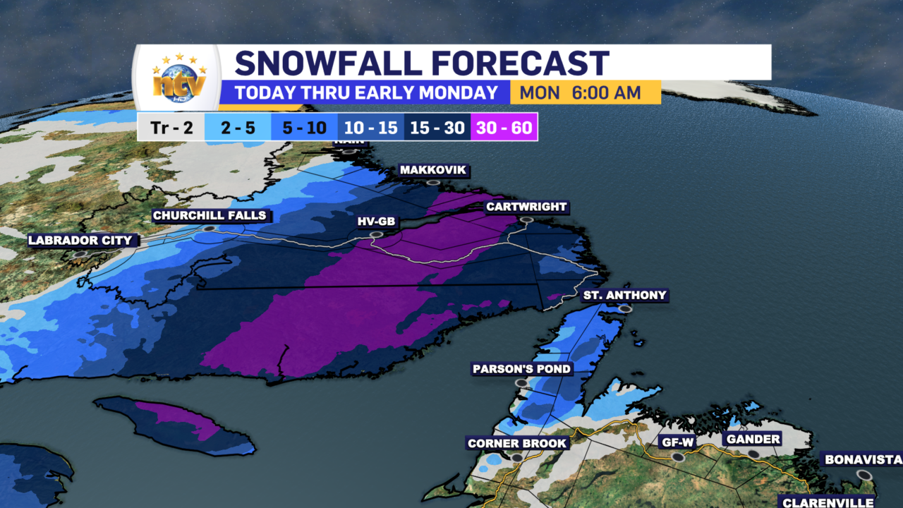
The snowfall between today and tonight will be significant. While some areas aren’t currently under winter weather alerts, like Happy Valley-Goose Bay, I suspect there will be significant snow in this area today. The GRAF model (seen below) suggests a narrow swath of 30+ cm of snow through a good chunk of southeastern Labrador. Personally, I think these warmings may get expanded later today to account for the heavy snowfall expected over much of this region.
The snow and wind will taper off tonight across the Big Land. As you can see in Futurecast (at the top of the page), it is timed out pretty well.
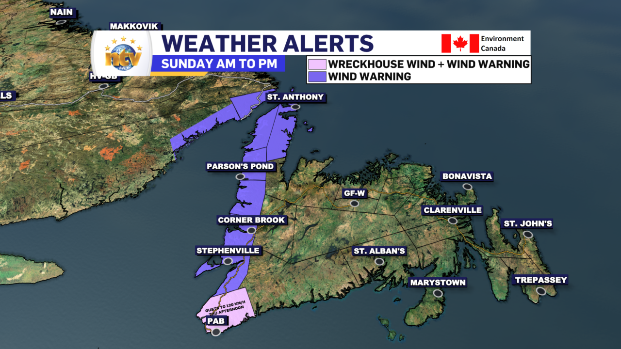
On the Island, we will see a bout of rain and wind today and unseasonably warm temperatures. The rain will primarily affect the West Coast and South Coast. However, central and eastern Newfoundland areas will see some rain and/or rain showers later today and this evening. For the moment, only Wind Warnings are in effect for western areas of the Island (as of 7:30 AM NDT). Areas under the Wind Warning can expect gusts to 100 km/h on the coast. Expect in the Wreckhouse area, where gusts will be as high as 150 km/h into this afternoon!
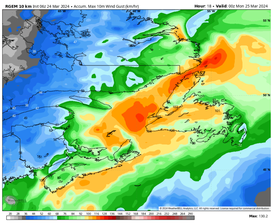
While there are no Wind Warnings currently in effect for areas east of the West Coast, some computer model guidance suggests that a good chunk of Central and northeastern Newfoundland will see high wind speeds this afternoon, with gusts above 90 km/h. If this transpires, I would expect some Wind Warnings to be issued at the last minute by the Gander Weather Office. The image below shows where those high winds are likely to be found. Note the areas in yellow and the corresponding value? That shows the peak wind gust is expected during the day on Sunday.
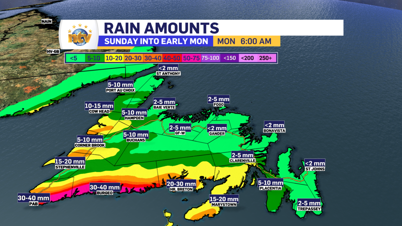
Today’s rainfall amounts over southern and western Newfoundland will be significant. Some locations along the South Coast will see over 30 mm of rain. However, most areas further north and east of there will not see rainfall amounts that high.
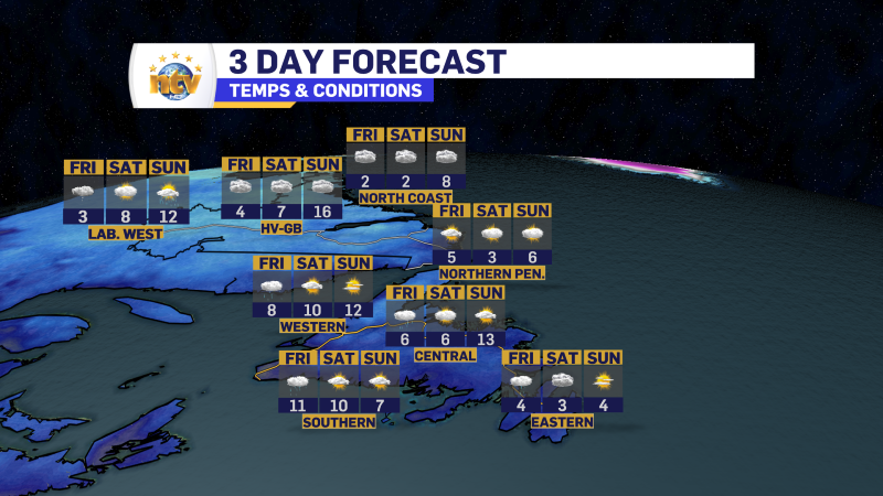
On top of all this, temperatures today will be unseasonably warm on the Island, with highs in many areas reaching 5º to 10º this afternoon. Sadly, this will short-lived as colder air returns tonight. And as stated above, the warm air will come with some wind. Even areas that don’t see super high gusts will still see speeds gusting to 60 or 70 km/h from the south at times this afternoon.
The weather improves for Monday across the board!
-
Your Latest Forecast!
Click here to visit the NTV Weather Centre to get your latest forecast!
-
Eddie’s Forecast; Some slight improvements for Friday, more noticeable this weekend
The area of low pressure that has driven all the wet weather across much of…
-

Eddie’s forecast; May starts like April ended
May starts like April ended… cold and damp for much of the Province. Eddie has…
