


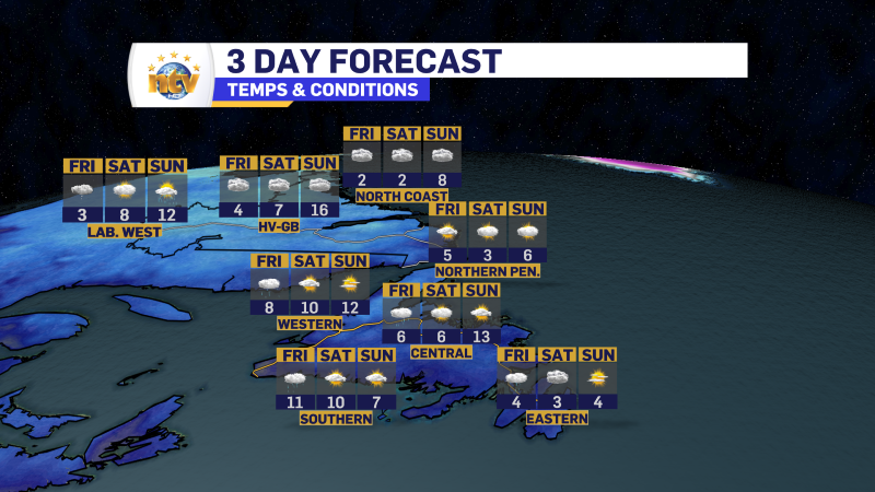
Quiet First Half of the Weekend
Saturday will a mix of sun and cloud across much of the Island, with a few lingering flurries on the West Coast. Highs range between -2° and 0° across Newfoundland. Labrador will see a mix of sun and cloud with flurries lingering early on the north coast. Highs will range from -2° in the south to -9° in the west and -6° in the north.
Spring-like Sunday? Yep! But it’ll be a tad windy
An area of low pressure si going to track through the Gulf of St. Lawrence Sunday. This is going to bring a combination of rain and snow to the West Coast, and snow to southeastern Labrador, along with some rain to the South Coast. Areas of central and eastern Newfoundland will just see some showers.

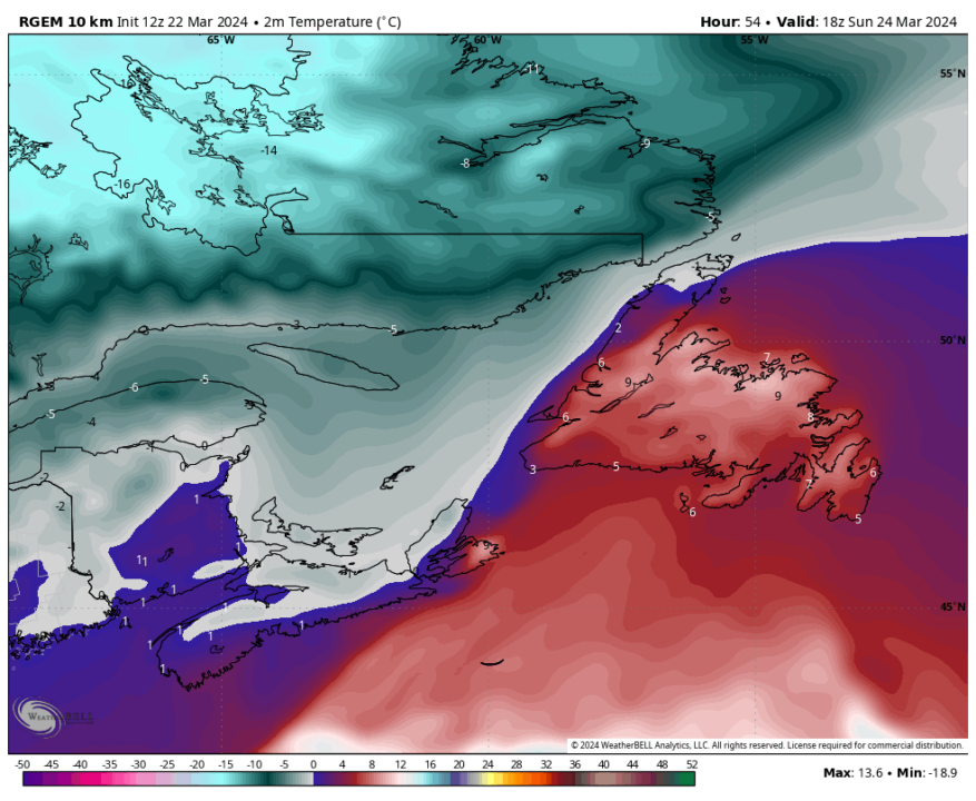
What I’ve buried is that the track of this low will allow much of the Island to get into some of the warmest air we’ve seen this month! Highs for many of us will be as warm as 10° Sunday afternoon as the low intensifies west of the Island. Unfortuntely it may not be the sunniest of days, but if we’re talking about nearly 10° in March do we really care? The image below should give you a good idea of what temperatuers we can expect Sunday.
The warmth will be brough forth by strong southerlies. The southerlies will affect most of the Island and many of us wil see gusts in the 70 to 100 km/h range at times Sunday. The map below shows us the expected peak wind gusts Sunday afternoon.
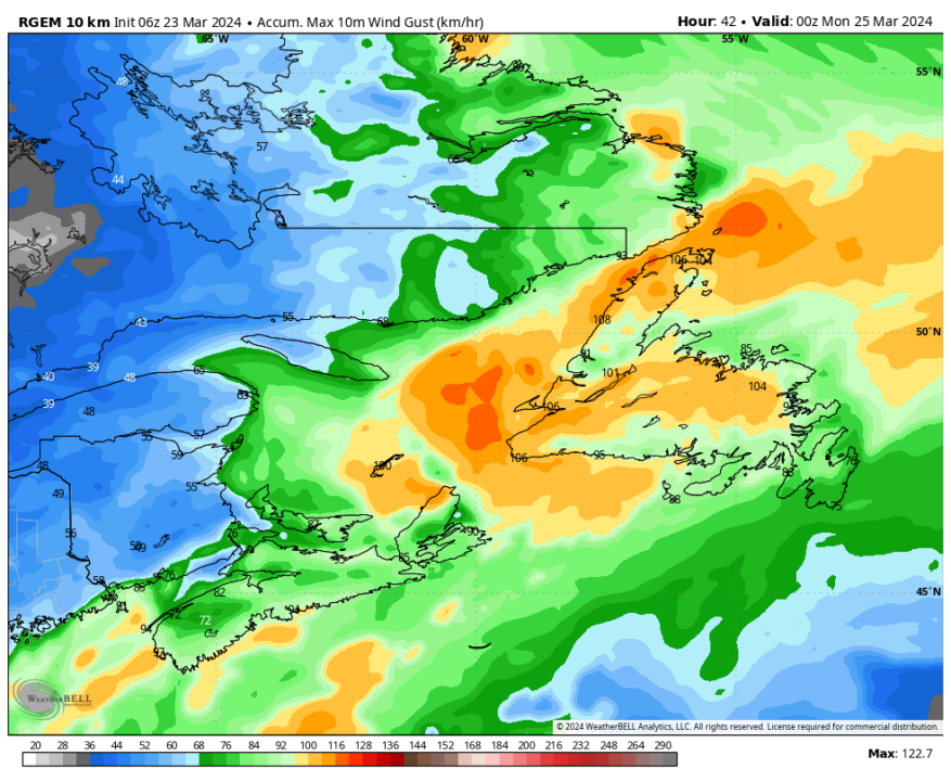
Note it looks like there will be a core of high winds through central Newfoundland, where gusts may exceed 100 km/h. This will likely result in Wind Warnings for the second half of the weekend. I also would expect some Rainfall Warnings as well for parts of southern and western Newfoundlnad.
What about next week?
Next week looks generally calm for the time being. Parts of the Avalon may see a period of freezing rain or ice pellets late Sunday night and early Monday morning as a cold front pushes through and ends our warm party.
After Monday the forecast looks okay… however some guidance indicates the chance of some freezing rain over portions of Island Tuesday or Wednesday. There is much disagreement on this and I’ll have updates over the weekend.
Temperatures will be near 0 on the Island between Monday and Wednesday of next week and areas north of the South Coast and west of the Avalon should see a few days of sun. Meanwhile it will be chilly and sunny in the Big Land with highs near -10° Monday, -6° Tuesday and near 0° Wednesday.
-
Your Latest Forecast!
Click here to visit the NTV Weather Centre to get your latest forecast!
-
Eddie’s Forecast; Some slight improvements for Friday, more noticeable this weekend
The area of low pressure that has driven all the wet weather across much of…
-

Eddie’s forecast; May starts like April ended
May starts like April ended… cold and damp for much of the Province. Eddie has…
