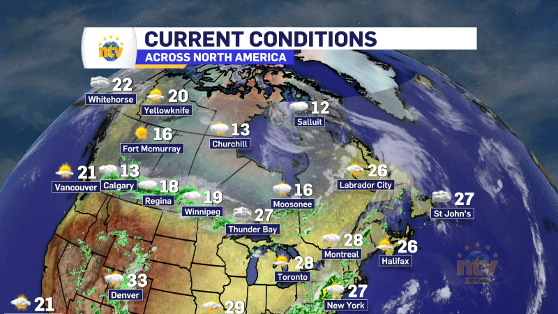
A strengthening area of low pressure has started its journey toward Atlantic Canada and will start to exert influence over the weather in Newfoundland and Labrador this morning. In fact, in some area, it already has. As of this writing, just after 6 AM, radar in picking up returns of snow, ice and rain across much of the Island, but it’s most concentrated on and near the West Coast.
The rain will become more widespread on the Island as the day goes along, arriving in eastern areas this afternoon. Speaking of the rain, ALL areas of the Island will see any mixed precipitation this morning, change to rain later this morning or this afternoon. The last place to see this happen will be on the Northern Peninsula, where snow and ice will fly for a few hours this morning into the afternoon before the change.

A Wreckhouse Wind Warning is in effect for two separate time frames for gusts up to 110 km/h. The first time frame is this morning into this afternoon and the second is Thursday morning until Thursday afternoon. This alert comes from the ECCC NL Weateher Office in Gander.
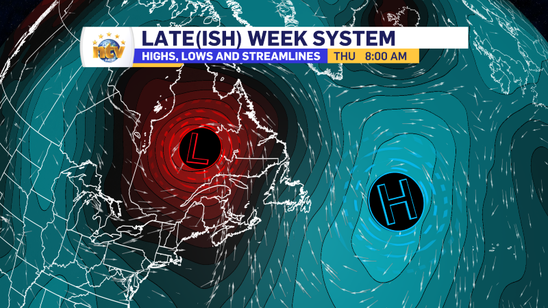
A Special Weather Statement remains in effect for Labrador from today through Thursday. Snow will fly in the Big Land today and this evening, followed by a change to freezing rain and rain overnight. A Freezing Rain Warning has also been issued for Labrador. In the east and south the freezing rain will occur this evening before the change to rain, farther north it will occur overnight, before the change to rain tomorrow morning. The surge of warm air will change the freezing rain to rain from south to north overnight… and Thursday, many areas may get as warm as 10º for a daytime max!


Now, all that being said, it’s still Wednesday, and travel may be challenging at times until the change to rain tomorrow. Snow is flying this morning in the West, and the webcams show that nicely. These images will update so if you’re looking to keep an eye on them, simply check back to this page.
Today, daytime highs in the Big Land will be several degrees below freezing, and travel will be wintry. The warmth will not arrive until later tonight and Thursday, along with some gusty winds. Here is what to expect today.

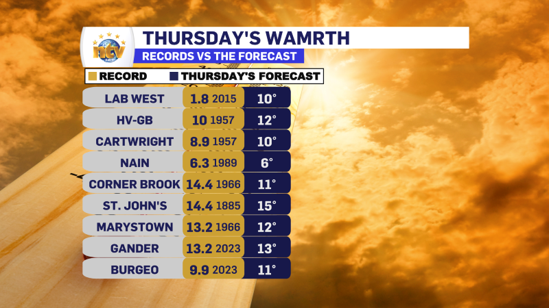
We are looking at some record highs Thursday across the region and I’ll have more details on that later today, starting at 5:30 on NTV’s First Edition and then at 6 PM on the NTV Evening News Hour.
-

Unsettled for most of the province today
There will be a risk of some morning showers along the west coast of the…
-
Hot weather continues across the province
It will be another nice day across the Island portion of the province with a…