


The weather for Tuesday is going to be calm across the Province. I hate to use cliches but this the ‘calm before the storm’. Expect sunny skies for the majority of Newfoundland and Labrador today, with the exception being along the Island’s West Coast, where flurries will fly occasionally throughout the day.
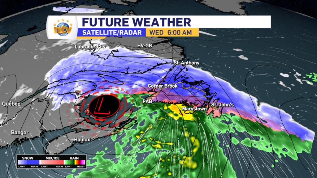
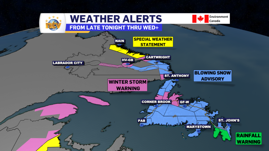
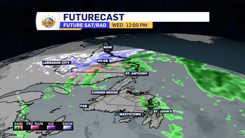
The next system will move in later tonight and will bring snow, ice, rain, and wind to the Island into Wednesday. Meanwhile, Labrador will see snow and wind arrive Wednesday and that will linger into Friday for some areas. Ahead of this, the ECCC NL Weather Office in Gander has issued Winter Storm Warnings, Blowing Snow Advisories, and a Rainfall Warning.
Snowfall amounts on the Island will generally be in the 5-15 cm range, with higher amounts in the higher terrain and most of that will fall overnight into Wednesday morning. The exception is on the GNP, where the snow will linger into Wednesday afternoon. Wind will combine with the snow to drive reduced visibility late tonight into Wednesday morning and a bit later in some areas.
Labrador will see primarily snow and and wind from this system beginning Wednesday. Along the coast totals will likely exceed 30 cm by the time it ends late Friday. I’ll have a more detailed breakdown of the expected weather later today.
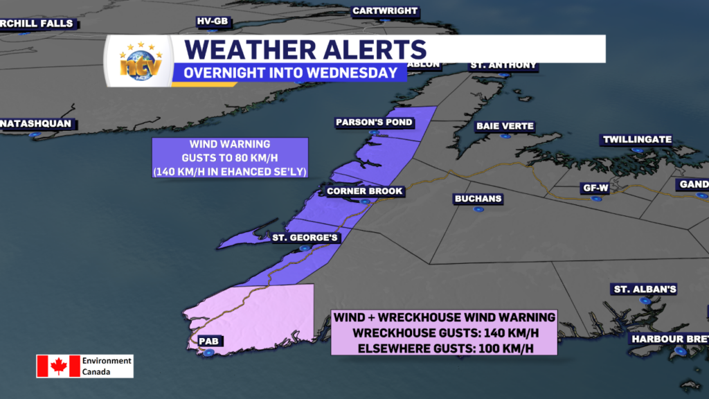
Wind Warnings and a Wrekchouse Wind Warning are also in effect from late tonight into Wednesday afternoon. Wind speeds along the West Coast will gust between 80 and 100 km/h, except as high as 140 km/h in areas that are prone to enhanced southeasterlies.
I will have your latest forecast up later today on the web and as much coverage as I can manage on the news this evening! /Eddie
-

Eddie’s forecast; May starts like April ended
May starts like April ended… cold and damp for much of the Province. Eddie has…
-
Not much change in the weather for Wednesday
An area of low pressure continues to spin southeast of Newfoundland and Labrador and remains…
-
The RDF continues into Wednesday… but there are some literal bright spots in the forecast
Get all the details in Eddie’s forecast from tonight’s NTV Evening News Hour!
