


The weather across much of the Island will not be as rainy today, compared to yesterday nor will it be as warm. However, areas of southern and eastern Newfoundland will see periods of rain and showers throughout the day, thanks to a weak area of low pressure to our south. There is also going to be some fog in the mix as well, and we are already seeing that over sections of eastern this morning, including in and around St. Johns.
Future Radar does a good job of showing where the rain is going to be today. Note it’s not going to be overly heavy, but more light and steady over areas of the south and east. This also doesn’t show cloud cover, but for today most of the Island is going to be under cloudy skies, with some breaks moving into the GNP and West Coast during the afternoon.
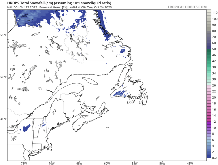
Temperatures are also going to be quite a bit cooler today for the Province, as a whole. Expect highs only into the middle and upper single digits. In fact, it may even be cold enough that the higher elevations of southwestern Newfoundland see wet snow today. The HRDPS model, pictured below, suggests that. If you’re heading down the Burgeo Highway today, be on the lookout for some flakage!
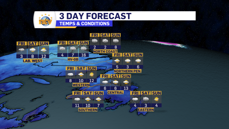
The best weather, hands down, across the Province, today will be throughout most of Labrador, where sun and cloud will be the rule. The exception is on most of the coast, where there will be showers and/or wet snow at times today.
-
Your Latest Forecast!
Click here to visit the NTV Weather Centre to get your latest forecast!
-
Eddie’s Forecast; Some slight improvements for Friday, more noticeable this weekend
The area of low pressure that has driven all the wet weather across much of…
-

Eddie’s forecast; May starts like April ended
May starts like April ended… cold and damp for much of the Province. Eddie has…
