


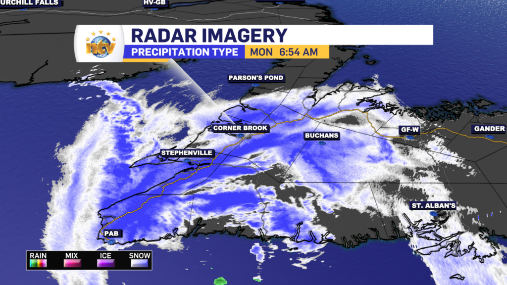
A weak and quick-moving area of low pressure will bring some snow to roughly the western half of the Island today. The snow has already started in the southwest and west and will continue to move north this morning. The silver lining is that the snow area should weaken as it lifts across the Island over the next few hours. Areas along the southwest coast and just inland from the West Coast will see a quick 10-15 cm this morning. Road conditions in the southwest aren’t great, as we can see by the compiled webcam images taken at 6:37 AM this morning.


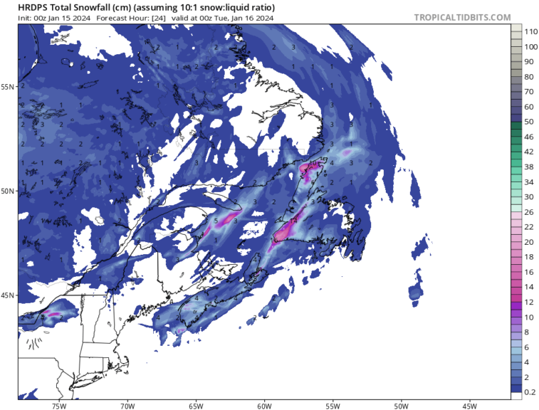
The HRDPS model seems to be doing a very good job of painting the picture about where the snow is this morning, and as you can see, once north of the Southwest Coast and west or east of a narrow swath of heavier snow that parallels the TCH, not much can be expected elsewhere across the Island, and the Province today. Weather conditions will improve for western areas later this morning.
Beyond the snow, we can expect partly to mostly cloudy to even cloudy skies across the Province. I’d expect more clouds than sun on the Island and more sun than clouds in Labrador. Temperatures will vary but are generally near or a little below freezing on the island to well below in Labrador.
The next weather maker moves in Tuesday night and will bring snow, ice, rain and wind to the Island and mainly snow and wind to Labrador. Special Weather Statements are in effect from ECCC NL ahead from Tuesday night through Wednesday. You can get the details on those here, and I’ll have more details posted later today.
Have a good one!
Eddie
-

Threat of wildfires on west coast higher this year, say forestry officials
As residents of the province prepare to head out into the woods for the Victoria…
-

Labrador West MHA wants water bomber back
With wildfires threatening Fort McMurray, Alta., again, Labrador West MHA Jordan Brown wants a water…
-

Province warns residents to be ready for forest fire season as wildfires threaten Fort McMurray
Evacuation orders and alerts remain in effect for Fort McMurray, Alta., as wildfires continue to…
