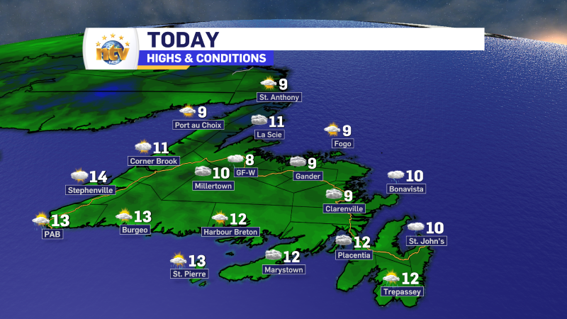
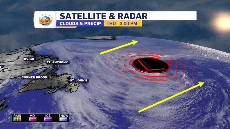
The northeast flow is going to do its dirty work across the Island today. That means areas in the onshore flow, which will be most areas from the east coast of the Great Northern Peninsula to northern and eastern areas of the Avalon, will be in the cloud cover and drizzle to start the day. On top of that, an area of low pressure is located southeast of Capre Race and that has helped to increase the wind speed over eastern areas this morning. You can also see Hurricane Kirk there as well, which isn’t directly impacting our weather this morning.

You can also see Hurricane Kirk there as well, which isn’t directly impacting our weather this morning. Kirl will not impact our weather as is expected to continue moving eastward across the Atlantic over the next few days.

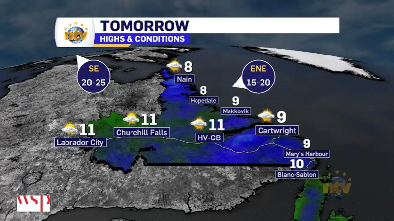
As the day goes on, these two features will move away from eastern Newfoundland, slackening the wind speed. This could potentially allow for some late-day sun breaks. Areas west of the Avalon will see more sun today. The South Coast, West Coast, and most of Labrador will see partly cloudy to mostly sunny skies throughout the day.
Tuesday looks like it will be on the quiet side, but that will be followed by another low moving in for mid-week which looks to bring to much of the Province Wednesday. I’ll have your forecast posted on the website later today and will see you on NTV starting at 5:30 PM this evening.
Have a great day!
Eddie
-
The first half of the weekend is lookin’ great!
After nearly two weeks of drizzle, clouds and fog over eastern and central Newfoundland, the…
-
A brilliant Friday on tap for much of the Province!
The weather will turn around for eastern and central Newfoundland on Friday, setting the stage…